
Blaze
A small route marker that only makes sense inside the trail system that owns it.
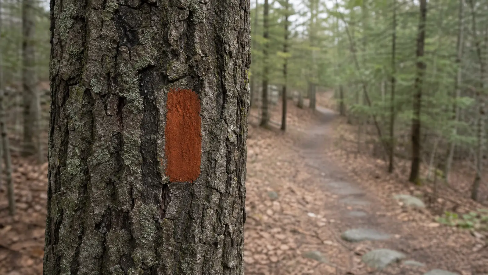
A blaze reassures you that you are following an established trail, but its color, shape, spacing, and turn signals depend on the managing trail system. Read the official legend before the hike, confirm the route after junctions, and stop early when the marks and the ground stop agreeing.
What does a trail blaze tell you?
A trail blaze is a painted rectangle, symbol, tag, or similar marker placed along an established route. It may appear on a tree, post, rock, bridge, or other durable surface. Its basic job is to identify the route and reassure hikers between trailheads and intersections.
| Mark encountered | Likely job | What confirms it |
|---|---|---|
| Painted shape or trail logo | Identify an established route | Official legend, map, or trailhead sign uses the same mark |
| Arrow or named sign | Direct travel at a decision point | Destination and direction agree with the mapped junction |
| Boundary paint or survey mark | Mark land management or property | Official trail guidance does not present it as the route symbol |
| Ribbon, scratch, or loose rock pile | May be temporary, unofficial, or unrelated | Land manager explicitly identifies it as an approved marker |
The mark does not carry one universal meaning. The National Park Service notes that national trails develop their own shapes, colors, and sizes. White identifies the Appalachian Trail in many places, while yellow identifies the Ice Age National Scenic Trail. A blue blaze can mean a side trail in one system and a standard hiking trail in another.
Read the local legend before treating any color as an instruction.
- Object
- Paint, plastic tag, metal marker, logo, arrow, or another approved route mark
- Location
- Tree, post, rock, bridge, sign, or structure selected by the trail manager
- Main job
- Identify the intended route and reassure travel between decision points
- Meaning
- Defined by the local park, trail system, map, or guide
- Limit
- A blaze does not prove the route is open, safe, or suitable today
A blaze is different from a boundary mark, survey monument, property sign, or hunting-season blaze orange. Check the trailhead sign and current official map so you know which mark belongs to your route.
Why can blaze spacing and visibility change?
There is no universal distance between blazes. Maintainers place them according to tread clarity, junctions, terrain, visibility, local policy, and the character of the place. A clear single-track path may need fewer marks than an old road crossing or an open area with several possible lines.
Reassurance marks are often closer to decision points. The Ice Age National Scenic Trail handbook gives one concrete example. It recommends a reassurance marker roughly 75 to 200 feet after an intersection or road crossing. That range belongs to that trail's maintenance guidance, not every trail.
Wilderness routes may use fewer markers on purpose. The Appalachian Trail Conservancy says blazes in some federally designated wilderness areas can be as much as a quarter mile apart. Side trails may have no marks there.
Do not use blaze count as an odometer. A long gap on obvious tread may be normal, while a short gap after a confusing junction may be deliberate. The map, trail description, and ground must still agree.
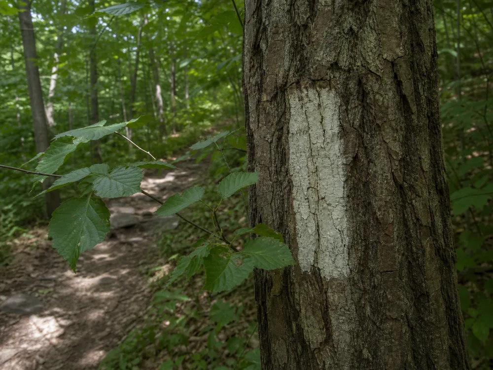
A blaze can look different from the opposite direction. The supporting tree, paint surface, sun angle, and background all change. Look back after a junction so you know which marks will face you on the return.
Season changes visibility too. Leaves can cover a marker in summer. Snow can hide low marks or make a pale blaze blend into the background. Storm damage can remove a marked tree while leaving the rest of the sequence intact.
Spacing responds to the ground. Expect a logical sequence, not a fixed number of steps between marks.
How should you follow blazes through a junction?
Approach a junction as a new navigation decision. Read the sign, match the trail name with the map, and identify which blaze continues after the split. A mark before the junction may only confirm the route you just walked.
Trail maintainers often place a reassurance blaze after an intersection. On some systems, two blazes or an offset pair warns of an upcoming turn. That convention is useful only when the official trail guidance defines it.
Confirm the mark after the turn before increasing your pace.
- Pause before the splitKeep the whole group at the last point where the route is certain.
- Read the sign and mapMatch the trail name, destination, direction, and junction shape.
- Find the outgoing markLook down the intended branch for the next official blaze or sign.
- Walk a short checkContinue only far enough to confirm that tread, direction, and markers agree.
- Look backLearn what the junction will look like on the return.
If several trails share a corridor, more than one blaze may appear together. Follow the symbol assigned to your route rather than choosing the most visible paint.
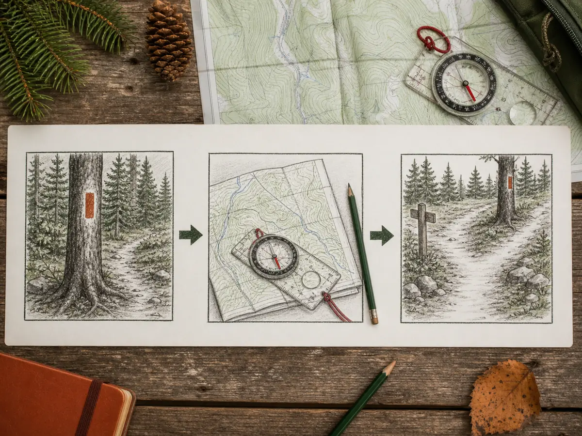
A compass bearing check helps when the route also requires a bearing or a map orientation check.
How do you read multiple blazes on one trail segment?
Two routes can share the same tread for a distance. In that shared corridor, both route symbols may appear on the same post, sign, or sequence of trees. Their presence together does not mean you can switch between routes without checking the map.
National Park Service guidance says multiple trail logos on one sign should be arranged side by side where trails overlap. The practical lesson is simple. Keep tracking the symbol assigned to your route until the map and markers show where the routes separate.
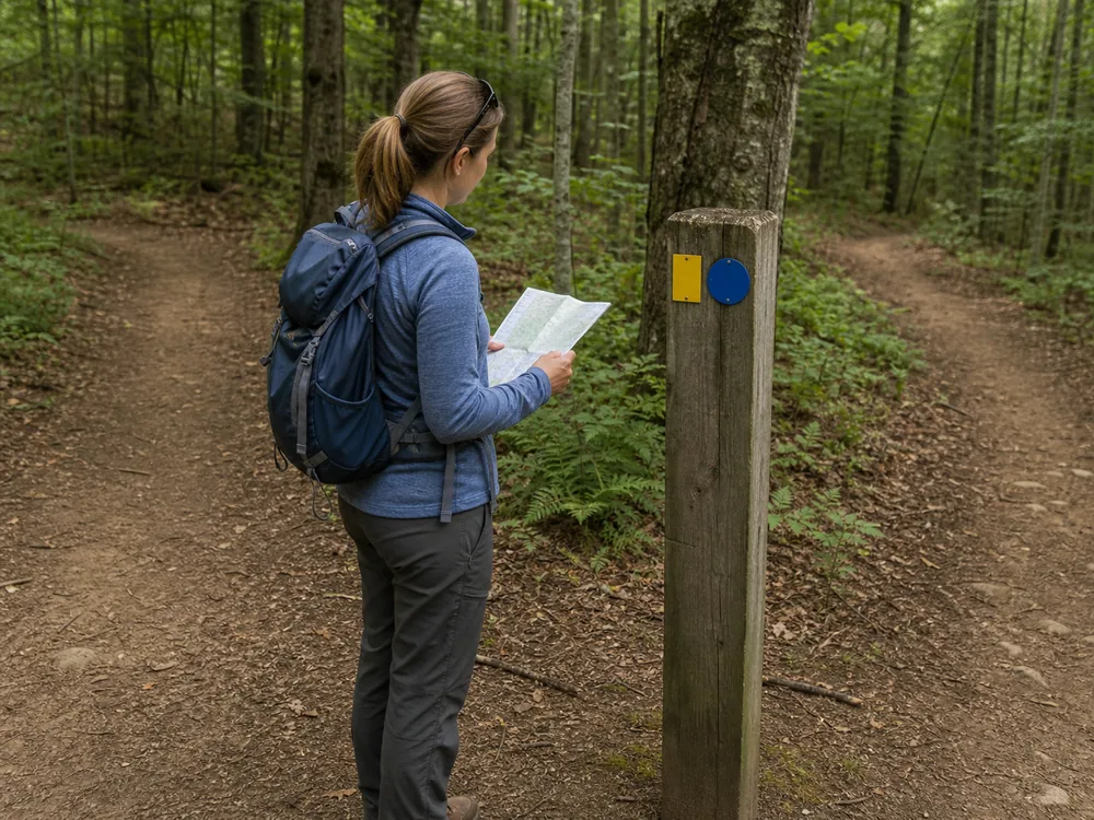
A loop can also share its entrance and exit with a main trail. The same marker may lead you to the loop junction, while a second color or shape identifies the loop itself. Color alone does not tell you clockwise, counterclockwise, outbound, or return direction unless the local legend says so.
At the split, read the route name, destination, and junction shape before choosing a branch. Then find your route's next mark on that branch. A marker for the other route may continue straight and look more obvious.
Paired or offset blazes add another local rule. Some trail systems use them to warn of a turn, and an offset upper mark may indicate the turn direction. Other systems do not. Confirm that convention before the hike.
Track your symbol through the split. More paint at a junction can provide more information, but it also gives you more ways to follow the wrong route.
If your assigned symbol disappears while another continues, stop. Check whether the routes separated, whether you missed a turn, or whether maintenance is incomplete before walking farther.
What should you do when the next blaze disappears?
One missing mark does not automatically mean you are lost. Trees fall, paint fades, vegetation grows, and snow can hide low markers. The useful question is whether the trail tread, direction, map, landmarks, and last confirmed point still agree.
Stop before uncertainty turns into distance. Do not keep walking downhill, follow an unmarked social path, or add your own paint, ribbon, scratches, or rock piles.
Return to known ground while the correction is still short.
Use a simple reset: note the time, identify the last certain location, compare the map with visible terrain, and retrace the known tread if safe. If you cannot relocate the route, use the emergency and contact steps set during trip planning.
The National Park Service advises a lost hiker to pause, find a location with map, compass, GPS, or landmarks, and retrace safely when possible. If safe self-rescue is not possible, contact emergency services and stay put unless an immediate threat requires movement.
If you recover the route safely, record the missing or damaged marker for the land manager. Note the trail name, your direction of travel, the nearest junction or mapped feature, and coordinates if your device can provide them.
Take one close photo of the marker surface and one wider photo that shows the tread and nearby choices. Describe what you observed, such as faded paint, a fallen marked tree, vegetation blocking the view, or competing symbols. Do not repaint, trim, nail, or move anything yourself.
What can a blaze never confirm by itself?
A clear marker can remain in place while conditions change around it. The blaze does not verify a bridge, gate, fire closure, flood, ice, water source, or safe return time. It also does not replace a map where wilderness rules intentionally keep markers sparse.
Treat the blaze as one navigation input. Current alerts, route description, weather, daylight, group ability, and an independent map still own the trip decision.
Marker present does not mean open or safe.
- Check the official route map and blaze legend before departure.
- Confirm current closures, access, weather, and daylight separately.
- Carry an independent route reference that works without signal.
- Mark the last confirmed location when the route becomes uncertain.
- Report damaged or confusing markers instead of repairing them yourself.
A stone cairn may mark routes where paint is unsuitable, while a switchback turn describes the trail's reversing shape rather than its marker system.
Sources
National Park Service Reference Manual 45 explains that trails develop their own blaze shapes, colors, and sizes. The Ice Age Trail handbook describes intersection and reassurance marking. The NPS outdoor emergency plan covers the pause, locate, retrace, and seek-help sequence. The Appalachian Trail Conservancy blaze overview shows how spacing and wilderness marking can vary on one major trail.
AnswersQuestions readers ask
What is a blaze on a trail?
A blaze is an approved painted or attached marker used to identify an established trail route. It may appear on a tree, post, rock, bridge, or another durable surface.
Do trail blaze colors mean the same thing everywhere?
No. Each park or trail system defines its own colors, shapes, and symbols. Read the official map or trailhead legend before following a color.
What do two trail blazes mean?
Some systems use two or offset blazes to warn of a turn or route change, but that convention is not universal. Confirm it in the local trail guidance.
What should I do if I stop seeing blazes?
Stop early, identify the last confirmed point, compare the map with the ground, and retrace the known route when safe. Do not create new markers.