
3 Dune Challenge: Sand, Route, and State Park Fees
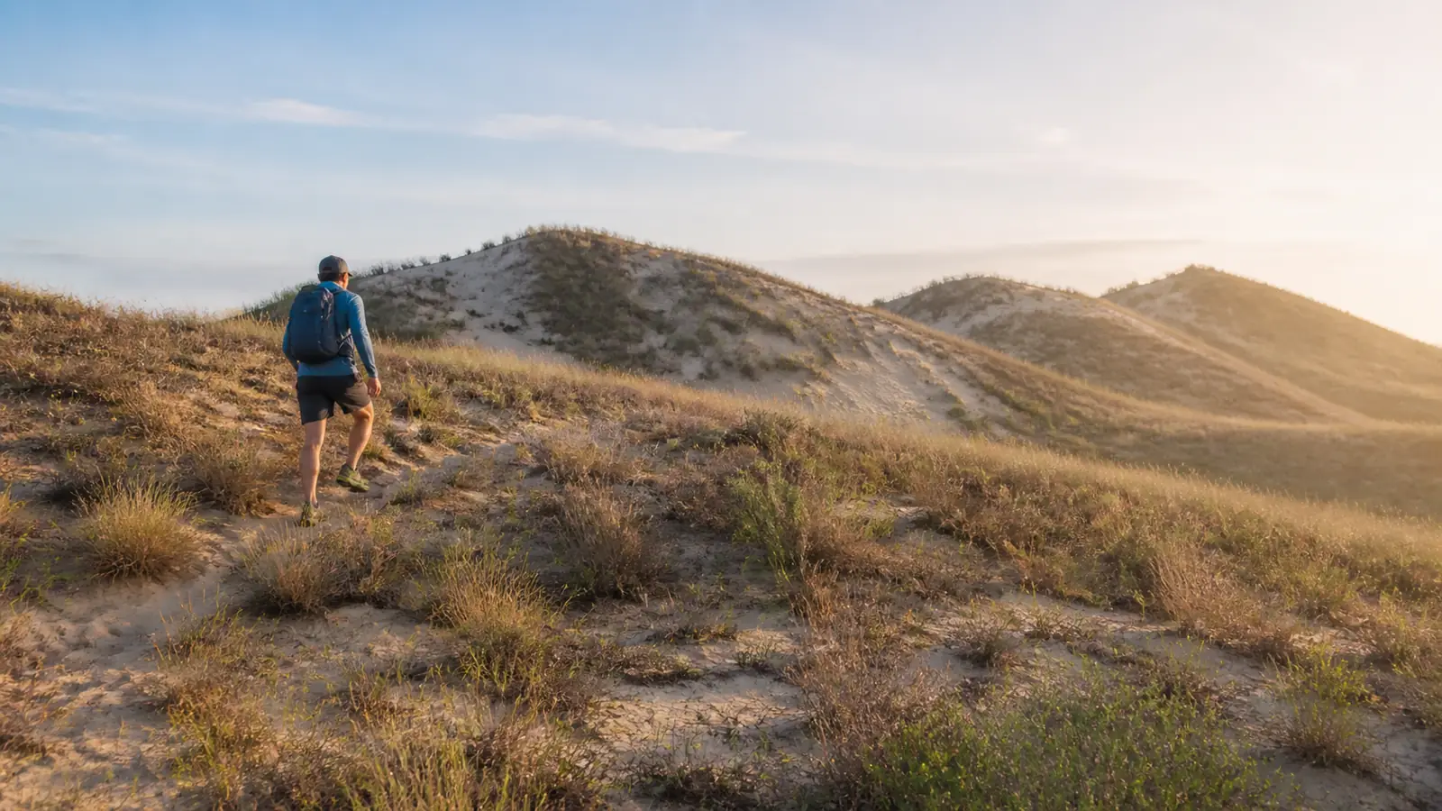
The 3 Dune Challenge packs three loose-sand climbs and 552 vertical feet into a 1.5-mile state park loop. Follow the summit sequence, know the Trail 7 bailout, and separate Indiana state park fees from the neighboring national park.
The 3 Dune Challenge is a 1.5-mile loop in Indiana Dunes State Park with about 552 vertical feet of climbing. Loose sand, three separate summits, exposed weather, and a route change after Mount Tom make the mileage feel much larger than it looks.
Treat it as a concentrated sand workout.
The loop is short enough for many groups, but your pace, bailout decision, current signs, and state park access still need a plan.
What does the 3 Dune Challenge actually climb?
The signed challenge starts by the Nature Center and follows Trail 8 over Mount Jackson, Mount Holden, and Mount Tom. The return changes to Trail 4 and a campground connection rather than reversing every summit.
- Start at the Nature Center and take Trail 8 toward Mount Jackson
- Continue over Mount Holden while Trail 8 remains the signed challenge route
- Check the Trail 7 bailout before committing to Mount Tom
- Climb Mount Tom and descend its long stair section with controlled steps
- Join Trail 4 after the named dune sequence
- Use the campground connection without cutting through occupied sites
- Return to the Nature Center and confirm the group is complete
Mount Jackson introduces loose-sand climbing, Mount Holden tests whether your first pace was sustainable, and Mount Tom arrives after the earlier effort. Updated Trail 8 signs were announced for 2026, so current markings on the ground outrank an old screenshot.
Three summits form one loop. Missing the Trail 4 finish can turn a compact challenge into unnecessary extra walking.
Why does 1.5 miles feel so hard in sand?
Loose sand slides backward under each step, which means part of your effort moves the surface instead of your body. A shorter stride and whole-foot placement usually waste less motion than long charging steps.
The total climbing accumulates through repeated rise and loss.
You never receive one continuous downhill finish after the first crest.
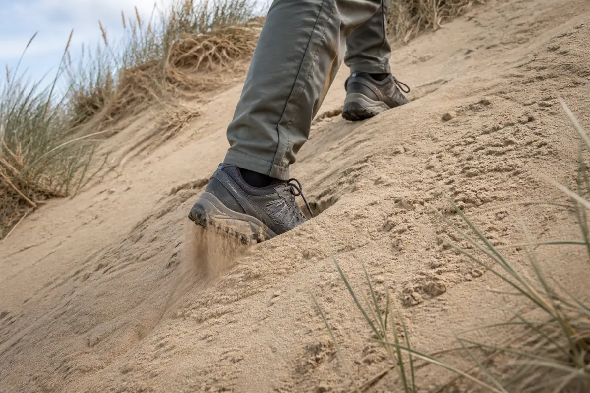
Use the first climb to learn the group's sustainable pace. Slow down before Mount Holden if breathing does not settle during a brief level section.
Heat adds another cost because exposed sand reflects sunlight and provides little shade.
A cool morning and a humid afternoon can produce very different outings on the same route.
Can children or mixed-ability groups use a bailout?
Trail 7 provides the important bailout before Mount Tom. You should use it when the first two dunes have already consumed the group's water, time, or controlled movement.
Children and first-time sand hikers may need more recovery than the distance suggests. Judge the decision from balance, pace, and comfort rather than promising the final summit because it looks close.
A bailout is useful only when the group recognizes it before passing the junction. Leave before control disappears.
When should you hike the dunes?
Cool, dry conditions reduce the combined load from sand and sun. Summer midday heat, thunderstorms, strong wind, and icy winter surfaces can each change the safest choice.
| Condition | Route change | Better decision |
|---|---|---|
| Cool and dry | Sand still shifts, but heat load is lower | Start steady and reassess after Mount Jackson |
| Hot and humid | Exposed climbs raise water and cooling needs | Start early or choose another day |
| Thunder nearby | Open crests provide little protection | Leave high ground and end the challenge |
| Strong wind | Blowing sand affects eyes and balance | Avoid exposed crests when control drops |
| Ice or packed snow | Stairs and firm tread become slippery | Use suitable winter gear or choose a lower route |
Lightning needs a conservative response because the three crests remain exposed. Do not wait for rain before leaving high ground when thunder is audible.
Dogs must remain leashed under current state park rules. Test hot sand before bringing a dog because paws can be injured before a person feels overheated.
How do you stay on the signed loop?
Follow Trail 8 across the three named dunes, then expect the route to change after Mount Tom. Save an offline map that shows Trail 7, Trail 4, and the campground connection.
At each junction, match the sign to the next named feature instead of simply taking the most worn path. Stop and return to the last confirmed marker when a turn no longer agrees with the map.
The campground finish deserves attention because roads and occupied sites can pull hikers away from the official connection. Stay on the signed public route.
The Nature Center is the clearest start and finish reference.
Its posted building hours do not automatically define every trail or gate hour, so check current park notices separately.
Do you need a permit or pay an entrance fee?
No separate trail permit is required for the challenge, but Indiana Dunes State Park charges admission.
The state park is a different fee owner from neighboring Indiana Dunes National Park.
- Trail permit
- None required for the signed challenge
- Indiana-plated vehicle
- $7 daily state park admission
- Out-of-state vehicle
- $20 daily state park admission
- Walk or bicycle
- $2 per person age five and older
- Start
- Indiana Dunes State Park Nature Center
- Federal pass
- Does not replace the Indiana state park fee
Enter the full Nature Center name in navigation so a broad “Indiana Dunes” result does not send you to the wrong park unit. Check Indiana DNR immediately before departure because fees and access notices can change.
What should you carry for a short sand climb?
Carry drinking water, sun protection, a saved route map, and a small first-aid kit. Secure shoes reduce the sand and friction that can create hot spots on repeated climbs.
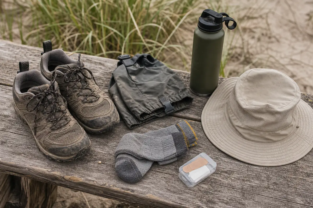
- Carry enough water for every person in the current heat
- Wear secure trail shoes with tread that remains stable in shifting sand
- Pack blister protection and spare socks if grit commonly causes hot spots
- Use a hat, sunscreen, and eye protection for exposed crests
- Save the current loop and mark the Trail 7 bailout
- Keep unnecessary weight out of the pack because soft ground magnifies it
Low gaiters are optional, while dry socks often matter more after sand enters a shoe. Carry the items that solve the day's heat, friction, and navigation problems.
Sources
Route and conditions. Indiana DNR Indiana Dunes State Park supports the Trail 8 route, rugged rating, Nature Center information, and current notices, verified August 30, 2026.
Challenge sequence. Indiana Dunes Tourism 3 Dune Challenge and Earth Trekkers route account support the distance, vertical climb, summit order, bailout, and Trail 4 finish, verified August 30, 2026.
Fees and signs. Indiana DNR entrance fees and the 2026 state parks update support current admission prices and updated wayfinding, verified August 30, 2026.
RespectHazards to plan for
- heat
- loose sand
- lightning exposure
- icy stairs
- route junctions