
Acadia National Park Hiking by Terrain and Access
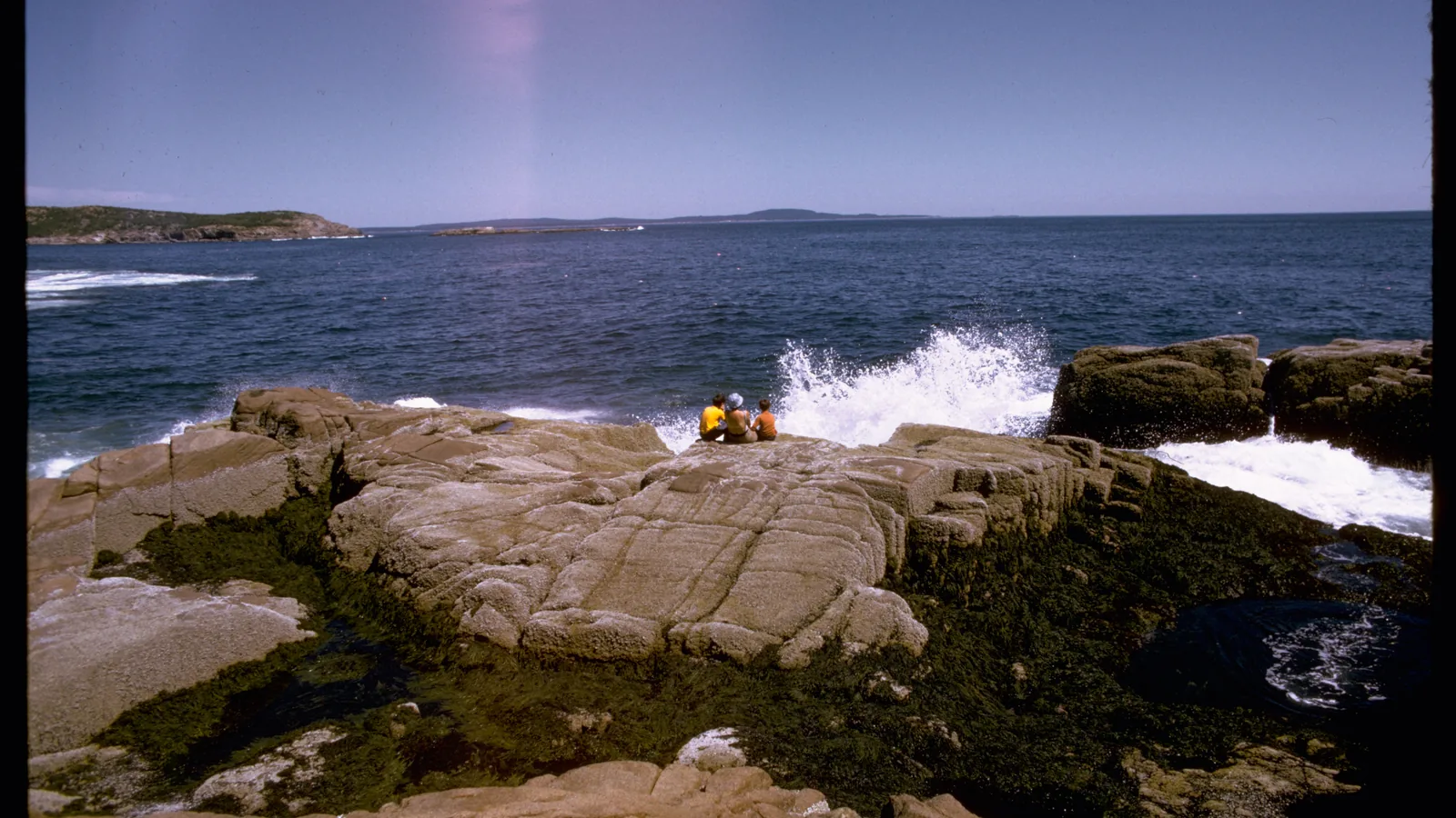
Acadia compresses coast, granite summits, forest, and ponds into a small-looking map, but the park's separated regions and time-sensitive access rules reward one-zone days.
Weather
Coastal fog, rain, wind, and fast temperature changes can alter visibility and traction. Summit conditions can differ sharply from Bar Harbor.
Plan the practical details
- Access
- Road access reaches Mount Desert Island and Schoodic Peninsula. Isle au Haut requires a passenger ferry, and peak Mount Desert Island trailheads may be easier to reach by the seasonal Island Explorer.
- Permits
- A park entrance pass is required year-round. In 2026, driving Cadillac Summit Road also requires a timed vehicle reservation from May 20 through October 25.
Acadia rewards a narrower plan than its fame suggests. Pick one part of the park and one kind of ground for the day, then let parking, weather, and tide decide which route within that plan still works.
The mountains are low by western standards, but many trails begin near sea level and climb over bare granite. Short mileage can include wet slabs, iron rungs, exposed edges, or a return that depends on a seasonal bus.
Choose the ground first. A pond path, carriage road, coastal ledge, and rung route ask for different balance, footwear, and tolerance for exposure even when their distances look similar.
- Park shape
- Mount Desert Island, Schoodic Peninsula, Isle au Haut, and smaller outer islands
- Hiking network
- More than 150 miles of trails
- Carriage roads
- 45 miles of broken-stone roads
- Entrance
- Park pass required year-round
- Cadillac road
- Separate vehicle reservation required May 20 through October 25 in 2026
- Backcountry camping
- Not allowed anywhere in Acadia
- Current details checked
- August 23, 2026
Those facts point to the central planning rule. A pass admits you to the park, while geography, transport, surface, and current conditions determine whether the intended hike is a sensible use of the day.
Which part of Acadia fits your trip?
Acadia covers nearly 50,000 acres, but those acres do not form one continuous hiking area.
The park includes Mount Desert Island, the mainland Schoodic Peninsula, ferry-access Isle au Haut, and smaller islands along roughly 60 miles of coastline.
Most first visits concentrate on eastern Mount Desert Island because Park Loop Road connects Sand Beach, Ocean Path, Jordan Pond, and Cadillac Mountain. That concentration also produces the park's most persistent parking pressure from June through September.
The west side of Mount Desert Island has a different rhythm. Echo Lake, Acadia Mountain, Beech Mountain, Seawall, Wonderland, and Ship Harbor spread the day across state roads and smaller parking areas, with fewer services and less of the east-side circuit feeling.
East side of Mount Desert Island
Best for Park Loop Road, Ocean Path, Jordan Pond, Cadillac, and a first visit built around seasonal bus access. Expect the heaviest congestion.
West side of Mount Desert Island
Best for quieter mountain, lake, and coastal walks around Echo Lake, Acadia Mountain, Seawall, and Bass Harbor. Carry a downloaded map because cell service is unreliable.
Schoodic Peninsula
Best for a mainland day of rocky coast, forest, bike paths, and Schoodic Head. It sits about an hour by road from Hulls Cove and has its own campground and seasonal bus service.
Isle au Haut
Best for a remote ferry-based trip whose boat schedule controls the day. Duck Harbor camping also requires a separate advance reservation and a complete water plan.
Bar Island
Best for a short walk from downtown Bar Harbor when low tide exposes the gravel connection. The tide, rather than parking at a park trailhead, sets the hard turnaround.
Treat those as separate day zones. Driving from an east-side trail to Schoodic or trying to add Isle au Haut after a Mount Desert Island morning converts hiking time into road or ferry time.
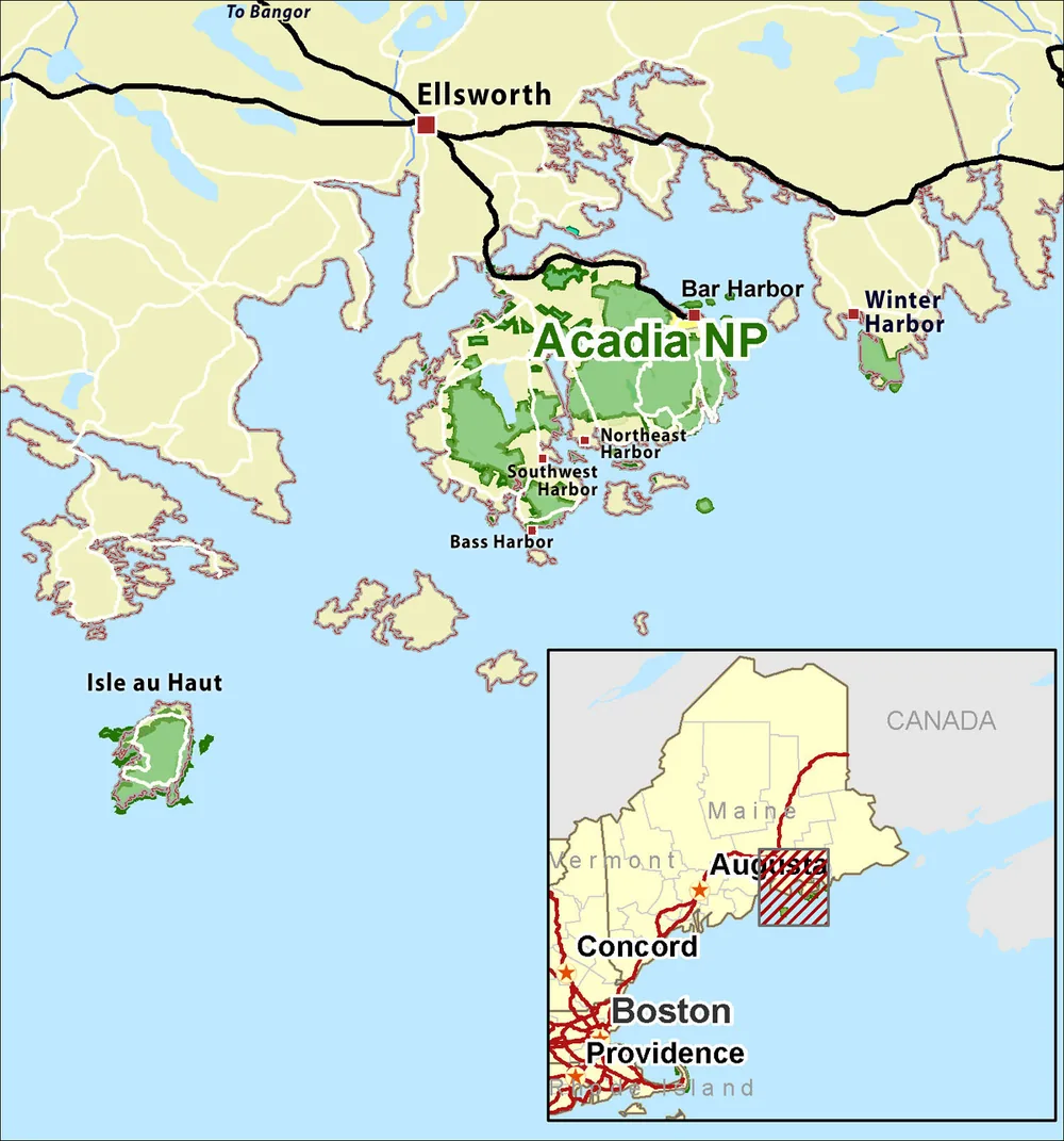
A useful first itinerary chooses one region, one main hike, and one nearby lower-commitment option.
If the main lot is full or the weather changes, the replacement still uses the same transport plan instead of sending you across the park.
Schoodic is the cleanest example of why this matters.
Its six-mile one-way loop road, 8.3 miles of bike paths, rocky headlands, and short mountain trails can fill a day, while using it as an add-on to Jordan Pond makes both places feel rushed.
Isle au Haut demands even firmer boundaries because the passenger ferry is the access road. Confirm both crossings before choosing the hike, and keep enough margin to reach the dock without turning the return into a race.
Match the hike to the surface, not the summit height
Acadia's highest summit is only 1,530 feet, yet elevation above sea level hides how the climb gains that height. A mountain trail may rise from near the coast over exposed granite, while a longer carriage-road loop may hold a broad grade and predictable footing.
The right comparison begins with what your feet and hands must do. Distance becomes useful only after surface and exposure are known.
| Route family | Representative option | Ground and exposure | What changes the choice |
|---|---|---|---|
| Gradual coast path | Ocean Path | Packed gravel and concrete near Sand Beach, then rougher gravel, rock, stairs, and ocean drops | Choose the section, not only the full 4.4-mile return |
| Pond loop | Jordan Pond Path | Easier east shore, then boardwalk, rocks, footbridges, and a harder west shore | A mixed group may use an out-and-back instead of forcing the full loop |
| Carriage road | Eagle Lake or Jordan Pond network | Broad broken-stone road with signed intersections and shared bicycle, horse, and pedestrian use | Distance and climbing still matter, but cliff exposure and scrambling are removed |
| Granite summit | Cadillac South Ridge | Forest, uneven rock, one iron rung, and a long exposed ridge | Weather, water, and the 7.1-mile return matter more than the summit number |
| Rung route | Beehive Loop | Steep granite stairs, iron rungs, hand-assisted climbing, and open cliff faces | Dry rock, comfort with exposure, and an uphill direction are essential |
| Coastal scramble | Great Head | Short mileage with rock steps, uneven granite, scrambling, and ocean edges | Sand, rain, surf, and a group's balance can raise the difficulty quickly |
| Mainland trail | Schoodic Head network | Forest, rocky summit approaches, packed gravel, and exposed shore options | Choose between easy coastal walking and short steep climbs before leaving the campground area |
Ocean Path shows why a route name can hide several different walks. The first 0.7 mile from Sand Beach to Thunder Hole is the most gradual portion, while the path becomes rougher beyond Thunder Hole and crosses granite stair sections near Otter Cliffs.
Jordan Pond Path changes character around the water. The eastern side offers the gentler line, but the western shore adds uneven rocks and narrow log boardwalks that can surprise someone who expected a flat lakeside stroll.
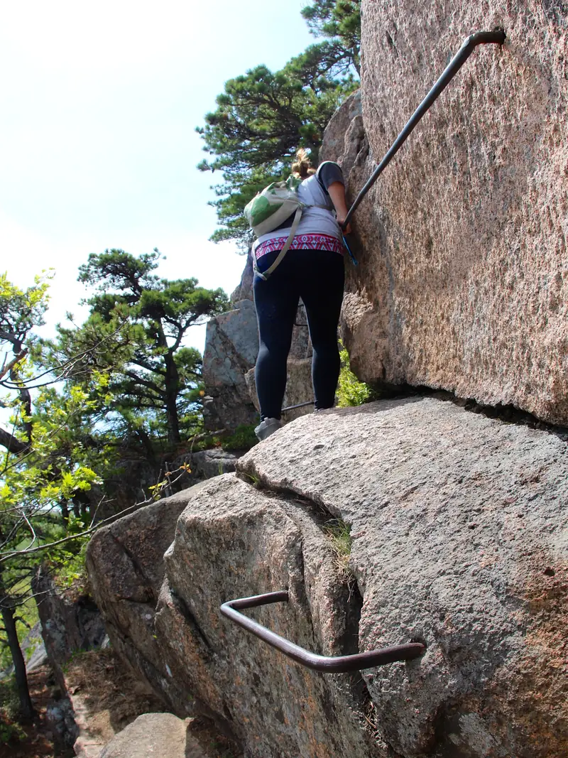
Beehive makes the opposite commitment. Its 1.4-mile loop climbs a 450-foot cliff on granite stairs and iron rungs, with unprotected drops and no sensible reason to reverse down the ascent line.
Great Head sits between the gradual coast path and the rung routes. It rises only 145 feet, but rock scrambling, sand on the first steps, and abrupt ocean edges make the longer 1.9-mile loop a poor place to judge difficulty from elevation alone.
Carriage roads give you a useful lower-exposure alternative, not a flat sidewalk. Their broken-stone surface, grades, junctions, cyclists, and horse traffic still require attention, while the roughly 16-foot width removes the hand-assisted climbing found on historic summit trails.
Use an out-and-back when the surface is the uncertainty. Turning before the rough western half of Jordan Pond or before Ocean Path reaches its uneven southern portion can preserve the scenery without committing the least steady person to the hardest ground.
Build the day around parking, not mileage
A full trailhead lot can erase a carefully measured hike before the first step. Jordan Pond, Sand Beach, Eagle Lake, Acadia Mountain, and Echo Lake are among the places the National Park Service says routinely fill during peak season.
Arriving before 8 am or after 5 pm reduces the chance of meeting the main midday congestion, but it does not reserve a space.
Legal parking is part of the hike. A shoulder, pullout, or closed lane does not become usable because the intended trail is short.
Four access decisions
- Night beforeConfirm the entrance pass, current alerts, bus service, and a second route in the same park zoneAn offline plan still works where cell service disappears
- Before 8 amStart the drive or reach the seasonal bus with the chosen trail and backup already namedThe group spends less of the hiking window circling a lot
- Lot fullContinue to the backup or switch to a bus-served access pointThe day stays legal and avoids blocking emergency or road traffic
- Return windowLeave enough time for the last practical bus or for a full walk back to the vehicleA point-to-point route does not become an unplanned road walk
The fare-free Island Explorer connects neighboring towns, campgrounds, carriage-road entrances, and many trailheads on Mount Desert Island and Schoodic Peninsula.
Service is seasonal, schedules change, and a full bus can require waiting for the next one.
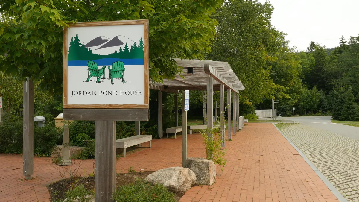
The bus is most valuable when the route already matches its stops.
Ocean Path can run one way between Sand Beach, Thunder Hole, and Otter Point, while Cadillac South Ridge can use a campground-area stop and a different trail for the return only when the current schedule supports that plan.
Cadillac summit is the important exception. Island Explorer buses do not climb Cadillac Summit Road, so a hiker who finishes at the top must descend on foot or use another legal ride arranged in advance.
- Download the current Island Explorer schedule before leaving reliable service
- Name one backup hike in the same region and terrain range
- Confirm whether the last bus leaves enough margin for a slow descent
- Carry the map and route details offline because cell service is unreliable on Ocean Drive and many trails
- Leave a full lot rather than waiting in a travel lane or parking outside a designated area
A bus plan also needs a walking plan. Know the distance from the stop to the trailhead, where the return stop sits, and what you will do if the intended bus is full.
For a driving day, keep the backup close enough to use the same road. If Sand Beach is full, a west-side replacement does not save time unless you were already prepared for the cross-island drive.
Cadillac needs two separate decisions
An Acadia entrance pass and a Cadillac Summit Road vehicle reservation answer different questions. The pass admits the visitor to the park, while the reservation controls one vehicle's timed entry onto the summit road during the managed season.
For 2026, the Cadillac vehicle reservation check station operates from May 20 through October 25.
Reservations are sold online, are not sold at the park, do not assign a parking space, and do not allow vehicle re-entry after departure.
Reservation-free does not mean effortless. Cadillac South Ridge covers 7.1 miles round trip through forest and along an exposed granite ridgeline, with one iron rung and limited roadside parking near the trailhead.
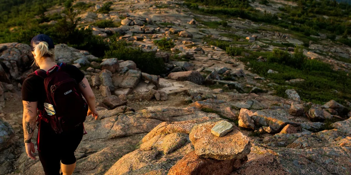
Driving works for a short summit visit, limited mobility, or a day whose hiking objective lies elsewhere. Hiking works when the climb itself is the main objective and the group can complete the full route under the forecast conditions.
Do not combine the two casually by assuming a bus will carry you down. A one-way hiking plan needs a confirmed trail descent, a legal pickup, or a route that returns to the starting trailhead.
The reservation also does not solve summit weather. Fog, wind, and wet rock can remove the view or make the exposed walking surfaces a poor match for the group even when the road entry is valid.
Fog and wet granite can rewrite the route
Bar Harbor can feel mild while Cadillac and the other summits sit in wind, cloud, or colder air. The National Park Service warns that mountain weather can differ sharply from conditions elsewhere on Mount Desert Island.
Summer temperatures can range from 45 to 90°F, and the coastal climate can move from sun to cold rain quickly.
Fog is common in June, July, and August, which can erase a view and the next visual landmark at the same time.
Wet granite is the more immediate route problem. Water darkens the rock, reduces friction, and turns a normal step into a balance test near cliffs, ladders, or open slabs.
- Remove a rung route if the granite is still damp or rain is approaching
- Choose a lower forest path or carriage road when fog hides the next cairn or horizon
- Turn around if wind makes a deliberate stance unstable near an edge
- Keep children and pets away from ocean ledges when surf or visibility worsens
- Check the official conditions page again on the morning of the hike
The safe replacement should change the consequence. Moving from Beehive to an exposed granite summit may change the name without removing slippery rock, wind, or poor visibility.
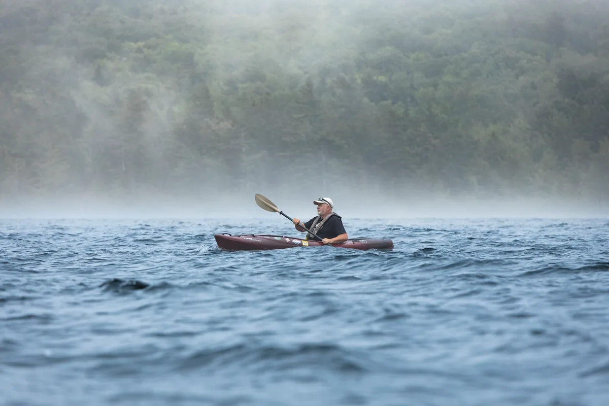
A carriage road, lower forest loop, or the gradual section of Ocean Path can lower exposure, but none removes every hazard. Roots and boardwalks become slick, bicycles share carriage roads, and coastal waves can reach beyond the edge you expected to remain dry.
Trips and falls are the park's leading safety problem. Good tread helps, while route choice, spacing, dry conditions, and a willingness to turn around control the situations in which that tread must work.
Carry at least one liter of water for a normal hike and more on warm days, as the park advises. Exposed granite offers little shade, and a cool morning can become a hot ridge before the return.
Blue blazes and Bates cairns mark many trails, but the park tells hikers to use a topographic map rather than relying only on the free handout map. In fog, keep the confirmed route underfoot instead of following an unofficial cairn or a boot track into open granite.
When is the best time to hike Acadia?
Late spring through early fall gives access to the broadest mix of trails, roads, campgrounds, and transit. The best period within that span depends on whether you value full services, lighter traffic, fall color, cool climbing weather, or fewer insects.
No month guarantees dry granite or a parking space. Choose the season by the feature you need open, then check the specific road, campground, bus, and trail again before travel.
| Season | What tends to work | Main tradeoff | Best planning move |
|---|---|---|---|
| Spring | Lower trails, carriage roads when open, early road access, cool hiking | Mud, rain, fog, partial facility openings, and blackflies that often peak from mid-May to mid-June | Keep a dry-surface alternative and verify seasonal road openings |
| Summer | Broadest trail access, campgrounds, visitor facilities, and Island Explorer service | Midday congestion, fog, warm exposed granite, and full popular lots | Start early, use the bus, and keep a same-zone backup |
| Fall | Cooler hiking, changing foliage, and many services through early or mid-October | Shorter daylight, busy foliage weekends, and facilities closing on different dates | Carry a headlamp and verify the exact operating calendar |
| Winter | Quiet coast, selected paved access, snowshoeing, skiing, and carriage-road travel when conditions permit | Closed roads and facilities, hidden trail markers, ice, and rapid weather change | Avoid committing to mountain trails and check the winter route status that morning |
The Park Loop Road normally operates from April 15 through December 1, while unpaved roads normally run from May 15 through November 15. Weather, maintenance, and seasonal closures can shorten either window.
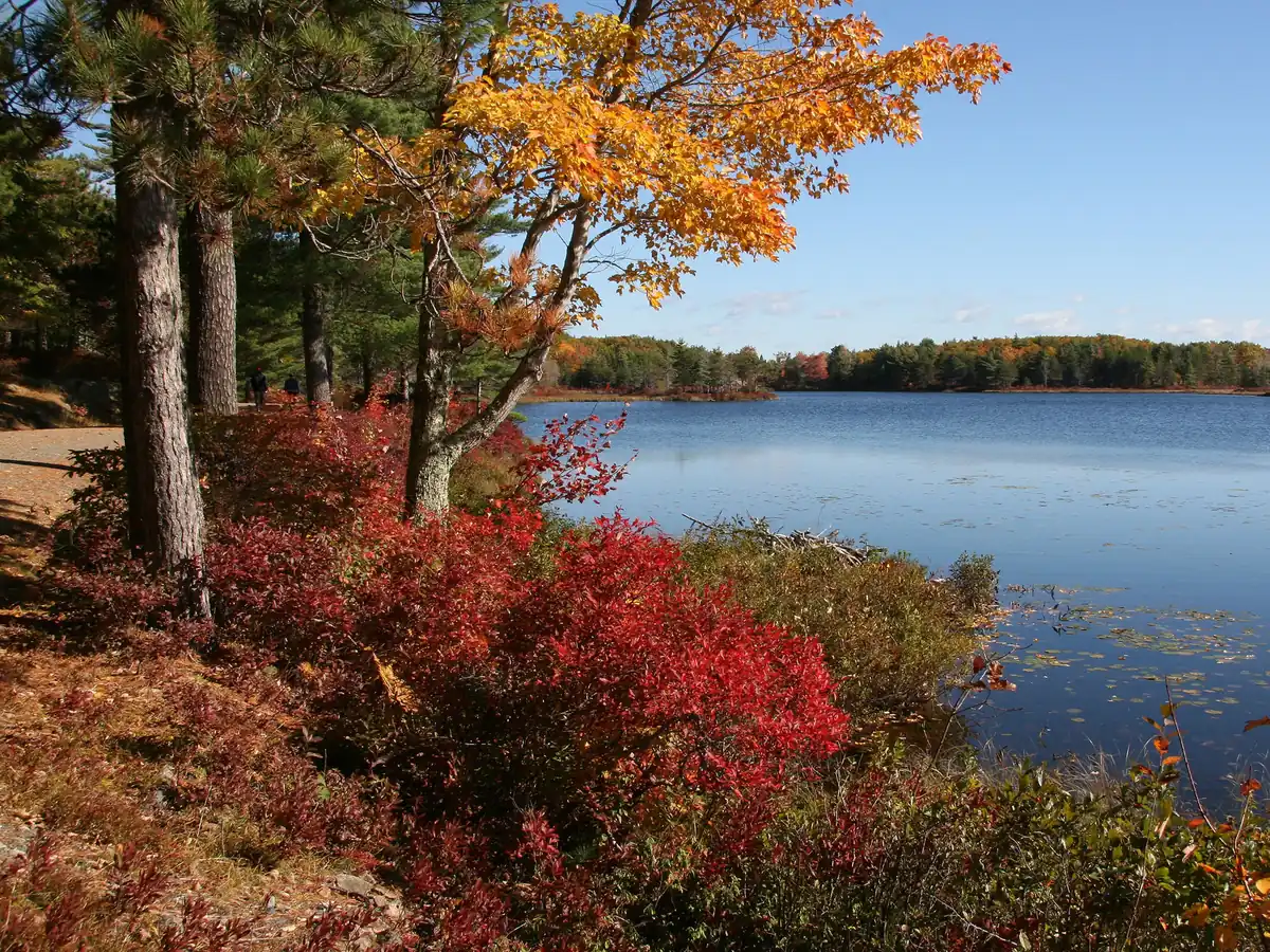
Summer has the fullest service network and the widest temperature range. It also concentrates visitors at the same east-side trailheads, so a bus-supported hike or a west-side day often works better than driving from landmark to landmark.
Early fall suits sustained hiking when the group can handle shorter days and cooler mornings. Peak foliage is usually around mid-October, but the date varies, and color does not keep a campground, restaurant, ferry, or shuttle open past its published season.
Spring can be quiet and raw. Blackflies are often most numerous from mid-May to mid-June, and damp soil, fog, lingering ice, or a closed unpaved road can matter more than the calendar label.
The park discourages winter mountain hiking because drifting snow can hide markers and ice can sit beneath the surface.
Snowshoes, cross-country skis, and conservative carriage-road plans fit winter conditions better than treating a summer summit route as unchanged.
Camping does not extend onto the trail network
Acadia has no backcountry, dispersed, roadside, overnight-parking, or winter camping. A long day hike ends at a reservable campground or lodging outside the park, not at a trail-side tent site.
All NPS campsites must be reserved online. Same-day booking may be possible only if Recreation.gov shows availability, so an empty-looking site is not permission to occupy it.
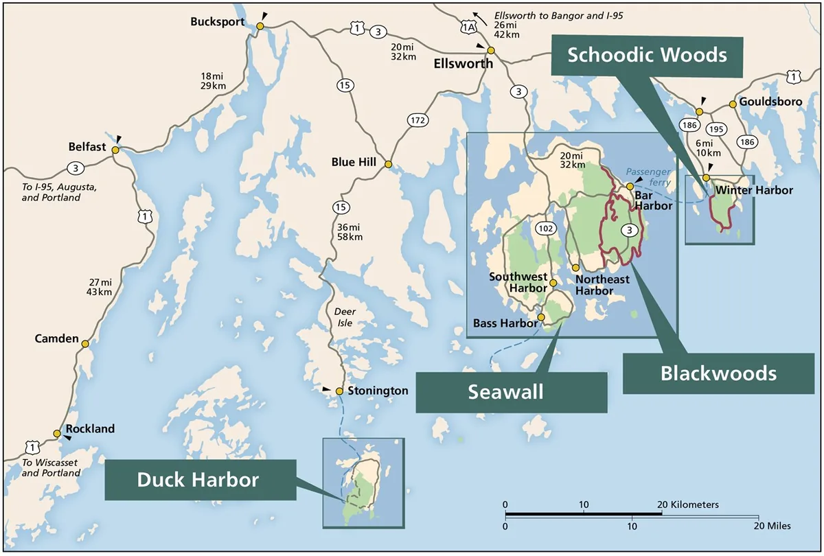
Blackwoods
An east-side Mount Desert Island base near Park Loop Road and the Cadillac South Ridge area. It reduces the drive to popular east-side trailheads but does not reserve their parking.
Seawall
A west-side Mount Desert Island base near Ship Harbor, Wonderland, Bass Harbor, and the quieter side of the island. It fits a west-side itinerary better than a daily return to Ocean Drive.
Schoodic Woods
A mainland base for Schoodic Head, coastal stops, and the peninsula's bike paths. It prevents an hour-long drive from Mount Desert Island from framing every Schoodic day.
Duck Harbor
Five lean-to shelters on ferry-access Isle au Haut. There is no potable water, so campers must bring or treat enough for the stay.
The campground calendar matters to the hiking plan.
In 2026, Blackwoods operates May 1 through October 19, Seawall and Schoodic Woods run May 20 through October 12, and Duck Harbor runs June 17 through October 5.
Those dates describe the scheduled season, not a promise that a site remains available. Reserve the campsite first, then design hiking days around its region and the transport that actually runs during the stay.
- Reserve every park campsite through Recreation.gov before occupying it
- Keep the entrance pass separate from the campground fee
- Choose Blackwoods or Seawall by the side of Mount Desert Island you plan to hike
- Use Schoodic Woods when the peninsula is a main destination rather than a rushed side trip
- Carry or treat all water for Duck Harbor because the campground has no potable source
- Store food and scented items according to current campground rules
A campground fee does not include the park entrance fee. It also does not grant access to a full trailhead lot or remove the Cadillac vehicle reservation requirement.
Backpacking searches often lead to Acadia because the park has long trail days and remote-looking coast. The legal overnight boundary is still firm, so link trails into a day route and return to the reserved base.
Keep coastal plans on the tide's clock
The Bar Island Trail begins on ground that disappears twice each day. A gravel bar connects downtown Bar Harbor to the island for about 1.5 hours before and 1.5 hours after low tide.
That creates a three-hour crossing window, not three hours of free hiking after arrival. The 1.9-mile round trip must leave enough time to cross the half-mile bar in both directions before water covers it.
Tide time is the turnaround time. A screenshot from another date cannot substitute for the tide table for Bar Island on the day you walk.
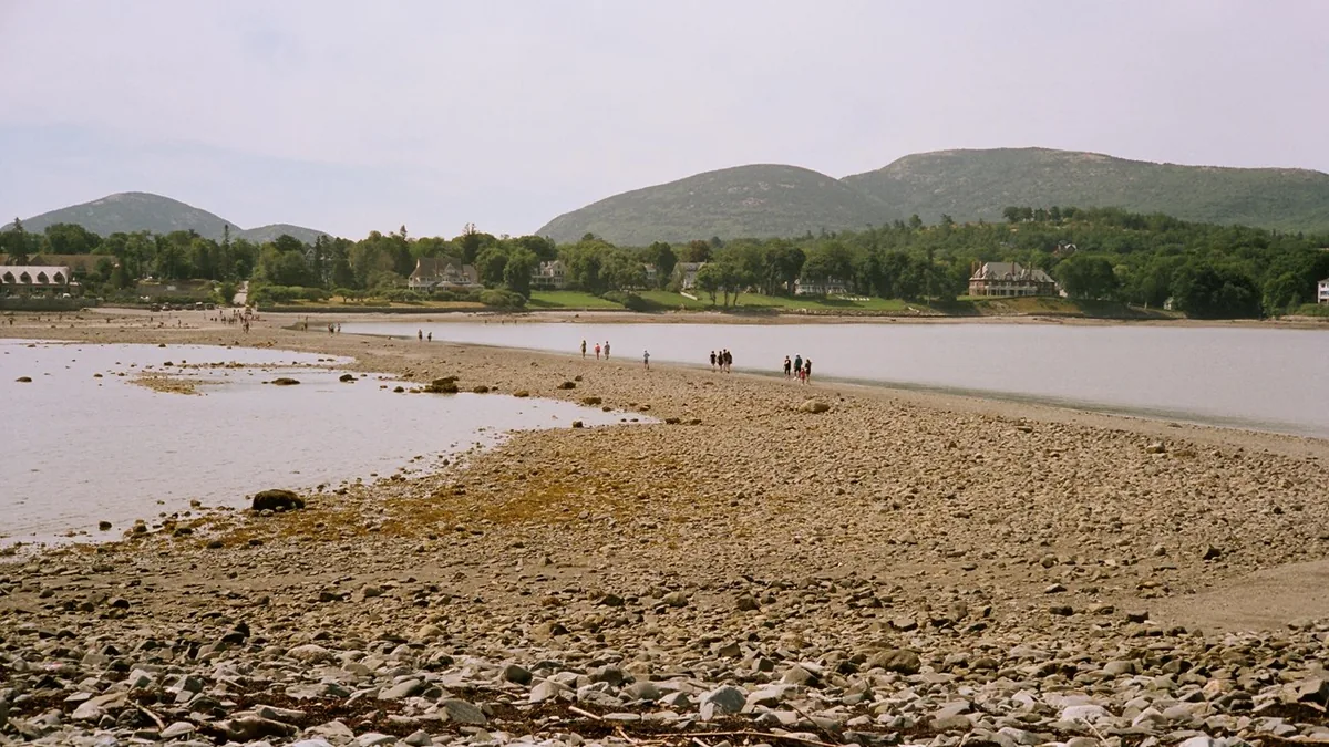
Bar Island is the clearest timing lesson, but the same coast requires attention elsewhere.
Tidepooling works best from 1.5 hours before to 1.5 hours after low tide, and rising water can isolate rocks or remove the dry return line.
Black rock and seaweed are especially slippery. Closed-toe shoes protect against sharp shells and rock, while slow steps protect the small animals living in pools and crevices.
The ocean remains cold even in summer, averaging about 55 to 60°F. Do not turn a missed land crossing into a swim, and keep children within reach near surf-facing ledges.
Ocean Path and Great Head do not disappear like the bar, but tide and surf still change where waves reach. Stay back from wet ledges, never turn your back on the sea, and move the route inland when a surf advisory raises the consequence of a coastal stop.
Finish the park plan with three current checks. Confirm the official conditions page, the weather at the actual hiking elevation, and the relevant tide or transport schedule on the same day.
Sources
Park geography, trail mileage, carriage roads, regional access, and current operating context were verified through the National Park Service Places to Go, Hiking, and Operating Hours and Seasons pages on August 23, 2026.
Parking and transit guidance came from the NPS peak-season traffic and Island Explorer pages.
Entrance and Cadillac access rules came from the current Fees and Passes page.
Seasonal weather, wet-granite guidance, and live access checks came from the NPS Weather, park brochure, and Current Conditions pages.
Campground rules and reservation details came from the official Campgrounds page.
Representative trail facts were checked against the official NPS pages for Ocean Path, Jordan Pond Path, Beehive Loop, Great Head, Cadillac South Ridge, and Bar Island.
RespectHazards to plan for
- wet granite
- cliff exposure
- fog and fast weather changes
- tidal cutoff
- traffic and illegal parking
- cold coastal water