
Bryce Canyon National Park Hiking by Elevation
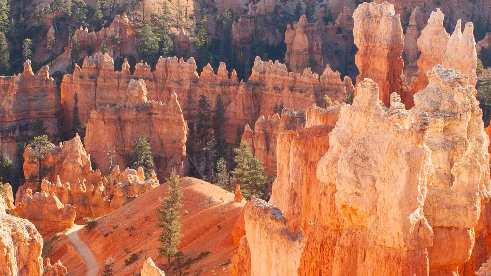
Plan Bryce by the uphill return, high elevation, shuttle loop, lightning shelter, seasons, and the boundary between day hiking and overnight permits.
Weather
Bryce sits at high elevation with large daily temperature swings, summer thunderstorms, winter snow, and icy freeze-thaw surfaces.
Plan the practical details
- Access
- The main amphitheater and its shuttle form one access system, while the southern scenic road and backcountry require separate driving or overnight plans.
- Permits
- Normal day hiking needs no permit. Backcountry overnights, developed campgrounds, and entrance admission use separate systems.
Bryce Canyon hiking begins on a high plateau and usually starts downhill. The easy first minutes borrow elevation that you must repay on the return, when the group is warmer, more tired, and still breathing thin air.
A useful plan therefore starts with the uphill finish. Choose rim, amphitheater, or backcountry terrain, then fit shuttle timing, thunder shelter, altitude response, and overnight permission around that commitment.
Budget the climb home first. Short mileage is not a complete measure when every step below the rim makes the exit steeper.
- 9,115 feetHighest park elevationsVisitors receive much less oxygen than at sea level
- 1 literPark water guidance every one to two hoursHeat, sun, and exertion can require more
- 10 milesLightning can strike from a storm you only hearThunder means move indoors
- 15 minutesTypical 2026 shuttle intervalCapacity and traffic can still create waits
The main amphitheater packs many choices into a small map. What separates them is the position of the rim, the surface beneath the hoodoos, and how quickly the group can reach shelter.
Why is hiking down into Bryce harder on the way back?
Bryce sits between roughly 8,000 and 9,115 feet. At the highest elevations, the park describes the available oxygen as about 70 percent of what a sea-level visitor may be used to.
That change can slow a normal walking pace before anyone feels ill. A person who talks easily at the rim may need more pauses after descending into warmer, less ventilated trail corridors and then beginning the climb out.
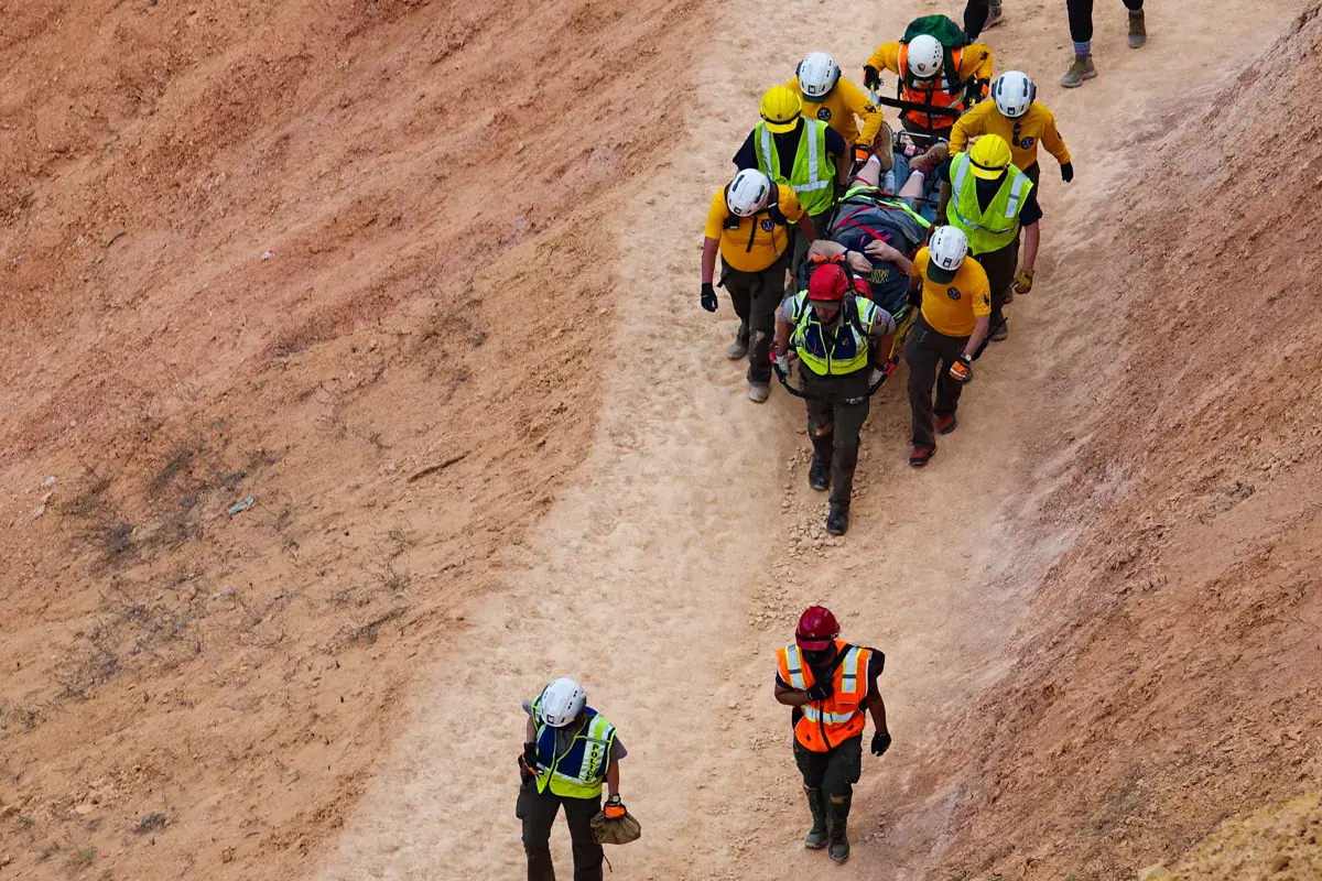
Set a turnaround by remaining energy, water, and weather time rather than by the attraction ahead. Turning after the group is tired leaves the hardest part of the hike unpaid.
Use shorter steps and a sustainable pace from the beginning. The goal is to reach the rim with enough attention for loose gravel, switchbacks, and other hikers, not merely enough strength to keep moving.
The Altitude Itinerary Check can help expose a fast jump from low lodging to a high first day. It does not diagnose illness, but it makes the planned elevation change visible before travel.
You should compare the planned climb with the energy and water remaining at the lowest point, because the rim is the finish rather than an optional extension.
Which Bryce Canyon hiking area fits your day?
Rim walks keep frequent exit points and rapid access to buildings or vehicles. Amphitheater routes descend among hoodoos and make the uphill return unavoidable, while backcountry routes add distance, navigation, and overnight logistics.
| Terrain family | What the day feels like | Main commitment |
|---|---|---|
| Rim viewpoint walk | Broad views with little elevation loss | Wind, lightning, ice, and cliff edges |
| Rim Trail segment | Flexible point-to-point walking between overlooks | Shuttle timing or a return walk |
| Amphitheater loop | Hoodoo corridors, switchbacks, and an uphill finish | Heat, altitude, footing, and climb capacity |
| Plateau forest route | Quieter trail with less continuous hoodoo exposure | Navigation, weather, and longer return distance |
| Backcountry route | Remote forest and rock terrain beyond the main amphitheater | Permit, campsite, water, and self-rescue |
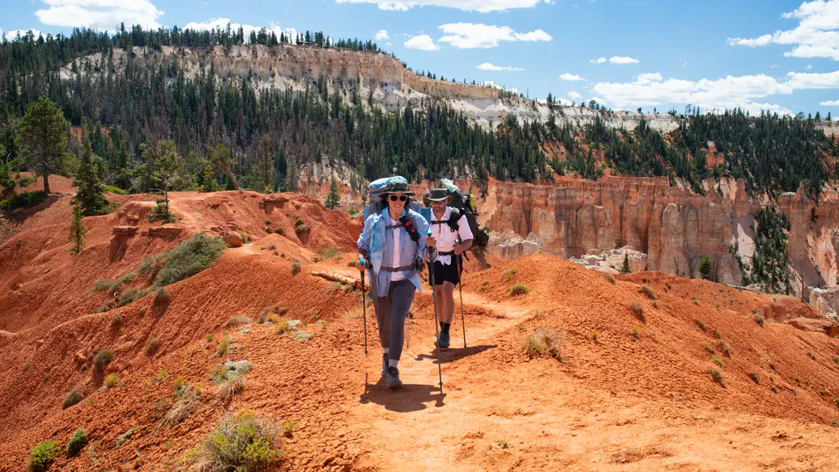
Queen's Garden and Navajo Loop form a popular combination because they join two distinct sides of the amphitheater. Current closures can break that combination, so verify each connecting segment instead of assuming the famous loop is intact.
Rim Trail is more adaptable. A group can walk one segment, use the shuttle for the return during its season, or turn an uncertain day into an out-and-back with shelter never far away.
Below the rim, trail width and footing can change between switchbacks, tunnels, and wash crossings. Passing slower hikers also takes time on narrow sections, so a crowded descent may not produce the fast schedule suggested by distance alone.
Do not combine two loops simply because the junction is open. Recheck water, remaining climb, and thunder before extending the route beneath the rim.
Terrain determines the cost of changing your mind. A rim route can often stop at the next overlook, while a below-rim route still owes the climb after the decision to turn around.
How does the Bryce Canyon shuttle work for hikers?
The 2026 Bryce shuttle runs from April 3 through October 18 on a seasonal schedule. Service is included with park admission, and buses typically reach a stop about every 15 minutes.
The best use is to park once outside or near the main amphitheater and connect viewpoints without repeatedly moving the car. That reduces congestion and makes a one-way Rim Trail segment practical.
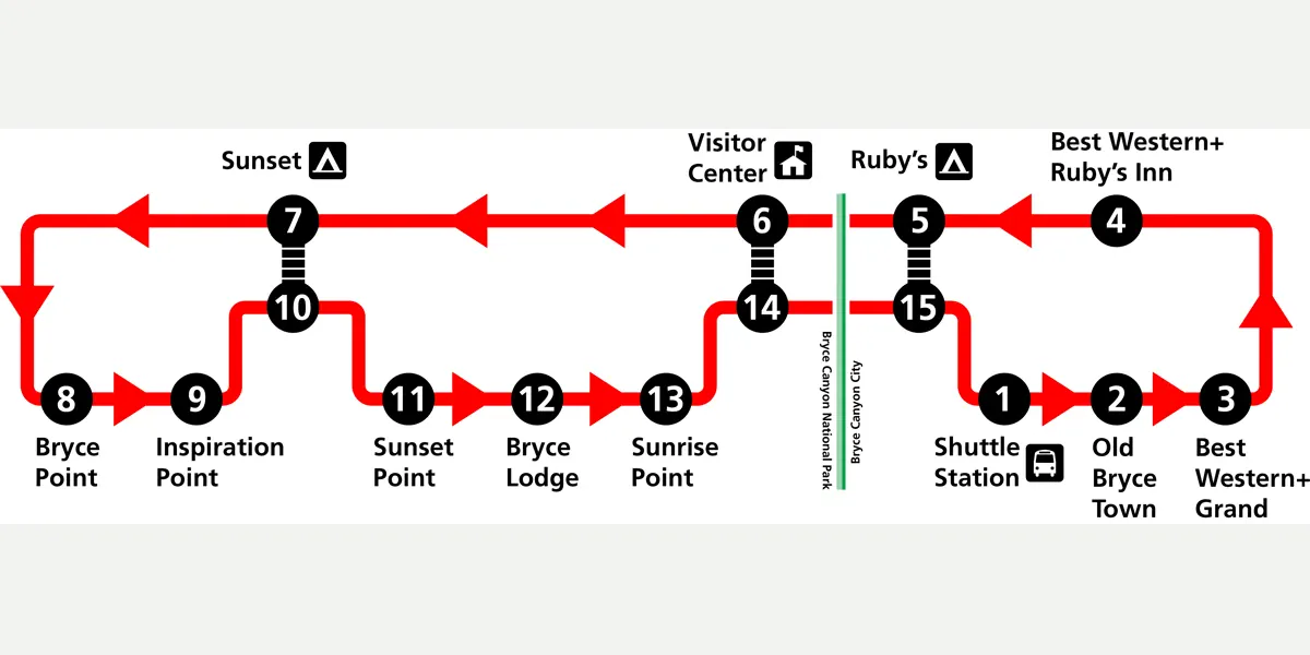
A shuttle-supported hiking day
- Before boardingSave the current schedule and identify the return stopCell service and live tracking are conveniences, not the return plan
- At the first stopConfirm the last practical bus and the walking alternativeA missed ride does not become an emergency
- During the hikeRecheck thunder, pace, and remaining daylight at each rim accessThe route can end at an earlier viewpoint
- At the finishBoard before the final scheduled trip rather than waiting for itTraffic or capacity can delay the expected bus
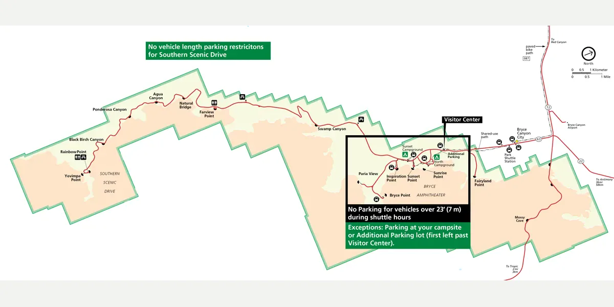
The shuttle does not run the full scenic drive to Rainbow Point. A southern park-road day remains a driving plan, while the shuttle concentrates on the amphitheater and nearby services.
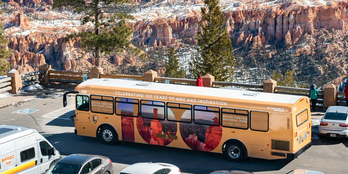
Large vehicles face additional parking restrictions during shuttle hours. Check the official vehicle map before entering the amphitheater corridor instead of discovering the limitation at a full lot.
The bus also gives a tired group an earlier exit from a Rim Trail plan. Name two intermediate stops before walking so the route can end without a debate when pace or weather changes.
Pets are not allowed on the shuttle, which changes transport for visitors traveling with a dog. A legal pet plan must stay within current park pet rules and cannot rely on leaving an animal in a hot vehicle.
When should you leave the Bryce rim because of lightning?
Bryce has a high lightning hazard, and the rim concentrates exposure. If you hear thunder, the storm is within about 10 miles and the correct destination is a substantial building or hard-top vehicle.
A shuttle shelter, isolated tree, open-sided structure, or pit toilet is not reliable lightning protection. Leave the Rim Trail and viewpoints early enough to reach real shelter before the storm arrives.
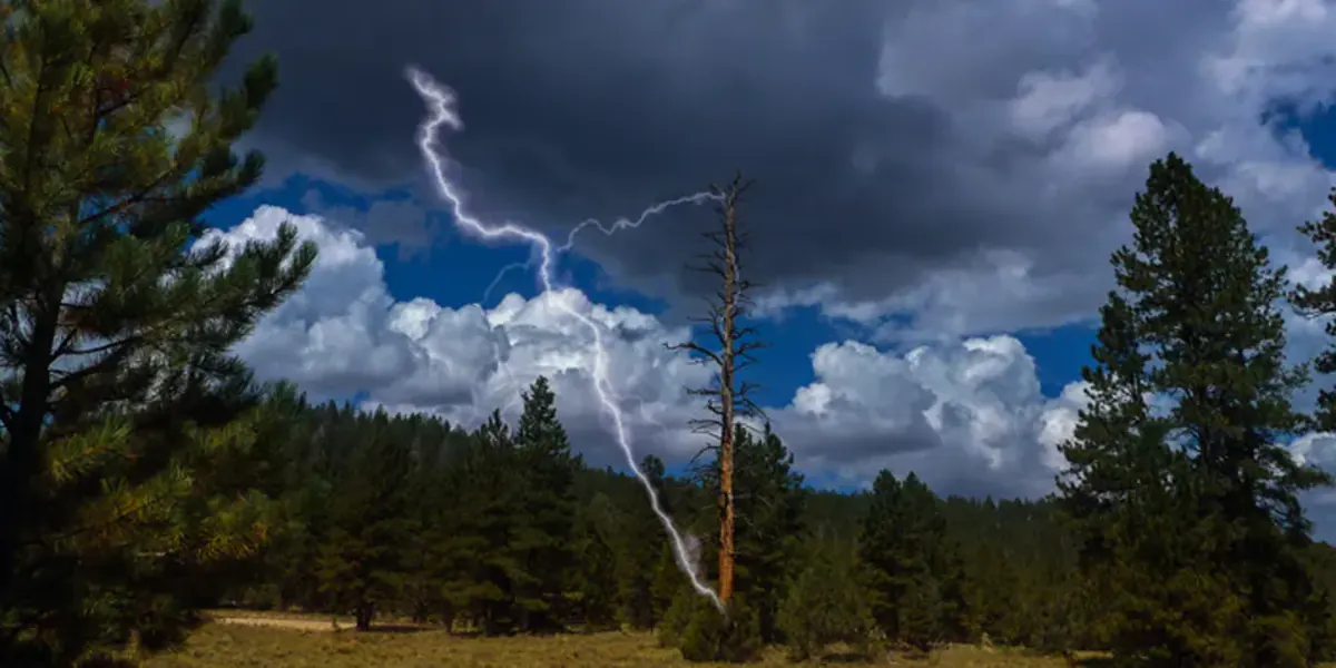
Summer storms often develop in the afternoon, which favors an early below-rim hike. A blue patch overhead is not proof of safety because lightning can travel beyond the visible rain shaft.
Heavy rain also changes hoodoo trails through runoff, mud, and falling debris. The useful fallback is a protected indoor stop, not another open viewpoint farther along the rim.
How does elevation affect hiking at Bryce Canyon?
A faster heartbeat and slower pace can reflect exertion at elevation, but headache, nausea, dizziness, unusual fatigue, or poor coordination deserve attention. Stop gaining elevation and reassess instead of pushing toward the next overlook.
Symptoms that worsen with rest can require descent and medical evaluation. Learn the recognition and descent boundaries for altitude sickness before the first high-elevation day.
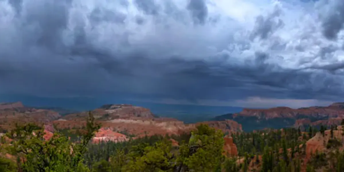
- Spend time at the rim before committing below it
- Turn around before fatigue makes the uphill return uncertain
- Stop ascent when headache or nausea appears
- Descend when symptoms worsen or coordination changes
- Use emergency services for severe confusion, collapse, or breathing difficulty at rest
Hydration supports normal function but does not cure altitude illness. Drink to thirst, eat regularly, and avoid forcing large volumes of water in an attempt to fix symptoms.
The group should move at the pace of the least acclimatized person. Splitting up leaves the person with the highest risk without the partners needed to notice a change.
Sleep, alcohol, illness, and a rapid drive from low elevation can change how the first day feels. Keep arrival day on the rim when the group has not yet shown that it can walk and recover normally at Bryce elevation.
One normal hour does not guarantee the rest of the day. Reassess after the first descent because heat, exertion, and altitude can combine on the uphill return.
When is the best time to hike Bryce Canyon?
Late spring through early fall offers the broadest services and trail access, but summer also brings afternoon lightning and busy parking. Winter produces striking snow-covered hoodoos with icy trails, short daylight, and a narrower operating pattern.
The best period depends on whether the main goal is a below-rim loop, a rim walk, an overnight route, or winter scenery. Verify the exact trail and road because freeze, thaw, rockfall, and snow can close individual segments in any shoulder season.
| Season | What tends to work | Main tradeoff | Better plan |
|---|---|---|---|
| Spring | Cool rim walks and gradually opening below-rim trails | Snow, mud, freeze-thaw debris, and changing services | Carry traction until the surface is confirmed dry |
| Summer | Full shuttle season and broad day-hike access | Afternoon lightning, sun, and crowds | Begin below-rim routes early and finish near shelter |
| Fall | Cooler hiking and lighter late-season traffic | Shorter daylight and tapering shuttle dates | Protect the uphill finish with an earlier turnaround |
| Winter | Snowy amphitheater views and quiet rim access | Ice, storms, road restrictions, and limited services | Use traction and choose short routes after a same-day check |
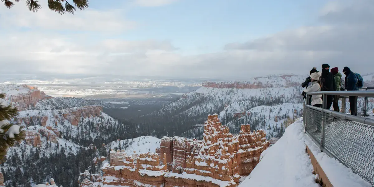
Snow can improve contrast while concealing trail edges. Winter hiking gear helps only after the route has been reduced to a sensible surface and exposure level.
Summer requires the opposite adjustment. Sun and altitude dry the body quickly, while the return climb produces heat after the cooler downhill start.
Spring and fall can cross freezing overnight even after a mild afternoon. A shaded switchback may preserve ice longer than the rim road, which makes same-day traction and closure checks more useful than a monthly average.
Daylight deserves its own margin outside summer. The final climb is not the place to discover that the group has no headlamp or that the shuttle has stopped running.
Do you need a permit to backpack in Bryce Canyon?
Ordinary day hiking does not require a Bryce trail permit. Overnight travel in the backcountry does, and the permit is tied to an itinerary and designated camping areas.
Developed campgrounds use their own reservation system. A North or Sunset campground booking does not authorize camping on Under-the-Rim Trail, and a backcountry permit does not reserve a developed site.
- Day hiking
- No general trail permit
- Backcountry overnight
- Permit required for the itinerary and campsite
- North Campground
- Developed campground with year-round operation
- Sunset Campground
- Developed campground closed in winter
- Entrance admission
- Separate from campground and backcountry reservations
An overnight route has a different rescue and weather problem from a day loop. Carry navigation, warmth, water treatment, and a route that remains legal if a connecting segment closes.
The distinction between backpacking and hiking becomes concrete here. Sleeping below the rim adds campsite, food-storage, weather, and permit decisions that cannot be solved by extending a day-hike packing list.
Permit availability should not set the route difficulty. Accept a different campsite only after checking the new daily mileage, water source, elevation change, and escape options with the overnight pack included.
Keep the issued permit accessible and follow the assigned sites. A desirable flat area outside the itinerary does not become a legal campsite because the group is tired.
Where should you camp for early Bryce Canyon hikes?
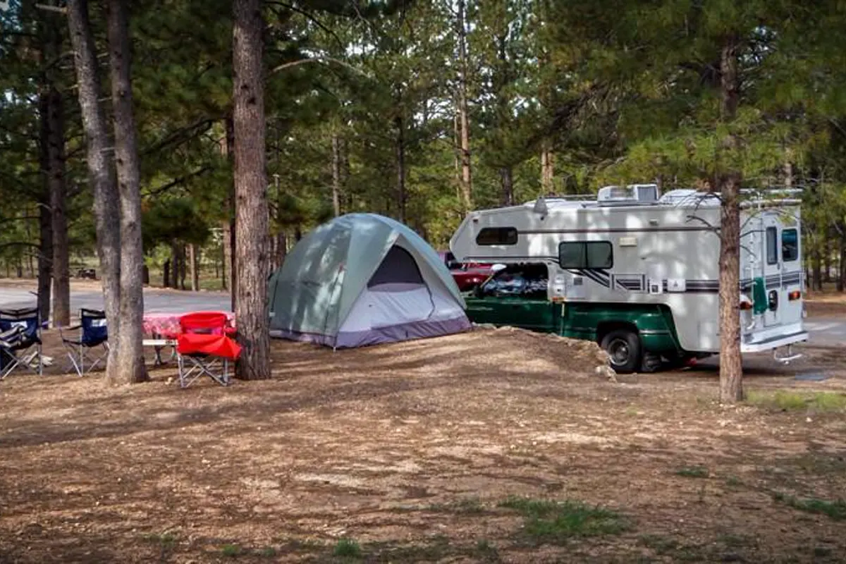
North and Sunset campgrounds sit near the visitor center and main amphitheater. A campsite can remove a drive from outside the park and let the group board the shuttle without moving the vehicle again.
North Campground operates year-round, while Sunset closes in winter. Reservation windows and open loops change, so use the current official campground page for the actual trip dates.
North Campground
Best for year-round developed camping near the visitor center, subject to current loop openings and reservations.
Sunset Campground
Best for seasonal access close to the amphitheater and shuttle, but it does not operate in winter.
Backcountry campsite
Best for a permitted wilderness itinerary whose water, navigation, and weather plan are complete.
Outside the park
Best when park sites are unavailable, with the entrance drive included in the morning schedule.
Leave the car at the campsite during shuttle season when the operating map supports the day's route. That reduces congestion and makes the campsite serve the hike rather than merely the night.
A convenient camp does not reduce altitude or erase the uphill return.
Keep the first hiking day conservative even when the trailhead is only minutes away.
Campground food storage and quiet-hour rules protect more than comfort.
A clean site reduces wildlife problems, while an early organized departure lets the group use the cool morning without waking neighbors or searching for loose gear.
Before sleep, stage water, layers, map, and shuttle information for the next day. That preparation turns the campsite into useful access instead of simply moving the same decisions to dawn.
The first morning should begin with the easiest uncertainty to verify. Check the sky, trail surface, and how each person responds to the campground elevation before committing to a long descent.
A short rim walk can be a useful altitude and footing check without borrowing hundreds of feet of elevation.
If the group sleeps poorly, wakes with a headache, or cannot walk and talk at an easy pace, reduce the below-rim objective. More convenient access does not compensate for a body that has not adjusted.
Keep the vehicle packed for both the chosen hike and its weather fallback.
Warm layers left in a tent cannot help when thunder sends the group back to a cold, windy rim.
During shuttle season, note the stop that returns you to camp as well as the stop that begins the hike. Similar stop names and busy loading areas are harder to sort when the group is tired.
The campground earns its value when it removes driving and protects the uphill-return margin.
That margin should remain visible in the day's turnaround time, water reserve, and final shuttle choice. If any one of those disappears, shorten the route before the group drops below the rim.
A rim fallback is useful only when it removes the exposed descent and uphill return that made the original plan unsuitable.
Sources
Trail distances, elevation change, and below-rim route descriptions were checked against the National Park Service Bryce day-hike guidance. Transport details use the current Bryce shuttle information.
Altitude and storm decisions use the park's high-altitude hiking guidance and lightning safety rules. Overnight planning was checked against official campground information.
RespectHazards to plan for
- altitude illness
- lightning
- dehydration
- falls
- snow and ice
- rockfall