
Grand Canyon National Park Hiking by Return Effort
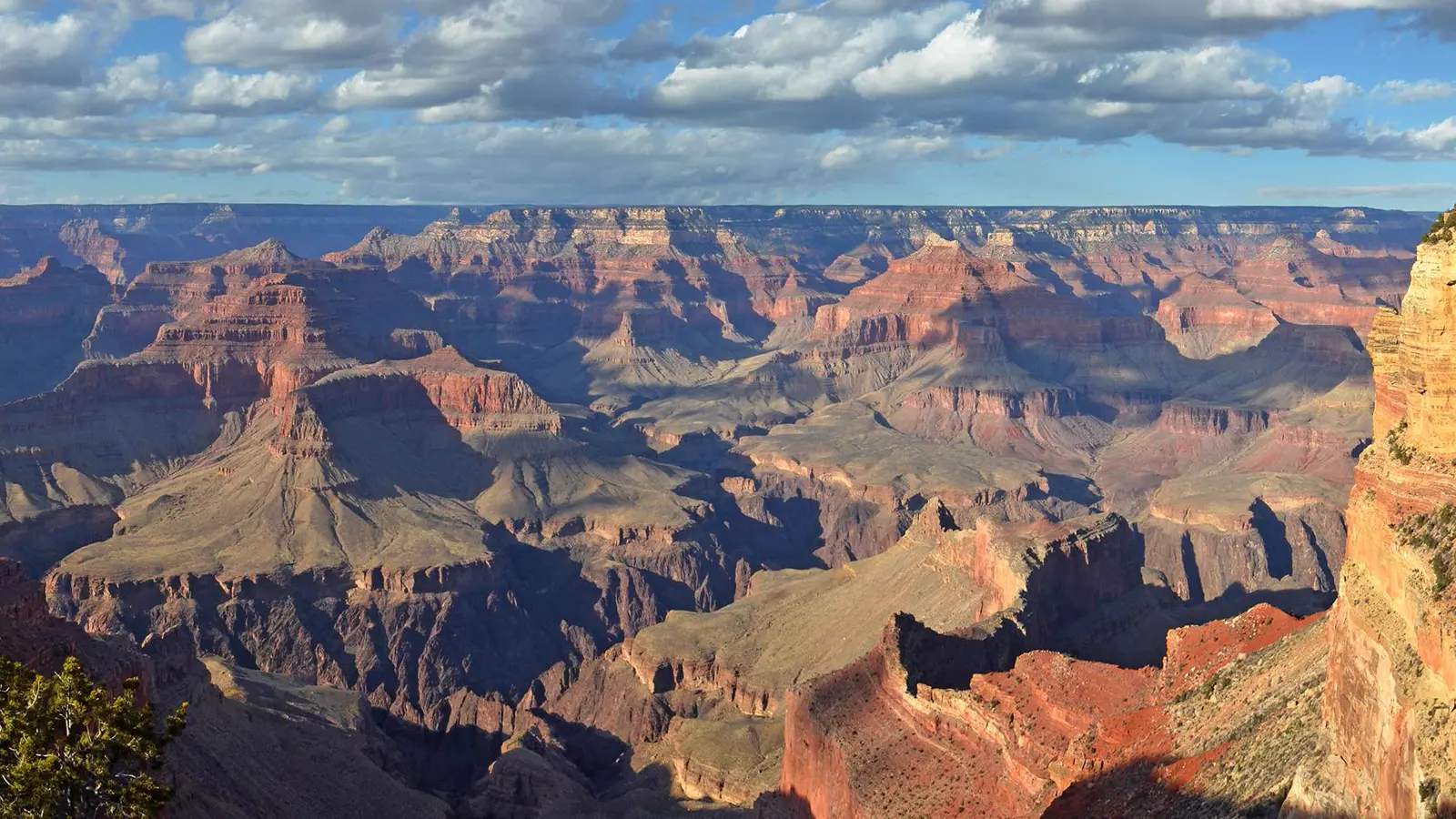
Plan Grand Canyon from the uphill return, with rim access, inner-canyon heat, current water, shuttle timing, and overnight permits built into the route.
Weather
Temperature rises rapidly below the rim. Summer heat, monsoon storms, winter rim ice, and large elevation differences can coexist in one trip.
Plan the practical details
- Access
- South Rim operates year-round with a seasonal shuttle network. North Rim vehicle access is seasonal and requires a separate long road approach.
- Permits
- Ordinary day hiking needs no backcountry permit. Overnight hiking, undeveloped rim camping, and river travel use separate permit systems.
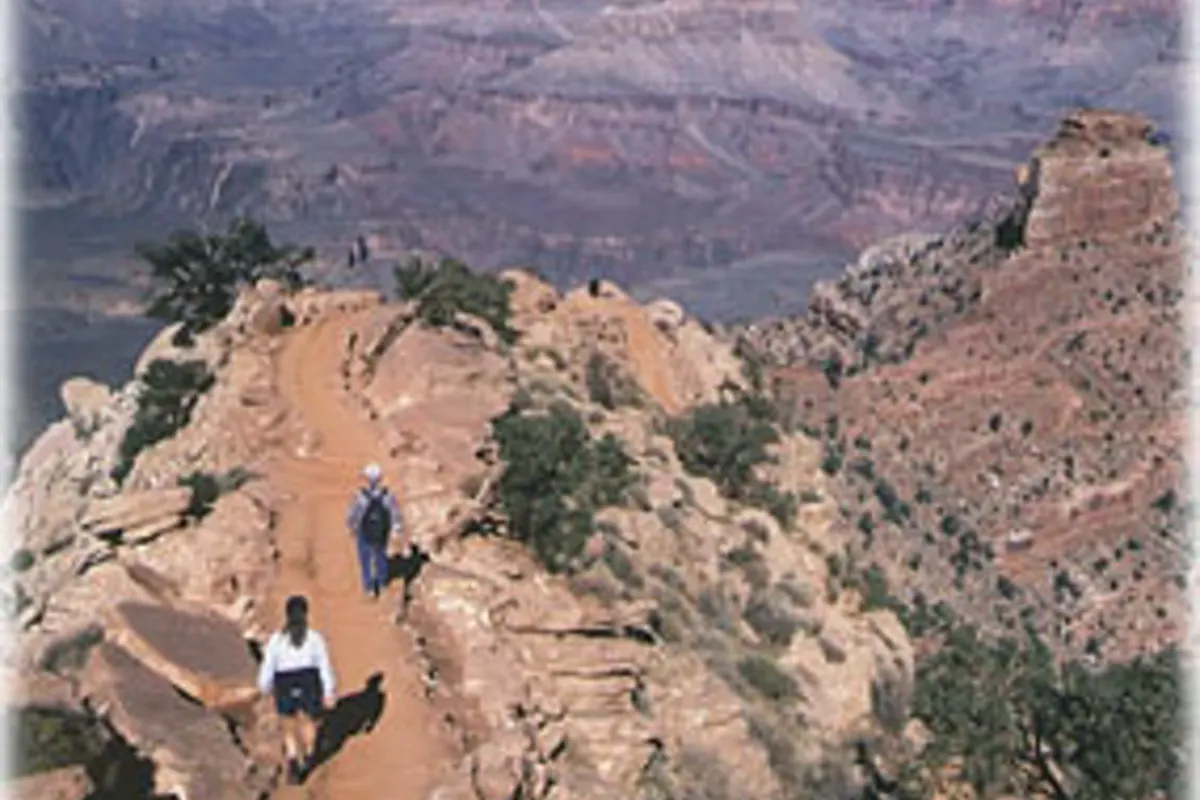
Grand Canyon hiking reverses the normal mountain day. You begin in cooler air, spend gravity on the descent, and meet the hardest climb after the inner canyon has become hotter and the group has already used hours of energy.
Plan from the return upward. You should choose the rim and access system first, limit your descent by current water and heat, and know how the shuttle or vehicle will reconnect the finish with the start.
The climb home owns the turnaround. An easy downhill pace is evidence of gravity, not evidence that the full route fits the group.
South Rim
Year-round road access, the largest service network, several shuttle routes, and the busiest inner-canyon trailheads.
North Rim
Seasonal road access, fewer services, higher elevation, and a separate drive far from the South Rim.
Rim walking
Flexible distance with frequent viewpoints and little required elevation loss.
Inner-canyon day hike
Rapid temperature gain, a delayed climb, limited shade, and water sources that can change status.
Backcountry overnight
Permit-bound itinerary with campsite, water treatment, food, and evacuation decisions.
The canyon covers 278 miles of the Colorado River and cannot be planned as one overlook. A South Rim day, North Rim day, and below-rim trip use different roads, seasons, services, and physical commitments.
Which rim should you use for a Grand Canyon hike?
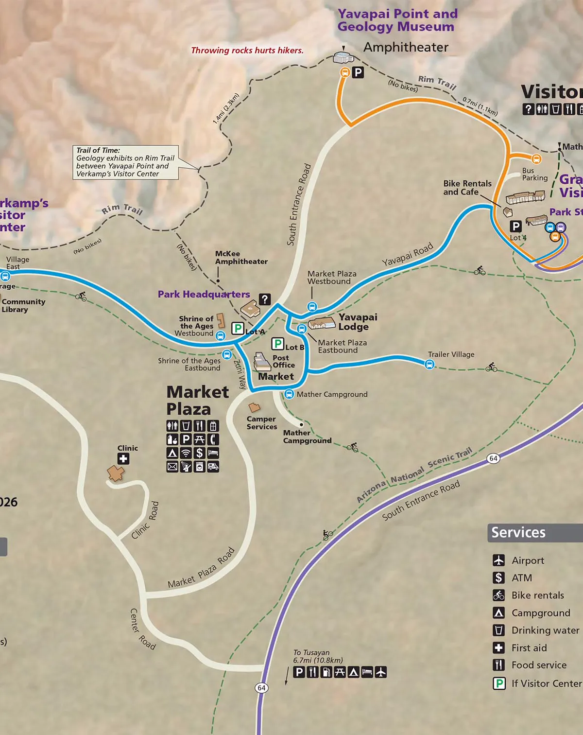
The South Rim remains open throughout the year under normal conditions. It provides the main visitor center, village, developed campgrounds, parking areas, and free shuttles that connect several trailheads.
The North Rim is a separate destination reached by a long road approach and closes to vehicle access during winter. Looking across the canyon does not make the opposite rim a nearby backup.
| Trip type | Access system | Main planning limit |
|---|---|---|
| South Rim viewpoint day | Private vehicle plus seasonal shuttle routes | Parking, route calendar, and last practical bus |
| South Rim below-rim hike | Bright Angel or South Kaibab access | Heat, water status, and uphill return |
| North Rim day | Seasonal State Route 67 access | Road season, limited services, and higher elevation |
| Rim-to-rim route | Two distant road systems or arranged transport | Extreme distance, logistics, weather, and permit needs for an overnight |
| Backcountry overnight | Permit itinerary and approved campsites | Water, daily elevation, campsite availability, and closures |
Choose the rim that matches your lodging and road approach before selecting a trail. A hotel name near one rim or a map pin across the canyon can hide several hours of driving.
Rim Trail is the adaptable choice when the group wants canyon scale without committing to the climb. It can be shortened at an overlook or combined with a shuttle during the current operating season.
The two rims also differ in elevation and weather. A route chosen for the North Rim cannot be evaluated with a South Rim forecast, even when both viewpoints face the same canyon.
Keep your lodging, entrance, and trailhead on the same rim unless the drive between them is an intentional part of the itinerary. Crossing by road takes hours and does not work as an afternoon correction.
Why does the climb out control the turnaround?
Every step below the rim increases the energy needed to leave. The air also becomes warmer, with inner-canyon temperature rising about 5.5 F for each 1,000 feet of descent.
Summer temperatures near Phantom Ranch can average roughly 30 F warmer than the rims. A cool dawn at the trailhead can therefore become severe heat before the group begins the sustained ascent.
- 5.5 FApproximate warming per 1,000 feet descendedRim weather cannot stand in for inner-canyon heat
- 30 FPossible average summer difference near Phantom RanchThe return can be much hotter than the start
- 10 am to 4 pmSummer hours to avoid inner-canyon hikingMove strenuous travel out of peak heat
- Zero waterSouth Kaibab between trailhead and riverCarry the full route supply for a day hike
Set the turnaround by the slowest climber and the predicted return temperature. If the group reaches the planned point early, keep the extra margin instead of spending it on more descent.
Trekking poles can help manage repeated steps, but they do not restore heat tolerance or climbing energy. The best control is a shallower turnaround reached before anyone feels depleted.
Do not attempt a rim-to-river-and-back day because the mileage looks familiar from another park. The vertical change, heat, limited shade, and delayed ascent create a different physical problem.
Mules also use several corridor trails. Listen for instructions, step to the uphill side when directed, remain quiet and still, and do not surprise stock with sudden movement near a narrow edge.
Resting does not erase the climb that remains. Use every stop to reassess food, water, heat, pace, and the next realistic turnaround rather than to negotiate for more descent.
Can you rely on trail water in the Grand Canyon?
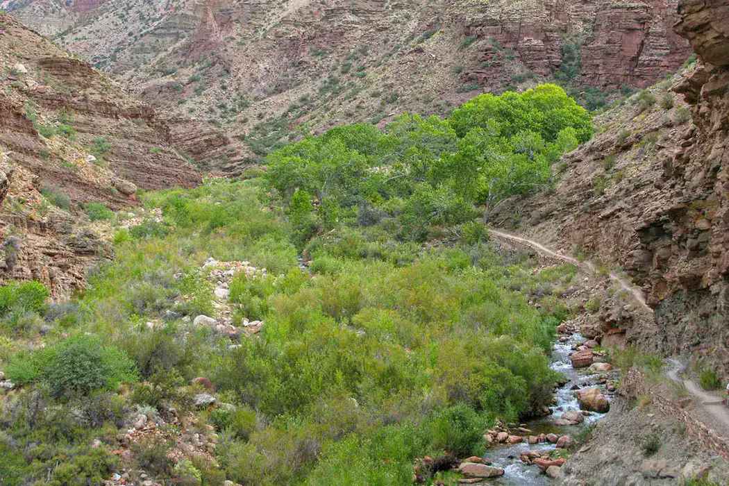
Grand Canyon water infrastructure changes with breaks, maintenance, freezing conditions, and closures. A tap shown on a map can be off on the day of the hike, so current status belongs beside the route distance.
South Kaibab has no water between the trailhead and the river. Bright Angel has seasonal pipeline stations, but each must be confirmed on the current hiking message page.
- Check every planned tap on the morning of the hike
- Carry enough water to reach the next confirmed source
- Bring a treatment method when the itinerary depends on natural water
- Turn around before the reserve is needed for ordinary progress
- Match food and salty snacks to the length and heat load
- Recognize the signs of dehydration before judgment and coordination decline
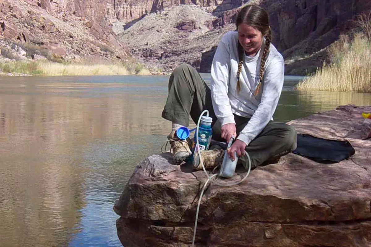
A water filter can remove many biological hazards, but the chosen method must fit viruses, sediment, capacity, and freezing risk. Chemical contamination and harmful algal growth may require avoiding the source entirely.
Do not force water beyond thirst in an attempt to prevent every heat problem. Regular food, salt, cooling, pace, and time of day work with hydration.
Pipeline stations can fail after the group has already entered the canyon. A small treatment system and knowledge of the next natural source create resilience only on routes where safe collection is legal and physically reachable.
Protect filters from freezing during cold rim nights. Ice can damage internal media without leaving visible evidence, which may make the next treatment unreliable.
When is it too hot to hike below the Grand Canyon rim?
From May through September, the park urges extreme caution for inner-canyon hiking. Summer travel should avoid 10 am to 4 pm, when limited shade and reflected heat make cooling difficult.
An early start is useful only when the return also clears the heat window. Starting at dawn and continuing uphill through midday moves the hardest work into the wrong part of the day.
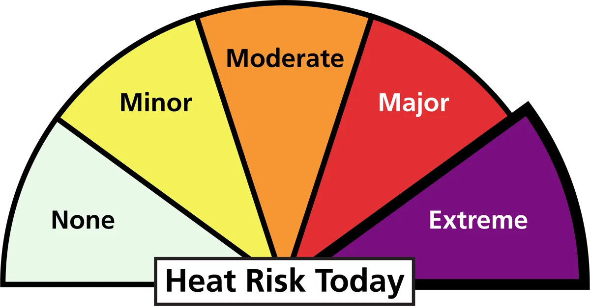
Rest before the group is exhausted and use shade whenever it is available. Eat often because appetite can fall during exertion even while the body needs carbohydrate and salt.
Nausea, dizziness, weakness, or unusual fatigue require a stop in the coolest available place with food and fluids. Confusion, collapse, or loss of normal behavior may indicate heatstroke and requires emergency help plus rapid cooling.
The strongest fallback changes elevation. Rim Trail, a museum, or a shuttle-linked overlook preserves the canyon experience without trapping the group below in rising heat.
How do South Rim shuttles connect trailheads?
South Rim shuttles connect visitor parking, village services, overlooks, and trailheads on seasonal routes. The system can support a one-way plan, but route calendars and last-bus times change during the year.
South Kaibab has no private-vehicle trailhead parking, which makes the shuttle or a legal drop-off part of the hike. Bright Angel access uses the village network and may finish far from the morning start.
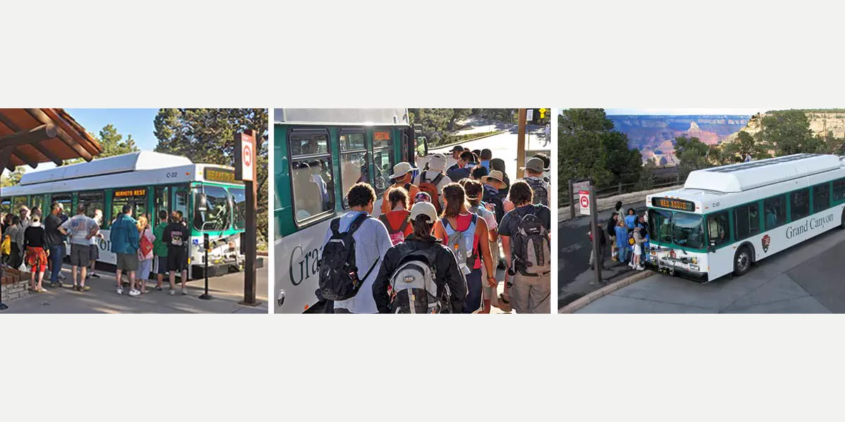
A shuttle-supported canyon route
- Night beforeSave the active route map and first useful departureThe start does not depend on finding a timetable after dawn
- At parkingLeave the vehicle in a legal all-day areaThe hike does not outlast a restricted space
- At the trailheadConfirm heat, water, closures, and return transport againCurrent conditions can still cancel the descent
- At the finishKeep margin before the last practical connectionA delayed climb does not become a road walk
The Hikers' Express provides selected early service in season, but it is not a universal dawn bus.
Verify the date and boarding point for the actual trip.
A phone can display a schedule, but it cannot move a group after service ends. Know the legal walking connection and whether the group could complete it after the planned climb.
Crowded buses can require waiting for the next vehicle. Keep warm layers and a small food reserve available after the hike instead of packing every essential where it cannot be reached at the stop.
Separate trailhead transport from village sightseeing. A group that moves the car repeatedly can lose the same morning window the shuttle was meant to protect.
When is the best time to hike Grand Canyon?
Spring and fall often suit sustained inner-canyon hiking because temperatures are less extreme. They also bring strong permit demand, variable rim weather, and occasional snow or ice at the trailhead.
Summer favors rim walks and very conservative early outings rather than deep day hikes. Winter can make the inner canyon comfortable while rim trails remain icy and North Rim road access is closed.
| Season | Better terrain | Main tradeoff | Useful decision |
|---|---|---|---|
| Spring | South Rim and many inner-canyon routes | Wind, late snow, and changing water status | Carry traction at the rim and verify every source |
| Summer | Rim Trail, overlooks, and short dawn walks | Extreme heat below the rim | Keep strenuous travel out of 10 am to 4 pm |
| Fall | Rim and inner-canyon hiking | Shorter daylight and high permit demand | Set an earlier uphill turnaround |
| Winter | South Rim and selected inner-canyon routes | Ice, snow, cold starts, and North Rim road closure | Use traction and protect exposed water equipment |
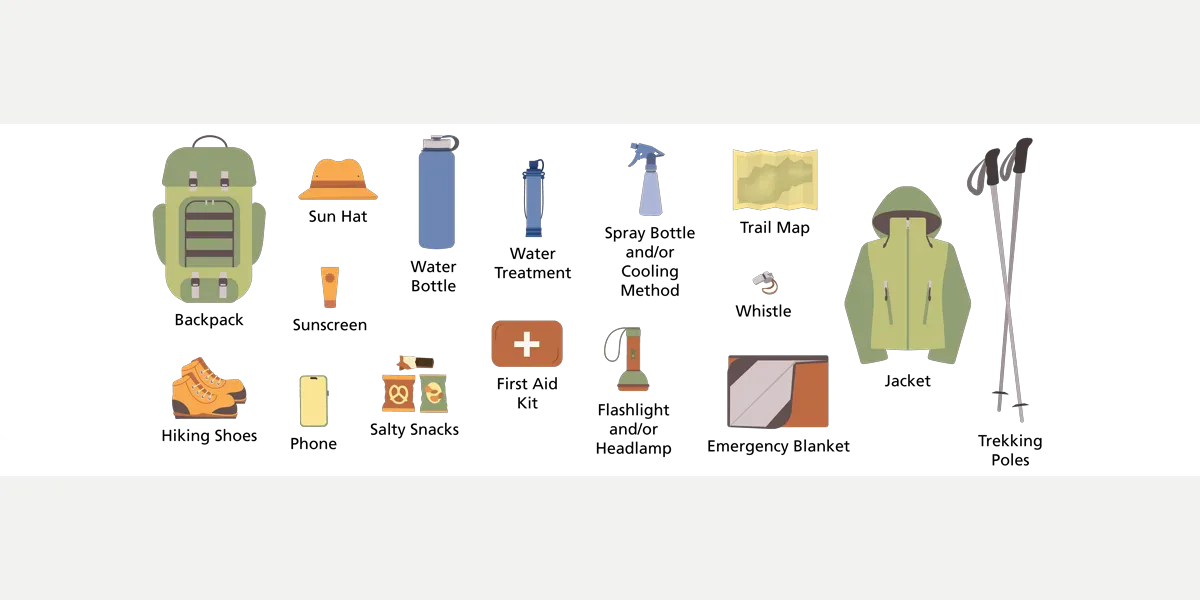
The useful season is defined by the elevation band you plan to enter. A warm river forecast and a freezing rim trail can both be true on the same morning.
Winter hiking gear matters most for the shaded upper switchbacks, where ice can remain after exposed ground has melted.
Do you need a permit to hike below the rim?
Ordinary day hiking does not require a backcountry permit. Overnight hiking, horseback travel, off-river overnight camping, and camping outside developed rim campgrounds do.
The permit authorizes specific dates and locations. It does not guarantee operating water, remove a closure, or make a daily elevation plan reasonable.
- Day hike
- No general backcountry permit
- Overnight below the rim
- Backcountry permit required
- Developed rim campground
- Separate campsite reservation or current operating system
- Rim-to-rim overnight
- Permit plus transport between distant rims
- River trip
- Separate river permit system
Build the itinerary around the permitted camps, then test each day against heat, water, ascent, and pack weight. The comparison between backpacking and hiking is especially sharp when every camp lies below the exit rim.
Carry water treatment even when the pipeline is expected to operate. A break should change how you collect water, not destroy the itinerary after the permit has started.
Permit competition is not evidence that a route fits. Reject an available campsite sequence when it forces a daily climb, water carry, or heat window beyond the group's proven ability.
Write the itinerary and emergency contacts on paper as well as the phone. Batteries drain quickly in heat and cold, and rescue information must remain readable when the device fails.
What should a backup Grand Canyon hike change?
A useful backup removes the condition that broke the main route. When heat removes an inner-canyon descent, another descent on the same aspect is only a new name for the same problem.
When water is off, choose a route that carries its entire supply. When ice affects steep upper switchbacks, choose a rim segment with a confirmed dry surface rather than relying on traction for a large fall consequence.
Heat failure
Stay on the rim, use the shuttle, and move between viewpoints or indoor exhibits.
Water failure
Choose a short route whose full supply can be carried from a confirmed fill point.
Shuttle failure
Use an out-and-back from legal parking instead of creating a one-way finish.
Ice failure
Move to a dry rim segment or postpone the descent rather than testing exposed switchbacks.
Crowding failure
Change to a quieter same-rim stop instead of driving toward the opposite rim.
Name the backup before departure and keep its map offline. A tired group should not need to invent a safe route after the original trailhead fails.
The fallback still needs its own weather, daylight, and access check.
Simpler does not mean consequence-free, but it should remove the hazard that made the first plan unreasonable.
Your group should be able to explain why the backup is safer before leaving the rim. A shorter descent may still fail if it shares the same broken water station, sun exposure, or icy upper switchbacks.
Set a decision time as well as a turnaround point.
If the main trailhead is not workable by that time, move to the fallback before parking, shuttle queues, and rising heat consume its useful window. Waiting for the original plan to recover can make both choices unsafe.
Keep the backup's food, water, traction, and map in the vehicle from the start. You should not have to return to lodging to make the alternate route possible.
After changing plans, tell the outside contact which route you are actually using.
The safest fallback often looks less dramatic on the map because it preserves options. A rim walk with several shuttle exits gives you repeated chances to shorten the day, while another below-rim trail commits the group to a second climb.
Sources
Heat, descent, water, and turnaround guidance was checked against the National Park Service Grand Canyon key messages, Hike Smart guidance, and safe-water information.
Trailhead transport uses the current South Rim shuttle information. Overnight and special-use requirements come from permits and reservations.
RespectHazards to plan for
- extreme heat
- dehydration
- falls
- water outage
- hyponatremia
- lightning
- winter ice