
Sequoia National Park Hiking by District and Elevation

Plan Sequoia National Park hiking by district, elevation, shuttle or road access, trail surface, water, bear storage, permits, and fire conditions.
Weather
Hot foothills can coexist with snow, cold nights, lightning, or wind above 7,500 feet. Fire and smoke can alter shade, tread, air, and road access.
Plan the practical details
- Access
- Generals Highway climbs through separate elevation districts. Giant Forest uses seasonal shuttles, while Mineral King has a long, narrow seasonal road.
- Permits
- No reservation is required for general entry. Wilderness nights require an actual permit tied to the entry trailhead and date; campgrounds use separate reservations.
Sequoia National Park hiking begins with an elevation choice. The foothills, Giant Forest, Lodgepole, and Mineral King can sit in different seasons on the same day, and the road between them is part of the route rather than empty travel time.
Choose one park district, check its road and shuttle status, then match the trail to the group's altitude and heat tolerance. That order prevents a giant-tree walk, an alpine climb, and a remote trailhead from being treated as interchangeable stops.
Elevation changes the whole day. The Ash Mountain entrance begins in hot foothills, while high trailheads can hold snow, cold wind, or overnight temperatures near freezing.
Which Sequoia National Park district should you hike?
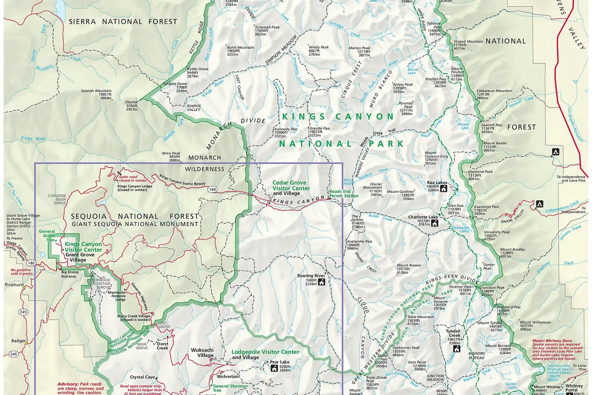
The Generals Highway climbs from the southern foothills through Giant Forest and Lodgepole before continuing toward Grant Grove. Tight curves, steep grades, construction, snow controls, and slow traffic make short map distances consume real daylight.
Giant Forest is the practical base for sequoia-grove walking, Moro Rock, and Crescent Meadow. Lodgepole gives access to Tokopah Falls and longer Sierra routes, while Mineral King is a separate high, narrow-road commitment with no quick connection to the main visitor corridor.
Foothills
Lower elevation, hot summer conditions, chaparral, river access, and trails that can become dangerous in midday heat.
Giant Forest
Sequoia groves, popular short walks, Moro Rock, Crescent Meadow, shuttle use, and heavy parking demand.
Lodgepole and Wolverton
Higher trailheads for waterfalls, lakes, forest routes, and wilderness departures.
Mineral King
A long, narrow seasonal road leading to high alpine trailheads, cold nights, steep climbs, and marmot precautions.
Keep one fallback inside the same district. Moving from a full Giant Forest lot to another shuttle stop preserves the day, while redirecting to Mineral King creates a different trip with a much longer approach.
District choice should include the return drive, not just the first trail. A late finish in Mineral King or the foothills leaves a different road problem from a late finish near Giant Forest, so lodging and fuel plans must match the same part of the park.
A map pin at the trailhead cannot show how long a slow mountain road will feel after dark. You should keep the day's final stop on the same side of the major drive whenever the route has already used most of the daylight.
How do parking and shuttles work for the giant sequoias?
The General Sherman Tree and Congress Trail draw concentrated traffic into Giant Forest. Summer shuttles connect larger parking areas with major stops, but the service has operating dates, route directions, and a last pickup that must fit the walk.
Parking at Giant Forest Museum can fill by mid-morning on busy days. Wolverton and Lodgepole may provide better park-and-ride options, yet a shuttle ride does not connect Sequoia National Park to Grant Grove or Cedar Grove in Kings Canyon.
A shuttle-aware grove visit
- Before arrivalConfirm the current shuttle season, road status, and last serviceAn old schedule does not strand the group
- At the districtPark in the larger recommended area and remove scented items from the vehicleCongestion and bear attractants are reduced
- At the first stopRead the route direction before boardingA loop bus does not carry the group away from its return stop
- Late in the dayWalk back or turn around before the final pickupThe return does not depend on a missed bus
Walk back to the vehicle when that option is practical and clearly mapped. It removes the last-bus dependency, though you still need enough daylight and water for the added distance.
How different is foothill and high-country weather?
Summer foothill temperatures can be intensely hot and dry at roughly 2,500 to 3,000 feet. A route near the Kaweah River may feel cooler beside water, but exposed climbs still accumulate heat and the river itself can be cold, swift, and hazardous.
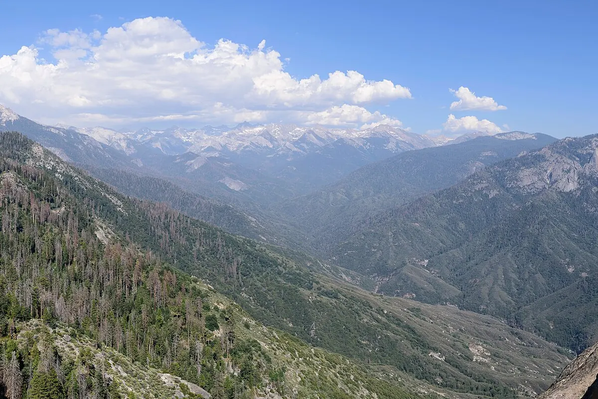
High Sierra terrain reverses the problem. Above about 7,500 feet, cool mornings, cold nights, snowfields, thunderstorms, and rapid temperature drops can appear while the lower entrance remains hot.
- 2,500 to 3,000 ftFoothill campground elevationHot, dry summer conditions are common
- About 6,000 ftGiant Forest elevation bandCooler air and winter snow change access
- 7,500 to 14,000 ftMineral King and alpine terrainCold mornings, snow, altitude, and storms become central
- 10 to 20°FPossible elevation temperature gapA valley forecast may understate the cold above
Carry the warm layer and rain shell where they can be reached without unloading the pack. If snow covers the trail or hides the return line, treat that as a navigation and traction problem rather than a scenic inconvenience.
Elevation also changes how quickly a modest route can exhaust a visitor arriving from lower ground. You should use the first climb to judge breathing, coordination, appetite, and recovery before committing to a longer high-country objective.
A slower day near the grove can preserve the rest of the trip when the group has not adapted as expected. Continuing upward because the mileage looks short removes that chance to reassess close to the road.
Which Sequoia trail surface fits your ability?
A paved grove path, granite stairway, forest trail, burned slope, stream crossing, and alpine pass impose different consequences. Mileage alone cannot compare them because foot placement, route finding, exposure, and retreat time change independently.
Moro Rock uses a steep stairway with railings and open exposure. A wet or icy surface can turn a short objective into the wrong choice for a person who is uncomfortable with heights or cannot descend confidently.
| Surface or setting | Main demand | A stronger fallback |
|---|---|---|
| Paved grove loop | Crowds, elevation, and shuttle timing | Shorten the loop and walk back to the parking area |
| Granite steps | Exposure, heat, wet rock, and controlled descent | Choose a forest trail without open edges |
| Burned forest | Falling limbs, weak roots, and obscured tread | Use an unaffected maintained route |
| High snow | Traction, navigation, cold, and delayed travel | Stay below the continuous snow line |
| Creek crossing | Flow, depth, footing, and a safe return | Turn around or use a route with a bridge |
Recent fire areas deserve a separate check because dead trees and damaged tread can remain hazardous after smoke has cleared. Do not use an older trail description as proof that a burned corridor is open or stable.
Can you rely on water sources and creek crossings in Sequoia?
Dry air and climbing increase water demand in the high country, while hot foothill routes can exhaust a carry quickly. Natural water should be treated before drinking, and a marked stream on a map does not guarantee convenient flow late in the season.
Fast snowmelt creates the opposite hazard. Cold water, polished rock, and strong current can make a familiar crossing unusable, especially when the return occurs after afternoon melt has increased flow.
- Carry enough water to reach the next verified source without depending on a seasonal trickle
- Treat natural water using a method appropriate for backcountry pathogens
- Turn around when a crossing is above the group's safe depth or speed
- Keep shoes on for traction and foot protection if a safe ford is attempted
- Recheck the same crossing before committing to a route that must return through it
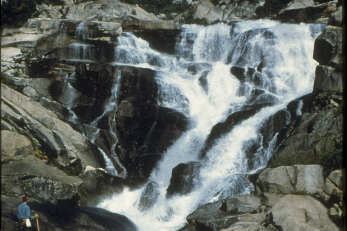
Never enter fast water because another group crossed earlier. Their height, balance, timing, and risk tolerance do not establish a safe threshold for your group.
Creek sound can hide the change between a shallow margin and a channel carrying enough force to move a hiker. If the crossing is required for the return, record its condition on the outward leg and leave time to retreat before afternoon snowmelt or rain changes it.
When the water is unsafe, waiting is useful only if the level is likely to fall within the remaining daylight. Otherwise, the correct decision is the alternate route that was chosen before the trip, not an unplanned search for another crossing.
How should you store food in Sequoia bear country?
Black bears in the Sierra have learned to investigate vehicles, campsites, and packs. Food, trash, toiletries, coolers, and other scented items belong in the required storage system rather than under a blanket or inside a tent.
At developed areas, use the provided food-storage boxes and follow posted instructions. In wilderness, approved animal-resistant containers are required in much of the park, so obtain the correct canister before reaching a permit station that may have limited rentals.
- Vehicle
- Remove visible and scented food according to current park instructions
- Campground
- Use the food-storage box whenever attractants are not in immediate use
- Wilderness
- Carry the required approved container for the route and season
- Trail break
- Keep packs within reach and never leave food unattended
- Bear encounter
- Give space, do not run, and follow current park bear guidance
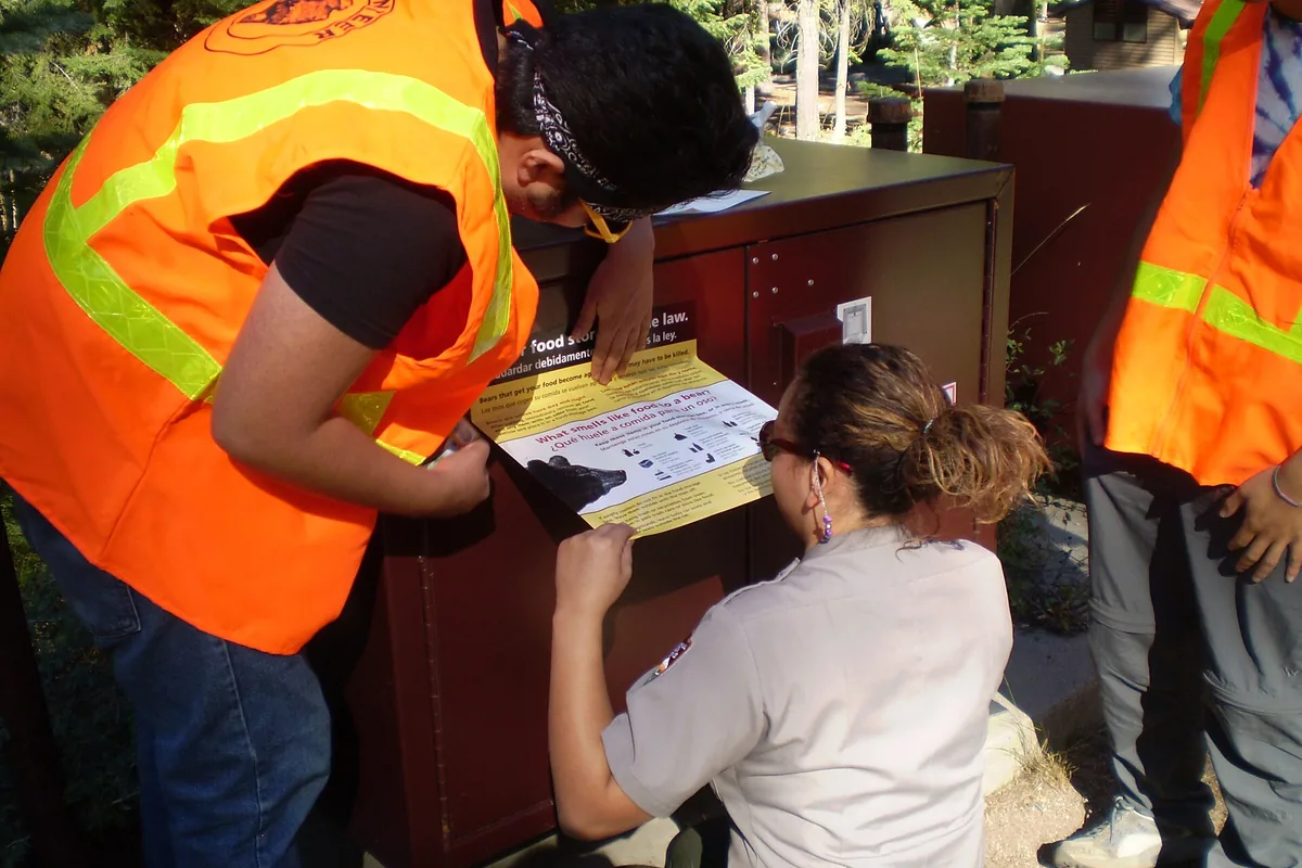
A clean camp protects the next visitor as well as your food. One successful reward teaches a bear to repeat the approach, which can ultimately lead to management action against the animal.
Do you need a permit to backpack in Sequoia?
Day hiking generally does not require a wilderness permit, but every wilderness overnight does. During the quota season, the permit is tied to a specific entry trailhead and date, and a reservation confirmation is not the final permit.
The 2026 quota season runs from May 22 through September 26. Outside that window, self-issue procedures may apply, but route-specific closures, food-storage rules, fire restrictions, and campsite limits still remain in force.
- Choose the exact entry trailhead and realistic first-night area
- Check quota dates, current availability, and route-specific restrictions
- Reserve through the official system when the quota season applies
- Collect or issue the actual permit using the current instructions
- Carry the required bear-resistant food storage before arrival
- Leave the route, camps, vehicle, and overdue time with an outside contact
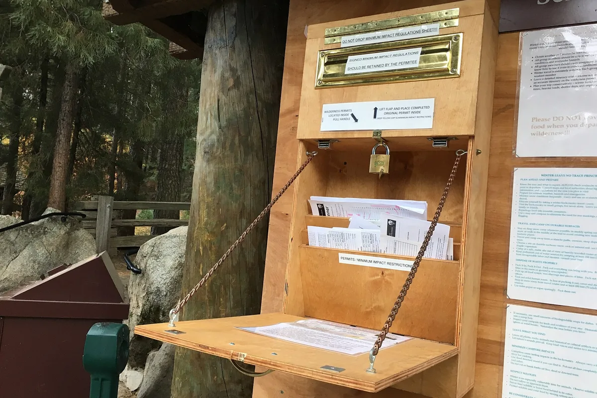
Do not sleep at a trailhead, pullout, or parking lot when a campsite is unavailable. A wilderness permit authorizes the named backcountry itinerary, not roadside camping before or after it.
Where should you stay for an early Sequoia hike?
Foothills, Lodgepole, and other developed campgrounds serve different elevations and trail districts. Reservation windows vary, popular dates fill early, and summer fire restrictions can change how a campsite functions.
Mineral King camping requires accepting the long approach and vehicle restrictions before arrival. Longer vehicles are unsuitable on parts of the road, and small-animal damage has historically made under-hood protection a practical concern at remote parking areas.
Foothills base
Best for lower trails and an early climb toward Giant Forest, with hot summer nights and fire restrictions.
Lodgepole base
Useful for Giant Forest, Wolverton, Tokopah, and high-country departures, with strong seasonal demand.
Outside Three Rivers
Adds the entrance climb each morning but provides fuel, services, and lodging outside the boundary.
Mineral King base
Commits the trip to a remote seasonal road and high trailheads rather than a quick park-wide tour.
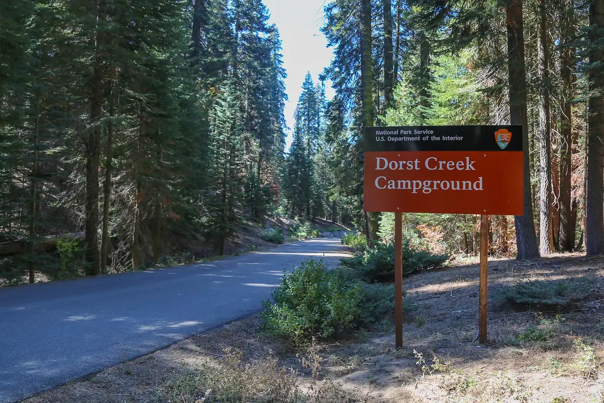
There are no gasoline stations inside the park boundary. Fill the tank before the mountain climb and carry the food, water, and vehicle supplies needed for a slow return through construction or wildlife traffic.
What makes a useful backup hike in Sequoia?
A useful alternate does not copy the same weakness. When the high country is under snow or thunderstorm risk, choose lower terrain, and when a lot is full, choose another stop on the same shuttle corridor.
When heat is the problem, move the start time or elevation.
Write the fallback into the trip note with its trailhead, route, and expected exit. That lets an outside contact understand a changed plan and keeps a parking decision from becoming an improvised hike.
| Failed dependency | Weak alternate | Better change |
|---|---|---|
| Full Giant Forest lot | Wait in a travel lane | Use a legal shuttle parking area or same-district walk |
| High-elevation storm | Another exposed summit | Descend to a forest or grove route |
| Unsafe stream | A longer route with the same ford | Choose a bridged or dry trail |
| Mineral King Road issue | Drive farther without a check | Use the main Generals Highway district |
| Overnight permit unavailable | Sleep near the trailhead | Reserve a legal campground or day hike |
The plan is ready when the group can name the district, road, parking strategy, elevation forecast, turnaround, overnight site, and one alternate that fails for a different reason. Recheck current conditions on the morning of travel because road, fire, snow, and trail information can change after the rest of the itinerary is settled.
How does wildfire affect Sequoia hiking conditions?
Wildfire effects continue after an incident disappears from the daily news. Burned slopes may have less shade, unstable trees, damaged tread, loose soil, and faster runoff during rain.
Smoke can also arrive from a fire outside the immediate district. Check the official fire and air-quality information, then reduce exertion or change the day when smoke affects breathing or visibility.
Do not enter a closed burn area to see the damage. A closure can protect hikers from falling trees and crews from people moving through an active work zone.
Hot, dry foothill travel requires an earlier start and more water after canopy loss. In higher terrain, a burned corridor may expose the route to wind and lightning sooner than an older description suggests.
Fire restrictions apply to camp as well as trail. Use a stove only where and when allowed, extinguish it completely, and never treat an existing fire ring as proof that a fire is currently legal.
The useful alternate changes both the affected area and the exposure. Another route inside the same smoke plume or closure zone does not create a meaningful fallback.
Photographs of clear air from an earlier season do not establish today's visibility. When ash, smoke, or active fire behavior affects the named corridor, follow the closure and move the trip outside that management area.
After rain, burned slopes can shed rocks and debris into roads or streams. Recheck the exit before entering a long route that depends on one narrow mountain road.
Smoke and burned terrain affect different decisions. Air quality can rule out strenuous travel across a whole district, while damaged tread or unstable trees may close one corridor even after the sky improves.
Sources
Road status, shuttle operation, campground rules, elevation conditions, and permit procedures were checked through the National Park Service pages for Sequoia and Kings Canyon National Parks. Key references include Road Conditions, Park Shuttles, Camping, and Wilderness Permits.
Trail reports and fire-area warnings came from the official Trail Conditions page. Information was verified August 24, 2026 and should be checked again before travel.
RespectHazards to plan for
- heat
- high snow
- cold streams
- black bears
- falling trees
- wildfire and smoke