
Mist Trail Has Three Finish Lines. Pick Yours First
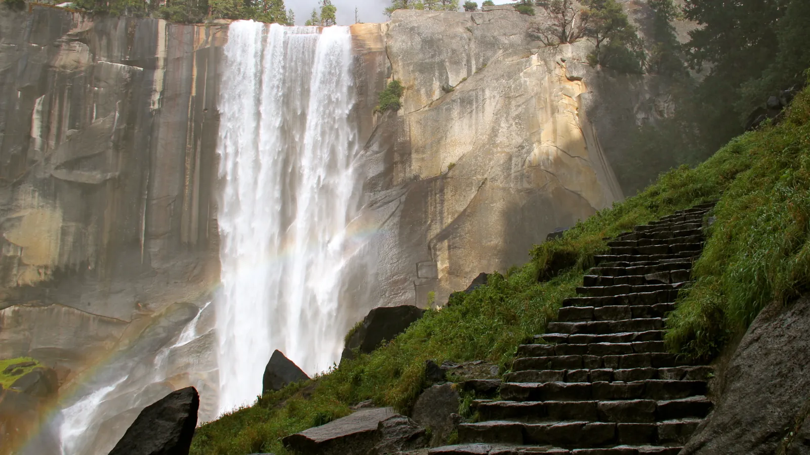
The Mist Trail can end at Vernal Fall Footbridge, Vernal Fall, or Nevada Fall. Pick the turnaround first because distance, climb, water, and the safest descent change at each point.
The Mist Trail has three common finish lines, which is why its distance seems to change from one description to another. You can turn at the Vernal Fall Footbridge, climb the granite stairs to the top of Vernal Fall, or continue to the top of Nevada Fall.
Those are different days on the same path. The longest option covers more than twice the distance and elevation of the Vernal Fall hike, while the shortest never enters the wet staircase that gives the trail its name.
Choose the finish line before you start. That choice sets the time, water, footwear, and descent plan, and it gives you a clear point at which a slower-than-expected morning becomes a shorter hike.
- Vernal Fall Footbridge if you want a 1.6-mile round trip with 400 feet of gain
- Top of Vernal Fall if you can manage wet, irregular stairs over a 2.4-mile round trip with 1,000 feet of gain
- Top of Nevada Fall if you have 5 to 6 hours for 5.4 miles and 2,000 feet of gain
- John Muir Trail descent if the longer return fits the daylight and current openings
- Current NPS conditions checked on the morning of the hike
That first decision matters more than whether somebody calls the Mist Trail moderate or strenuous. Difficulty changes at the footbridge, again at the Vernal Fall fork, and again above the first waterfall.
Choose your turnaround before you leave Happy Isles
The National Park Service publishes three official Mist Trail objectives from Happy Isles. The footbridge is a moderate outing, while both waterfall tops are strenuous hikes.
| Finish | Round-trip distance | Elevation gain | Typical time | What commits you |
|---|---|---|---|---|
| Vernal Fall Footbridge | 1.6 miles | 400 feet | 1 to 1.5 hours | A sustained paved climb, with no granite stairway |
| Top of Vernal Fall | 2.4 miles | 1,000 feet | About 3 hours | More than 600 steep steps that may be wet with spray |
| Top of Nevada Fall | 5.4 miles | 2,000 feet | 5 to 6 hours | Another 1.5 miles of rocky climbing beyond Vernal Fall |
The table explains why one blanket distance is misleading. A person who expects a three-mile walk may be picturing Vernal Fall, while a companion may be thinking about Nevada Fall and a much longer afternoon.
Mileage hides the commitment. The extra 1.5 miles beyond Vernal Fall includes steep switchbacks, another 1,000 feet of climbing, and a descent that starts after the group has already worked hard.
The NPS time ranges are useful planning references, not promises. Crowds, waterfall spray, heat, a slow shuttle connection, and the condition of your knees can all extend the day.
Pick the lowest objective that everyone in the group can complete with some reserve. A higher finish can remain an option only if the group reaches each checkpoint on time, still has enough water, and moves securely on the actual surface.
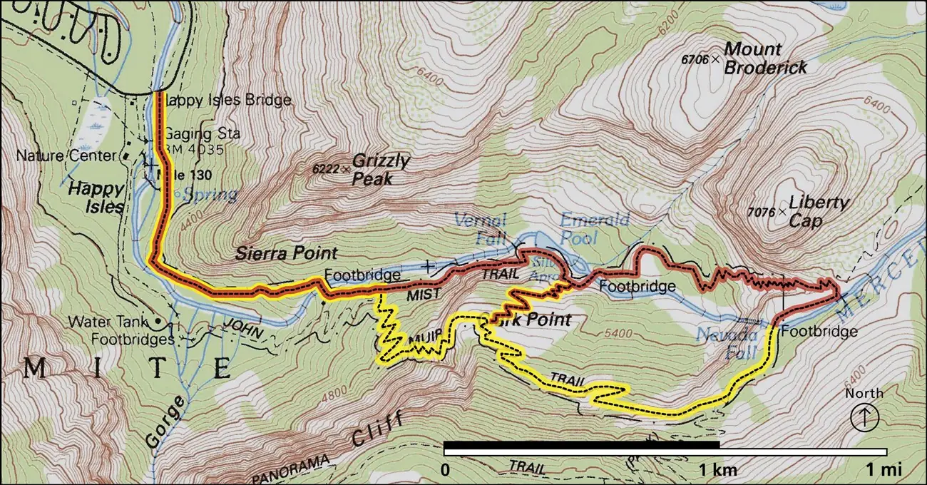
Half Dome is not a fourth Mist Trail turnaround. It uses this corridor before continuing deep beyond Nevada Fall into a separate 14-to-16-mile objective with its own permit rule.
The first mile is the quiet test
Pavement makes the opening look gentle, but it does not make it flat. From Happy Isles, the trail gains most of the footbridge's 400 feet in 0.8 mile and climbs almost continuously.
Most people reach the start by walking from Curry Village or riding a valley shuttle to stop 16. There is no parking at the trailhead, so the distance between your parking space and Happy Isles belongs in the day even though it does not appear in the official trail mileage.
- Start
- Happy Isles, Yosemite Valley shuttle stop 16
- Nearest practical parking
- Curry Village, less than one mile from the trailhead
- First checkpoint
- Vernal Fall Footbridge at 0.8 mile
- Seasonal treated water
- Happy Isles and Vernal Fall Footbridge, usually May through October
- Trail fork
- About 0.2 mile beyond the footbridge
The lower path follows the Merced River through trees, but the grade begins doing useful diagnostic work. If somebody is already breathing harder than expected or needs repeated stops before the footbridge, the wet stairs will not make the day easier.
Use the footbridge as a real checkpoint rather than a place to negotiate with the original plan. The group should still be moving steadily, drinking normally, and comfortable with the time when it arrives.
The bridge gives a direct view of Vernal Fall and makes a satisfying finish for a shorter hike. Turning there avoids the narrow staircase while still delivering the river corridor and the first major waterfall view.
The lower hike also has the simplest toilet plan. Restrooms are available at Happy Isles, and the seasonal facilities at the footbridge let you turn around without depending on the vault toilets farther up the route.
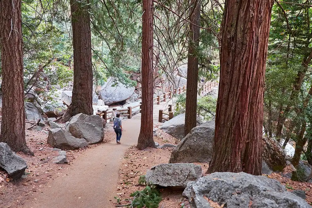
Treated drinking water and seasonal toilets at the Vernal Fall Footbridge also make it the last easy logistics reset. The fountain usually operates from May through October, but a closed or dry fountain does not reduce how much water the upper trail requires.
Start with enough water to reach the chosen high point even if the fountain is unavailable. A seasonal fixture is a useful backup, while an empty bottle at the bridge turns an equipment problem into pressure to drink untreated river water or abandon the upper route.
About 0.2 mile beyond the bridge, the Mist Trail and John Muir Trail divide. The left-hand Mist Trail line leads directly toward the spray and granite stairs, and that fork is the moment to make an honest second decision.
What makes the Vernal Fall stairs hard?
The trail changes from a steep approach into a wet staircase as it enters the spray below Vernal Fall. Over the next 0.3 mile, more than 600 uneven granite steps rise toward the top of the 317-foot waterfall.
The steps vary in height, depth, and angle. A rhythm that works on a normal staircase breaks when one tread is narrow, the next is tall, and people are descending through the same channel.
Spring and early summer usually bring the strongest spray. The water can soak clothing and turn polished granite slick even on a clear day, so weather overhead does not tell you whether the steps are dry.
Three hazards overlap here. Water reduces grip, the grade raises the cost of a stumble, and opposing traffic limits where you can recover balance.
Shoes need a tread that still grips when wet, but footwear cannot cancel poor spacing. Do not crowd the person ahead, and do not step outside the established line to overtake a slower group.
Trekking poles help on the approach and later switchbacks, yet the narrowest stair section may require a free hand for the railing. Collapse or secure a pole before it becomes something that catches between steps or blocks a passing hiker.
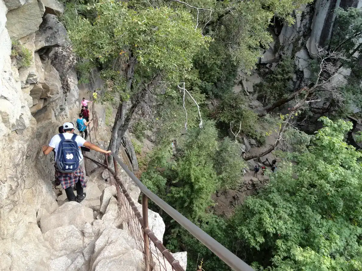
The top of Vernal Fall is a viewpoint beside moving water, not a place to relax the boundary. Stay behind railings and away from wet rock at the brink, where the river drops 317 feet.
If the staircase has already made someone unsteady, returning down the same steps may be harder than climbing them. Continue only far enough to use an open alternative descent when the official route and the group's remaining energy support that choice.
Above Vernal Fall, the route changes character
The spray eases above Vernal Fall, but the water hazard becomes less obvious. Emerald Pool and the Silver Apron can look calm compared with the waterfall, even though the current feeds directly toward the drop.
Swimming and wading there are prohibited. Stay on the established trail and treat every slab near the river as suspect, including rock that looks dry from a few steps away.
The decisions above Vernal Fall
- Vernal Fall brinkStay behind railings and reassess time, water, and legsThe Nevada climb adds another major block of work
- Emerald Pool and Silver ApronRemain on trail and out of the waterA calm surface does not remove the current toward the waterfall
- Nevada switchbacksSet a turnaround time before the long rocky ascentContinuing late converts the descent into a headlamp problem
- Nevada Fall footbridgeChoose Mist Trail or John Muir Trail for the returnThe two ways home differ in distance, grade, and seasonal availability
The continuation toward Nevada Fall adds about 1.5 miles of steep, rocky switchbacks. This is where the route stops feeling like a waterfall stair climb and begins to feel like a sustained mountain hike.
Shade comes and goes, while granite reflects heat back toward the trail. A group that started cool beside Vernal Fall can be climbing in a much warmer pocket shortly afterward.
Nevada Fall drops 594 feet, and a footbridge crosses the Merced River above it. The bridge is the natural high-point marker for this version of the hike, not an invitation to approach the brink outside the protected route.
Vault toilets sit beyond the top of Vernal Fall and near the top of Nevada Fall. Their presence helps with a long day, but it should not be read as evidence that the upper route has the services of a developed valley path.
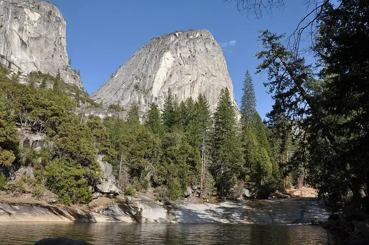
Do not let the summit feeling at Vernal Fall erase the return calculation. If the group reaches that point near its turnaround time, Nevada Fall is the part to remove rather than the reason to abandon the time.
The best reason to continue is that everyone is moving securely, has enough water for the upper climb, and still has a daylight margin. Scenery is not evidence that those conditions are true.
Which way should you descend?
Descent is a separate route decision because tired legs behave differently on wet steps. Retracing the Mist Trail is shorter, while the John Muir Trail gives you more distance and a less direct line with different views.
From the top of Nevada Fall, the NPS describes the John Muir Trail as approximately 4 miles one way. The Mist Trail line is roughly 2.5 miles one way, so the alternative adds meaningful distance to the return.
| Decision | Mist Trail return | John Muir Trail return |
|---|---|---|
| Distance | Shorter and more direct | Longer, at about 4 miles one way from Nevada Fall |
| Surface | Steep granite steps that may be wet | Longer switchbacks with a different grade and surface |
| Traffic | Opposing hikers on the narrow Vernal stair segment | Often spreads movement over a broader route |
| Views | Close waterfall and river corridor | Liberty Cap and a different view of Nevada Fall |
| Best fit | Dry steps, secure knees, and a need for the direct line | Enough daylight and water, with a preference to avoid the wet stairs |
| Override | Closure, ice, or unsafe crowding can remove this option | Seasonal Ice Cut closure or current work can remove this option |
Shorter is not automatically easier. The direct route asks tired quadriceps and knees to control each irregular step, and spray can make the most crowded section slick.
The John Muir Trail usually makes more sense when the stairs are wet or congested and the group has enough time for the extra distance. It also changes the scenery, with views toward Liberty Cap and a different angle on Nevada Fall.
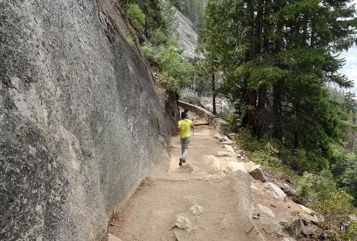
Knee pain can reverse the recommendation. Long switchbacks may be more tolerable than tall steps for one person and more painful for another, so test the first few downhill movements before committing to a longer line.
Seasonal status overrules preference. The upper John Muir Trail Ice Cut closes in winter, the lower Mist Trail stair segment also closes seasonally, and repair work can redirect hikers at other times.
If both choices are open, decide at the high point before fatigue turns the discussion into a delay. Match the surface to the least steady person in the group, then keep the descent together.
Do you need a permit for the Mist Trail?
The NPS does not list a separate day-hike permit for the footbridge, Vernal Fall, or Nevada Fall versions of the Mist Trail. You still need to meet Yosemite's current park entrance requirements and pay the applicable entrance fee.
The permit confusion comes from Half Dome. Hikers who continue past Nevada Fall toward the cable route need a Half Dome permit beyond the base of Subdome when the cables are up, which is a different objective from the waterfall hikes described here.
- Confirm the current Yosemite entrance requirements and fee before travel
- Check the NPS conditions page for Mist Trail closures and repair detours
- Park at Curry Village or another legal valley lot because Happy Isles has no trailhead parking
- Use the valley shuttle to stop 16 or include the approach walk in your time
- Carry a Half Dome permit only when your separate objective continues into the permitted cable route
A park entrance pass and a trail permit solve different problems. The entrance pass admits you to Yosemite, while a Half Dome permit limits access to the cable route beyond the Mist Trail corridor.
Parking is the practical constraint most likely to change the morning. Yosemite warns that valley parking can fill early during busy periods, and a late arrival may involve traffic delays before the hike has started.
For spring through fall in 2026, the NPS advises drivers to reach Yosemite Valley before 8 am because parking is usually full after that time. This is operational guidance rather than a reservation, so an early arrival improves the plan without guaranteeing a space.
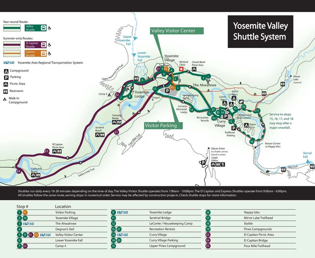
If you drive, park once and use the shuttle or walk. Moving the car around Yosemite Valley after lots fill can consume the daylight margin that the Nevada Fall option needs.
The valley shuttle serves Happy Isles at stop 16, but a full bus or a wait is possible on busy days. Treat the shuttle as transportation rather than as a precise appointment.
Start with the access facts that are true for your date. Fees, reservation systems, traffic controls, shuttle operations, and trail work can change more quickly than the granite route itself.
When are the granite steps open?
Vernal Fall and Nevada Fall remain reachable year-round, but the exact combination of open trail segments changes with ice, falling-rock risk, and maintenance. A winter visit does not follow the same line as a summer visit.
The lower Mist Trail beside Vernal Fall closes in winter because falling ice and rock can strike the narrow stair corridor. The upper John Muir Trail between Clark Point and the top of Nevada Fall also closes in winter because its Ice Cut becomes dangerously slick.
The weekly pattern is temporary. Do not carry it into another season or year without opening the current NPS conditions page again.
The 2026 closure begins above the Vernal Fall Footbridge at the Mist Trail and John Muir Trail junction. That means a weekday hiker can still reach the footbridge, then must use the signed alternate line during work hours.
The detour also changes the numbers that made the original turnaround feel manageable. A route measured on the direct stairs becomes longer when it bends through Clark Point, so keep extra time and water rather than applying the normal 2.4-mile or 5.4-mile figure to the work-day path.
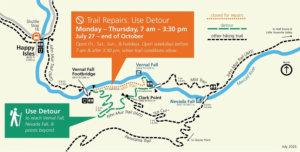
Winter routing needs the same discipline. Snow may hide the tread from roughly November into May or June, while an open segment may still carry ice that makes normal footwear inadequate.
Check conditions again on the morning of the hike because rain, rockfall, fire, repair work, or rescue activity can change access after an itinerary was made. An old screenshot does not update itself.
Download the current map for offline use only after that check. The dated copy helps when reception disappears, while the trail signs remain the final authority if crews move a closure point during the day.
When a signed closure conflicts with the preferred loop, the sign wins. Do not step around a barrier because another website still shows the usual route.
Water and footing decide how the day ends
Carry water for the finish line you chose, not for the first fountain you expect to find. The NPS suggests about 1 liter to the footbridge, 2 liters to the top of Vernal Fall, and 3 to 4 liters to the top of Nevada Fall.
Those amounts are planning references for each person. Heat, body size, pace, and a longer John Muir Trail return can raise the need, while drinking large amounts without food or electrolytes can create a different problem.
Treated water is available near Happy Isles and usually at the Vernal Fall Footbridge from May through October. There is no treated drinking water above the footbridge, so a seasonal fountain cannot supply the Nevada Fall portion after you have passed it.
- Shorten the hike if a deliberate step slides on wet granite
- Turn at the footbridge if the group arrives later or more tired than planned
- Do not continue above the last treated-water point without enough water for the chosen finish and return
- Change the plan for thunder, extreme heat, smoke, or a new closure
- Treat new knee or ankle pain on the ascent as a warning about the descent
- Carry a headlamp when the day could extend beyond the original schedule
The route concentrates several ordinary hiking problems in one corridor. Heat and dehydration develop on the climb, while spray, loose decomposed granite, and crowds raise the chance of a slip.
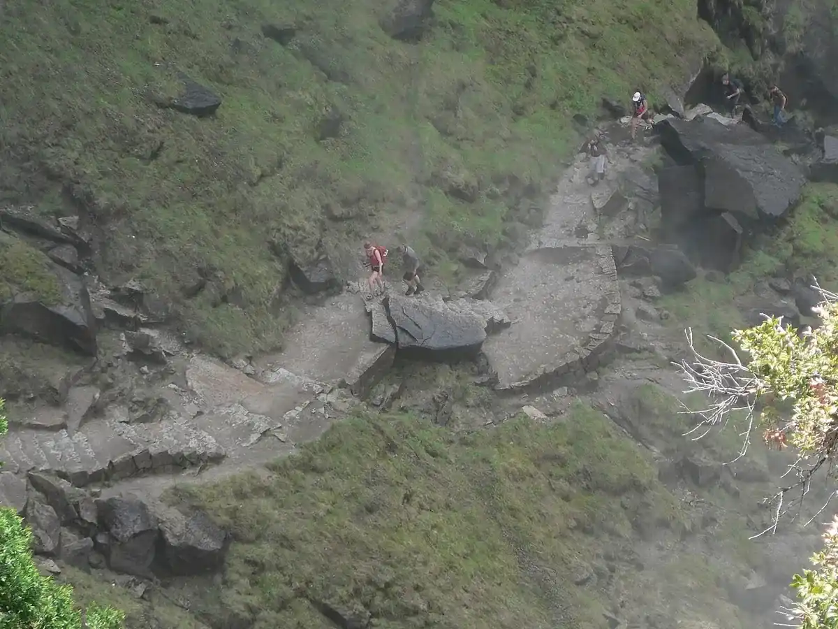
An ankle that feels sore while climbing can become unstable on descent. A knee that tolerates uphill steps may hurt when it must brake the body through hundreds of downhill repetitions.
Leave pets, bicycles, and strollers out of the plan because the NPS prohibits them on this trail. Carry a headlamp even for a daytime start when Nevada Fall or the longer descent remains possible.
Fast water needs one simple boundary. Do not swim or wade in Emerald Pool, Silver Apron, or the river above either waterfall, and do not cross railings to get closer to a brink.
The right end to the day is the highest point the whole group can reach and leave with control. A lower turnaround preserves the waterfall, the valley walk, and the trip home, which is more than a late push can promise.
Sources
Official distances, elevation gains, route descriptions, seasonal water, restrooms, parking, pet restrictions, winter routing, safety notices, maps, and the 2026 repair detour were verified against the National Park Service page for Vernal Fall and Nevada Fall Trails on August 16, 2026.
Current road and trail status came from the National Park Service Yosemite conditions page. The permit boundary came from the NPS Half Dome day-hike and permit pages, while entrance and congestion planning came from the NPS Yosemite fees and traffic pages.
The hero photograph is Vernal Falls and Mist Trail by David Fulmer, licensed CC BY 2.0. Other photographs are credited in their captions, and the route, access, and repair maps are National Park Service works.
RespectHazards to plan for
- slick wet granite
- steep drop-offs
- fast water
- heat and dehydration
- ankle and knee injuries