
Yosemite National Park
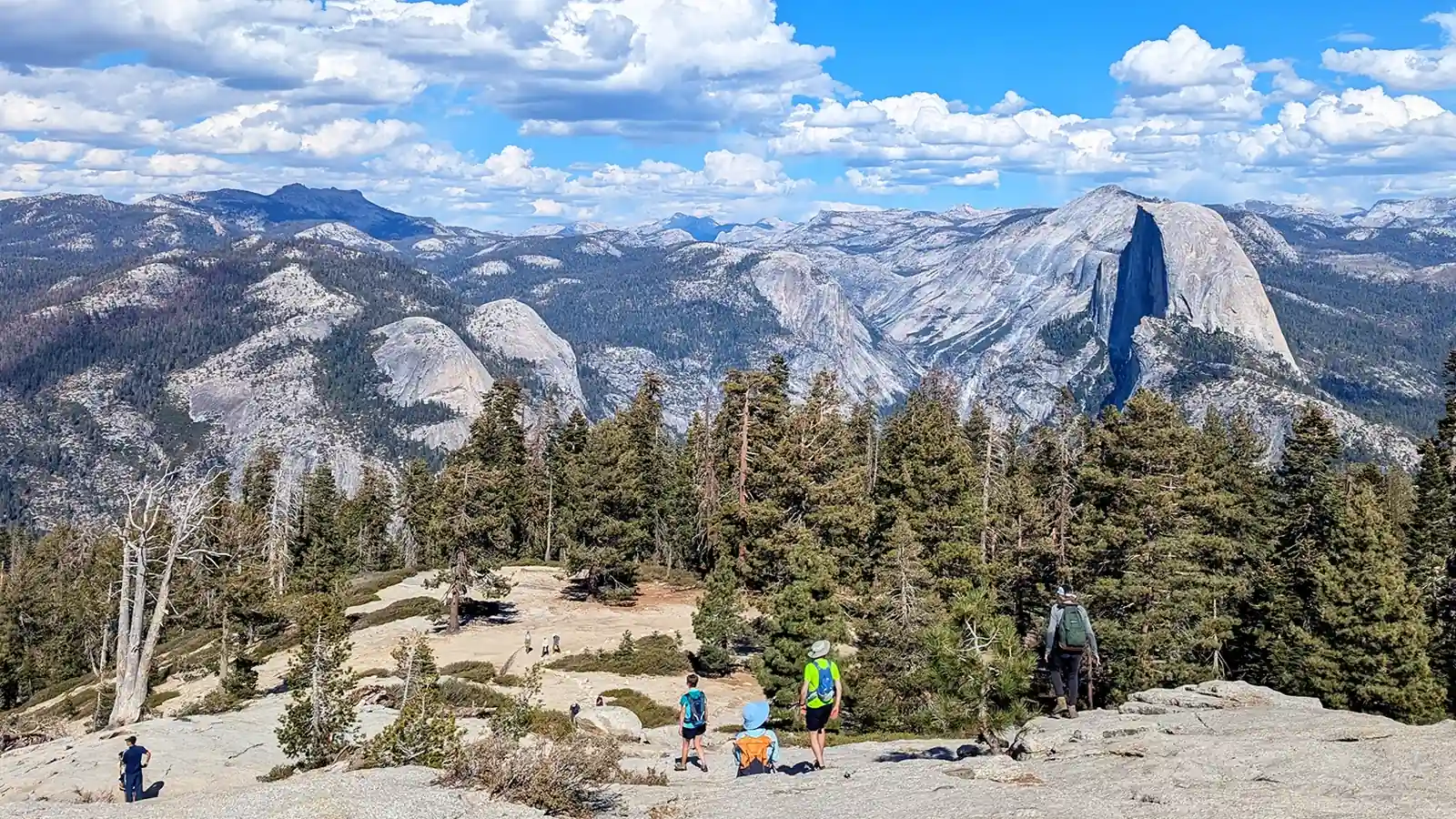
Yosemite National Park spans several elevation-separated hiking regions, from the year-round Valley to seasonal Tuolumne Meadows. Choose the region first, then confirm roads, permits, weather, camping, and transport for the dates you will travel.
Weather
Elevation ranges from about 2,000 to over 13,000 feet. Valley heat, high-country cold, snow, thunderstorms, and smoke can affect different parts of the park at the same time.
Plan the practical details
- Access
- Year-round access from the west via Highways 41, 140, and 120, subject to weather and chain controls. Tioga Road and Glacier Point Road close seasonally.
- Permits
- No entrance reservation is required in 2026. Half Dome cables, overnight wilderness trips, campgrounds, and lodging use separate permit or reservation systems.
Yosemite National Park is too large and too vertical to plan as one sightseeing stop with a few trails attached. Yosemite Valley is the famous center, but the park covers nearly 1,200 square miles and rises from about 2,000 feet to more than 13,000 feet.
That range creates several hiking seasons at the same time. A warm, open Valley trail can sit below a snowbound high-country trailhead, while a road closure can turn two points that look close on a map into separate trips.
Start by choosing the part of Yosemite that fits your dates and desired effort.
Then confirm its road, permit, camping, weather, and transport conditions before committing to individual hikes.
Those numbers explain the central planning rule. Choose the region first because a list of famous trails cannot tell you whether their trailheads are open, close to your bed, or sensible on consecutive days.
Which Yosemite area fits the hike you want?
The National Park Service organizes hiking around Yosemite Valley, Glacier Point Road, Wawona and Mariposa Grove, Hetch Hetchy, Crane Flat and White Wolf, and Tuolumne Meadows.
Each area produces a different trip even before you select a trail.
Yosemite Valley gives the greatest concentration of famous views, developed services, shuttle stops, and trailheads. It also concentrates traffic and places several strenuous routes at the base of cliffs, so a short distance on the map can involve thousands of feet of climbing.
Glacier Point Road moves the starting line to the south rim. That access opens hikes toward Sentinel Dome, Taft Point, and longer rim routes, but a one-way descent to the Valley requires a real return plan because no ordinary trail loop puts your vehicle back at Glacier Point.
Wawona and Mariposa Grove suit hikers who want giant sequoias, lower-pressure forest walking, or a base near the south entrance.
Hetch Hetchy offers reservoir, canyon, and waterfall terrain at a lower elevation, though its entrance road follows restricted hours and has no public transportation.
Crane Flat and White Wolf link forested north-country trailheads with the higher Tioga corridor.
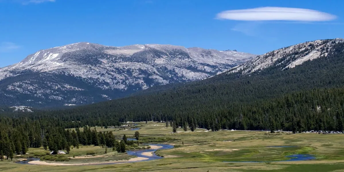
Tuolumne Meadows sits around 8,600 feet and gives direct access to granite domes, alpine meadows, lakes, and long wilderness routes when Tioga Road is open.
| Area | Hiking character | Access dependency | Best fit |
|---|---|---|---|
| Yosemite Valley | Floor walks, waterfall routes, steep rim climbs | Year-round road access, but parking and trail closures still change | First visits and mixed-ability groups that plan separate effort levels |
| Glacier Point Road | South-rim viewpoints and long descents | Seasonal road plus return transportation for one-way hikes | Hikers prioritizing elevated views over Valley-floor access |
| Wawona and Mariposa Grove | Sequoia groves, forest, and south-park trails | Grove shuttle and road operations vary by season | A quieter day near the south entrance |
| Hetch Hetchy | Reservoir shore, canyon heat, and waterfall approaches | Daylight road hours and no public transit | Spring or fall hikers with their own vehicle |
| Crane Flat and White Wolf | Forest, quieter trailheads, and north-country access | Tioga corridor conditions affect many options | Repeat visitors spreading time beyond the Valley |
| Tuolumne Meadows | Alpine lakes, domes, meadows, and wilderness routes | Tioga Road, seasonal services, snow, and altitude | Summer high-country hiking and backpacking |
The table is a base-selection tool, not a ranking. A Valley hotel does not make Tuolumne a casual add-on, and a high-country campsite does not make a dawn Valley trailhead convenient.
The areas also differ in how easily a group can shorten the day. Valley floor paths offer frequent junctions and developed stops, while a Tuolumne or Hetch Hetchy route may commit the group to a longer return before the first clear turnaround.
Match that exit pattern to the least experienced hiker. A remote trail is a poor place to discover that the group expected the frequent water, toilets, shade, and transport found near Yosemite Village.
For a short visit, one region often supplies enough hiking for the whole stay. A longer trip can pair two areas, but the transfer should be a planned travel block rather than time borrowed from a hike.
One valley can hold three different hiking days
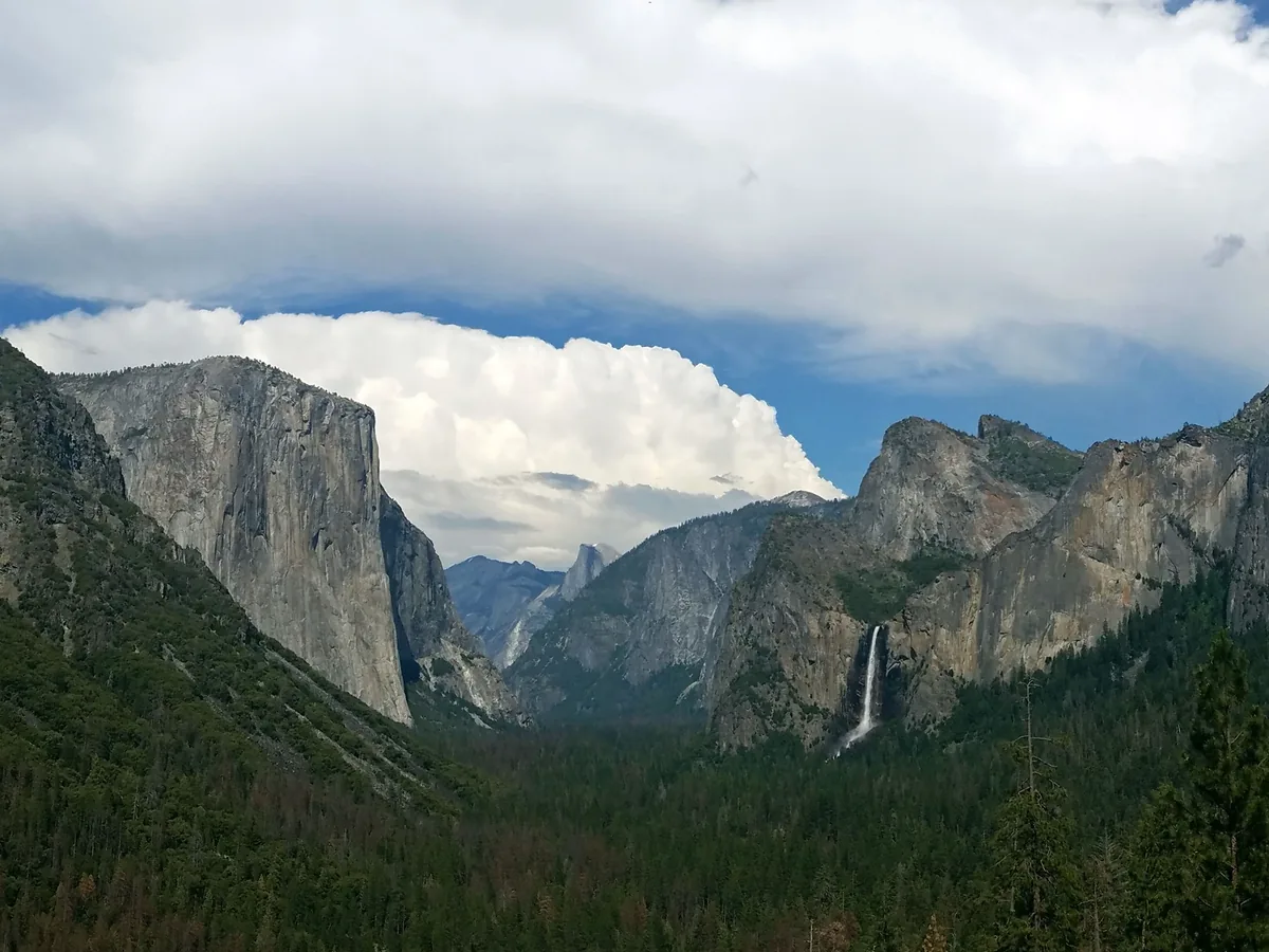
Yosemite Valley looks compact from a viewpoint because the floor is roughly seven miles long. The hiking effort changes quickly when a route leaves that floor and climbs the granite walls.
A level or rolling day can connect meadows, the Merced River, Mirror Lake, and lower waterfall viewpoints. These routes work well after a travel day, with children who are comfortable walking, or between strenuous days, though summer heat and total distance still matter.
A waterfall day adds sustained climbing and wet or irregular footing. The Mist Trail alone has several legitimate finish lines, so the name of the route does not define one distance, one elevation gain, or one exposure to spray.
A rim day is a different class of effort. The Upper Yosemite Fall route gains about 2,700 feet in 3.7 miles on the ascent, and the return asks tired legs to control the same descent.
The Four Mile Trail creates another rim connection when open, climbing roughly 3,200 feet between the Valley and Glacier Point.
A downhill-only version still loads knees for miles, and the trip fails logistically if the ride to or from the rim was only assumed.
Rest days should change movement rather than merely reduce mileage. A meadow and river walk lets calves recover from granite steps, while another short but steep climb may repeat the same strain as the previous day.
- Choose a Valley-floor circuit when time together matters more than a summit. - Choose one waterfall objective when steep climbing, spray, or close views are the goal. - Choose a rim ascent only when the whole group has the time, water, traction, and descent strength for it.
Do not stack two strenuous Valley climbs because both trailheads are close to the shuttle. Vertical gain sets the day, and the descent often exposes fatigue that the ascent concealed.
Set a turnaround time before leaving the floor, especially when the planned finish is optional. A lower objective reached with enough energy to descend safely is a complete hike, not a failed attempt at the higher one.
When does Yosemite hiking open up beyond the Valley?
There is no single best month for hiking Yosemite National Park. The useful question is which elevation and feature you want, because waterfall flow, snow cover, road access, heat, and smoke do not peak together.
Most precipitation falls from October through May, and snow can cover much of the park from roughly November into May. Lower trails may clear while Glacier Point and Tioga Road trailheads remain buried or flooded by meltwater.
Spring puts the focus on the Valley, Wawona, and Hetch Hetchy. Waterfalls and creeks gain power, daylight grows, and lower routes open first, but cold water, unstable snow, downed trees, and difficult creek crossings can remain above the warm trailheads.
Early summer expands the trail network unevenly.
A road may open before every trail is dry, every service is operating, or every wilderness crossing is straightforward.
High summer usually gives the broadest access to Tuolumne Meadows and other high country. It also brings Valley heat, busy parking, afternoon thunder, and the possibility of regional wildfire smoke.
Autumn can offer cooler air and fewer visitors after the busiest weeks. Shorter daylight, dry waterfalls, freezing high-country nights, reduced transport, and the possibility of an early storm narrow the margin.
Winter changes the activity as well as the temperature. Winter travel equipment can be more appropriate than hiking boots where snow hides the tread, and traction does not solve the navigation problem created by a buried trail.
Transitional months demand the widest range of plans. March, April, October, and November can produce warm sun followed by a storm, so a reservation made for a shoulder season should not depend on one exposed route or one high road.
How the hiking emphasis changes
- November through FebruaryKeep plans near year-round access or use winter travel equipmentHigh roads close and ordinary trail navigation may disappear under snow
- March through JuneFollow the snowline upward and treat runoff as a hazardWaterfalls strengthen before high-country access becomes reliable
- July through SeptemberUse the broad trail network but start exposed hikes earlyHeat, lightning, crowds, and possible smoke become daily planning factors
- October transitionFavor flexible day hikes with a lower-elevation backupA cold storm can close a road or end seasonal transportation quickly
- Waterfall priority favors spring into early summer, with extra distance from fast water. - High-country priority usually favors the period after Tioga Road and trails have opened. - Cooler lower-elevation hiking often favors fall, if smoke and early snow remain absent.
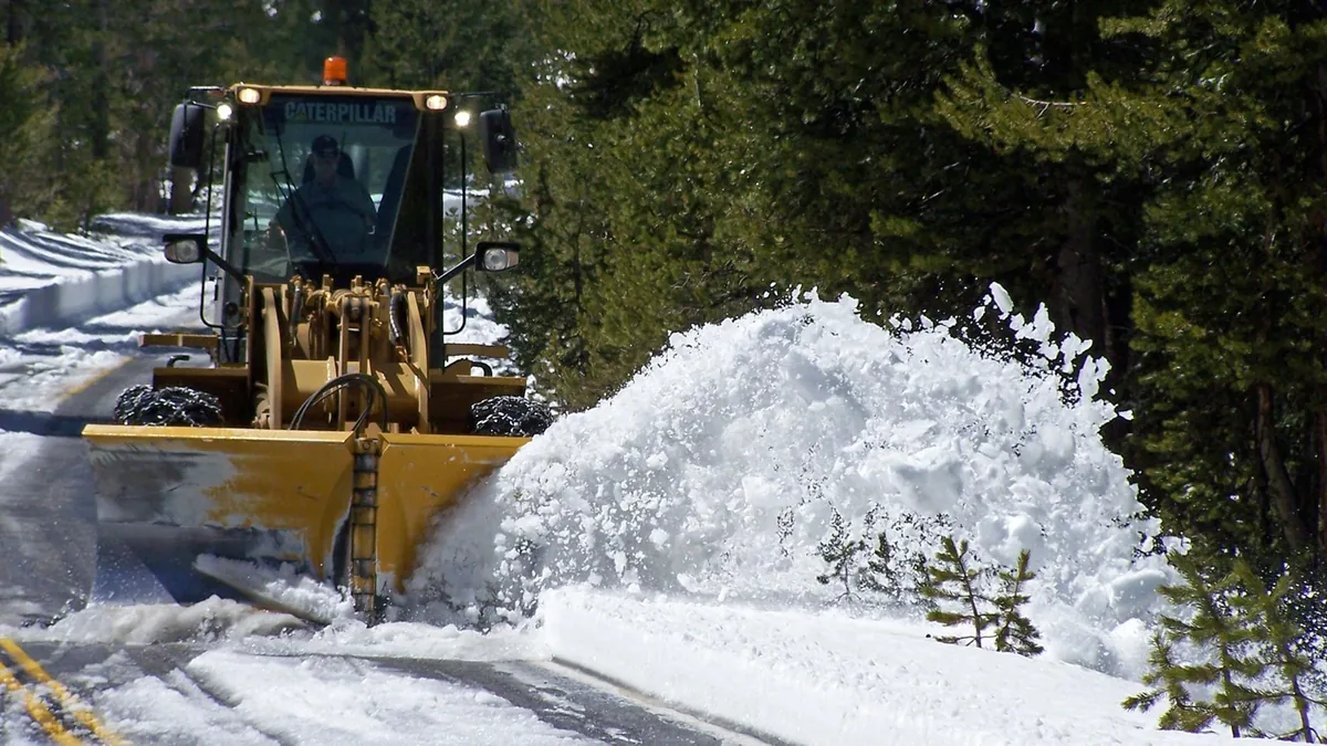
These are patterns rather than promises. The NPS warns that road opening cannot be predicted reliably even in late spring because one storm or a difficult plowing season can change the date.
Book around a region that is normally plausible for the season, then keep a lower or less access-dependent alternative.
That approach preserves the trip when the snowline does not follow an average calendar.
Road access can redraw the park overnight
Four roads carry most of the consequences for hikers. Tioga Road crosses the high country, Glacier Point Road reaches the south rim, Hetch Hetchy Road controls reservoir access, and the Valley road system determines whether parking or a shuttle connection is practical.
Tioga and Glacier Point roads normally close for winter. Opening dates vary with snowpack, avalanche risk, plowing, road damage, and spring storms, so lodging on one side of the Sierra should never assume the Tioga crossing is available.
Hetch Hetchy is open only during posted daytime hours for ordinary day visitors. Arriving late can erase the hike even when the road itself has no seasonal closure.
The western entrances on Highways 41, 120, and 140 can reach the park year-round, subject to weather and chain controls.
The Tioga Pass entrance from the east normally closes with Tioga Road, which can turn an east-side approach into a much longer drive around the Sierra.
Navigation apps sometimes choose roads that are unsuitable or closed seasonally. Build the drive from the official park directions and road status, then compare the arrival time with the gate hours and the intended trailhead rather than only the park boundary.
An open road also does not guarantee complete services. Food, drinking water, toilets, tours, and buses may start later or run on narrower schedules than vehicle access.
The fallback should answer the same reader need. If a Tuolumne lake day becomes impossible, a lower forest or Valley route fits better than forcing a long drive to another famous objective.
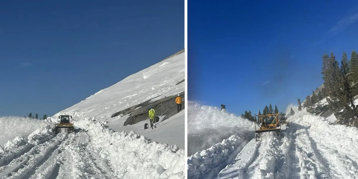
Save the current map and closure notice for offline reference, but obey signs and barriers encountered in the park. A downloaded page records an earlier state, while field closures reflect the conditions crews are managing now.
Which Yosemite permits do you actually need?
A reservation is not required to enter Yosemite in 2026. The park entrance fee still applies, and this policy does not remove reservations or permits for camping, lodging, Half Dome, or overnight wilderness travel.
That distinction matters because one Yosemite trip can touch several systems. Entry answers whether a vehicle can enter, lodging and camping answer where the group sleeps, and trail permits answer whether a specific regulated hike or wilderness start is allowed.
- Park entry in 2026
- No entrance reservation required, though the entrance fee still applies
- Ordinary day hike
- No wilderness permit required unless the route includes regulated Half Dome access
- Half Dome cables
- Permit required whenever the cables are up
- Overnight wilderness trip
- Wilderness permit required year-round for the starting trailhead
- Frontcountry campsite
- Separate campground reservation during the applicable reservation season
- Lodging
- Booking secures the room but does not replace a Half Dome or wilderness permit
Wilderness permits are tied to the starting trailhead and daily quota, not simply to the park.
The NPS currently releases 60 percent through a lottery 24 weeks ahead, while the remaining 40 percent become available seven days ahead.
Do not build a backpacking trip around the hope of finding an unused walk-up permit during the busy season. The NPS says few, if any, may remain, and a permit must be collected during wilderness-center hours.
Half Dome adds another boundary. A wilderness permit does not automatically authorize the cables, although qualifying backpacking applications may request Half Dome access through the process set by the park.
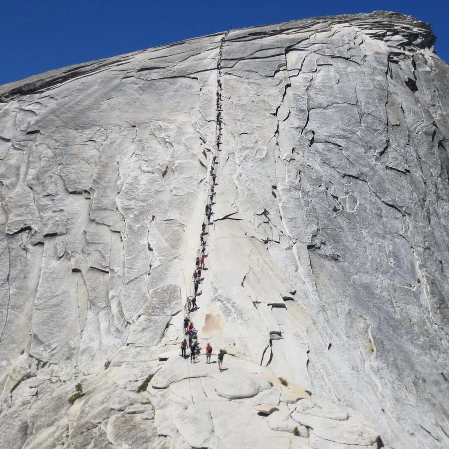
Treat every date-sensitive rule as a fresh check. The no-reservation entry policy is specific to 2026, and future park management may respond differently to traffic, construction, fire, or resource pressure.
Camping and backpacking use different booking logic
Frontcountry camping places a vehicle or tent in a developed campground. Backpacking uses a wilderness permit tied to a trailhead and allows camping under wilderness regulations after the required travel from developed areas.
Yosemite has 13 popular campgrounds, and all use reservations during at least part of the April-through-October period.
Release windows differ by campground, so the date for Upper Pines should not be assumed to apply to Tuolumne Meadows or Camp 4.
Campground location changes the hiking plan as much as the campsite type. A Valley campground supports early Valley starts, while Wawona, Hodgdon Meadow, and Tuolumne place the group near different road corridors and make a cross-park dawn objective less realistic.
Sleeping in a vehicle is allowed only in a campsite where you are registered to stay. A trailhead parking lot, roadside pullout, or full campground does not become legal overflow lodging.
- Confirm a registered campsite, lodging booking, or legal wilderness itinerary for every night
- Match a wilderness permit to the intended starting trailhead and direction
- Know the campground reservation release window and first-night arrival rule
- Move food, trash, toiletries, and other scented items into the required locker
- Carry an approved bear-resistant food canister for an overnight wilderness trip
- Keep food within arm's reach while picnicking or hiking
Yosemite treats many scented objects as food, including toiletries, coolers, trash, and used cooking items. In campgrounds, those items belong in the provided food locker whenever they are not actively being used.
Backpackers must use an approved bear-resistant container throughout the wilderness. Hanging food is not a legal substitute, and the canister must hold the scented items as well as meals.
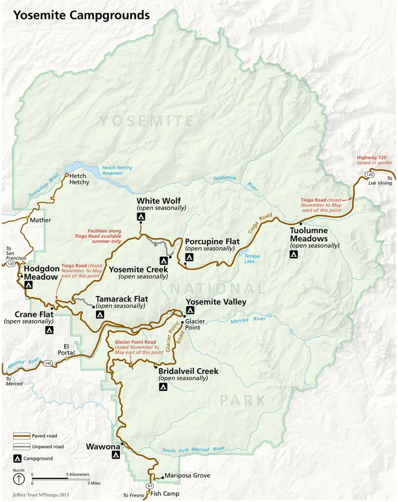
Pack all scented items together before arrival so they can move quickly into a locker. This simple organization prevents wrappers, toiletries, or an empty cooler from being left in the vehicle after dark.
Waterfalls are most powerful when footing is least forgiving
Peak runoff gives Yosemite waterfalls their greatest volume, but it also increases current speed, spray, creek crossings, and the consequences of a slip. The water can look smooth near shore while accelerating toward rocks, strainers, rapids, or a waterfall downstream.
The NPS reports that 15 to 20 visitor rescues each year are associated with people entering the water intentionally or accidentally. Cold mountain water can weaken a strong swimmer quickly, even when the air is hot.
Polished granite deserves the same caution. Rock beside a waterfall can remain slick in heavy spray, while dry-looking granite may carry sand or a polished surface with less grip than expected.
Choose bridges and signed trail crossings. If an unbridged crossing is deeper, faster, colder, or less stable than expected, turn around rather than converting a hiking plan into a swiftwater problem.
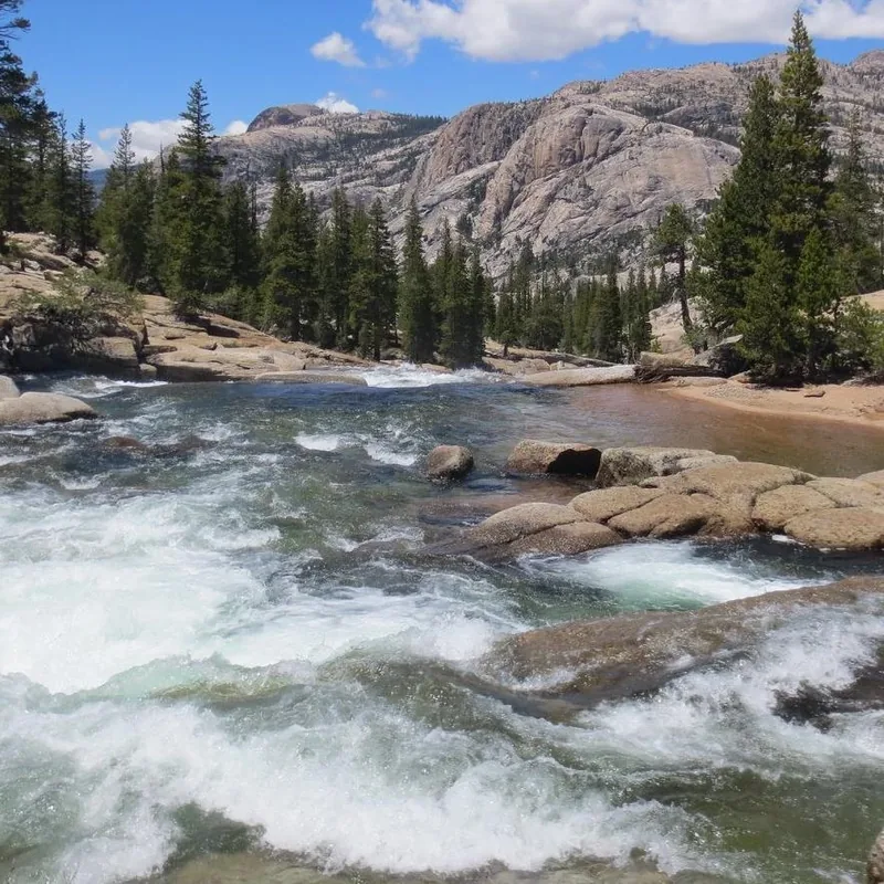
Waterfall season rewards distance as much as proximity. A viewpoint with dry footing and a complete view often communicates scale better than the last wet ledge near the current.
Heat below, altitude above: pack for both
Yosemite Valley sits near 4,000 feet, while Tuolumne Meadows is around 8,600 feet.
The two areas can share a sunny forecast and still deliver different temperatures, breathing effort, overnight lows, wind, and thunder exposure.
NPS climate normals put the average July high near 89 F in the Valley and 72 F at Tuolumne Meadows. That contrast does not include the additional cooling from wind or a storm over an exposed granite ridge.
One park, two summer climates
- 4,000 ftYosemite ValleyLower trailheads can become hot during a long climb
- 8,600 ftTuolumne MeadowsHigh-country starts add altitude and colder mornings
- 89 FAverage Valley July highShade and early starts protect the climbing window
- 72 FAverage Tuolumne July highA mild average still allows cold wind and thunderstorms
The NPS hiking-safety reference suggests carrying and drinking at least one quart of water every two hours. Treat that as a starting reference rather than a promise, because heat, body size, pace, route length, and water availability change the requirement.
- Carry a headlamp, even when the planned hike should finish in daylight. - Check a forecast for the actual hiking area, not only Yosemite Valley. - Start exposed high-country routes early enough to retreat before afternoon thunder develops. - Give a newly arrived hiker time to notice headache, nausea, unusual fatigue, or poor coordination at altitude. - Carry a warm layer and rain shell when a sunny Valley morning leads to the high country.
Natural water must be treated before drinking. A blue line on the map also cannot guarantee late-season flow, so confirm current water information when a route depends on a creek or spring.
Pace the first hour below the effort the group could sustain at home. High-country fatigue becomes easier to manage when it is noticed before the route reaches an exposed pass or a long return.
How do you avoid losing half the day to traffic?
Open entry in 2026 does not reserve a parking space.
Busy weekends and holidays can still produce queues, full lots, traffic controls, and long walks between the available space and the intended trailhead.
The most reliable strategy is to reduce vehicle moves. Choose one region for the day, arrive with an alternate trail in that region, park once when possible, and use walking or available transit for the final connection.
- Choose one regionGroup nearby objectives so the day does not depend on driving across the park
- Check traffic and road statusLook before entering a corridor where a queue has no quick exit
- Arrive before pressure buildsEarly access improves options but never guarantees a space
- Park once in Yosemite ValleyUse the free shuttle or walk between linked Valley stops
- Keep a same-region fallbackSwitch objectives without joining another cross-park traffic line
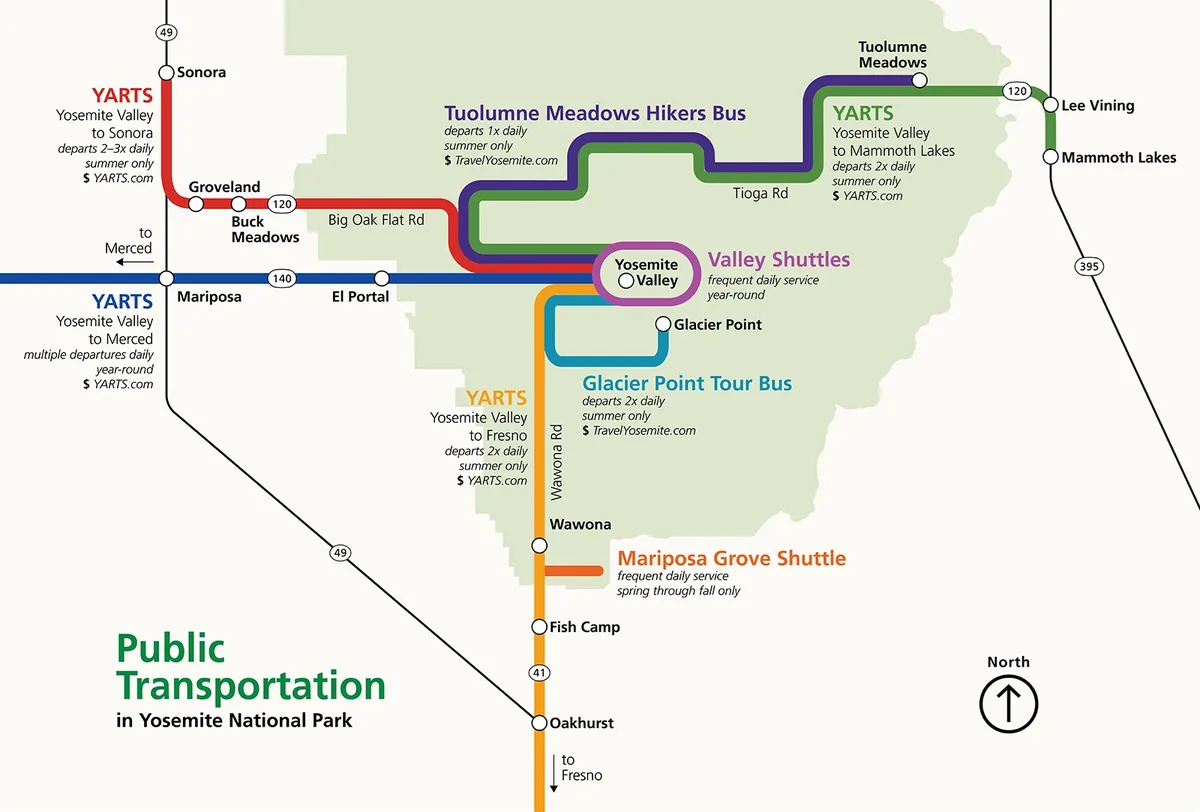
The Valleywide shuttle serves lodging, food, campgrounds, and trailheads, with buses listed every 12 to 22 minutes. The East Valley route focuses on Yosemite Village, Curry Village, the Pines campgrounds, and eastern trailheads, with buses listed every 8 to 12 minutes.
Those intervals are schedules, not a guarantee that the next bus has room. Walking between close Valley stops can be faster when platforms are crowded, while a distant trailhead still requires enough time for the full connection.
The shuttle is most useful after the group accepts its boundary. It helps circulate within the Valley, but it does not turn remote areas into Valley stops or guarantee a one-way trail transfer on Glacier Point Road.
Transport outside the Valley is more conditional.
Seasonal YARTS and tour services reach some areas, but Hetch Hetchy has no public transportation and Tuolumne-area service is not available every year.
Build the trip so one missed bus changes the trail, not the night's legal sleeping plan. The last connection deserves the same attention as the first ascent.
Sources
Park size, hiking regions, trail guidance, weather, seasons, roads, transportation, permits, camping, food storage, and water safety were verified on August 16, 2026 against the official National Park Service Yosemite pages used in this profile.
Current and future-facing details should be rechecked through the NPS pages for current conditions, hiking, seasons, weather, public transportation, permits and reservations, wilderness permits, campground reservations, bears and food storage, and water safety. The conditions page is the authority for closures and operating changes on the travel date.
The images are public-domain National Park Service works or separately licensed photographs identified in their captions.
The official map remains a planning aid, while signs and closures in the park control when conditions differ.
Yosemite hiking questions that change the plan
What is the best month to hike Yosemite National Park?
There is no single best month across all elevations. Late spring favors waterfalls and lower routes, summer normally gives the broadest high-country access, and early fall can bring cooler hiking with shorter days and drier falls.
Do I need a permit for a Yosemite day hike?
Most ordinary day hikes do not require a wilderness permit. Half Dome requires a permit whenever the cables are up, and temporary management rules can add restrictions, so check the exact trail before departure.
Can I drink water from Yosemite streams?
Natural water should be treated before drinking, and seasonal sources may be dry. Carry enough to reach a confirmed source and do not depend on a map symbol alone.
Are dogs allowed on Yosemite hiking trails?
Pets are generally limited to fully paved roads, sidewalks, bicycle paths, and specified developed areas. Most hiking trails, shuttle buses, wilderness areas, and snow-covered routes do not allow them.
How many days do I need for Yosemite hiking?
Two or three days can support a strong trip when each day stays in one region and uses a different effort level. More time helps when the plan includes both the Valley and high country, because the transfer and seasonal access deserve their own margin.
The final check happens on the morning you travel. Confirm roads, trails, weather, smoke, water, shuttle operations, and permit documents, then use the region-based fallback if any one condition has changed.
RespectHazards to plan for
- fast and cold water near falls and creek crossings
- heat and dehydration at lower elevations
- altitude and afternoon lightning in the high country
- snow, ice, smoke, and rapidly changing road access