
Aasgard Pass Trail: Snow Hazards, Permits, and Descent
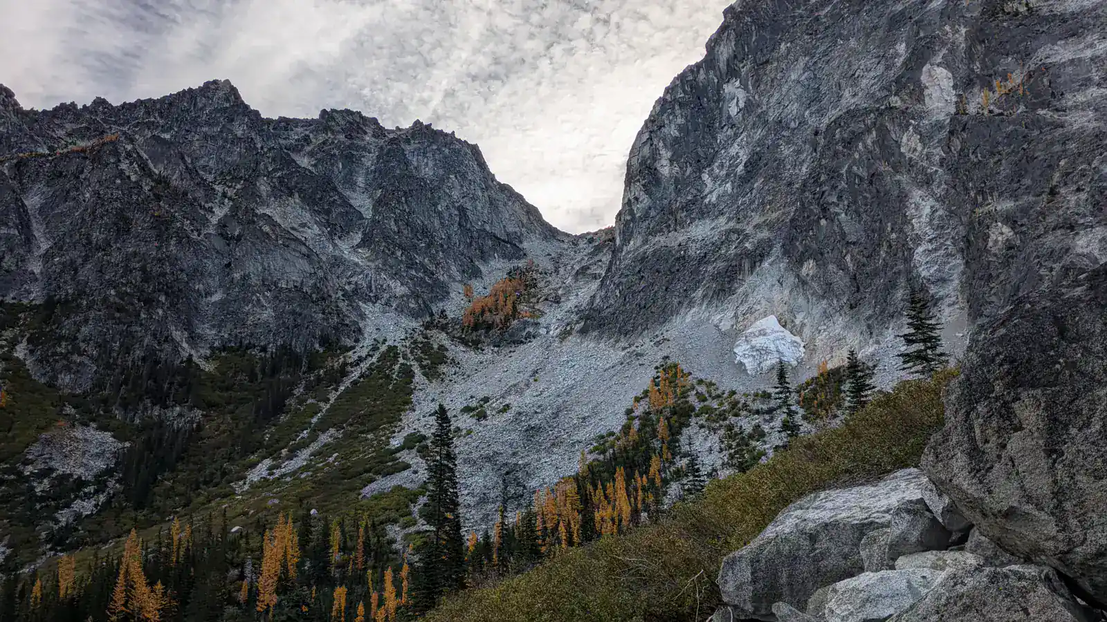
Aasgard Pass gains about 1,900 feet in less than a mile on an unmaintained route above Colchuck Lake. Safe travel depends on route finding, snow skill, avoiding the hidden waterfall line, and preserving the full descent.
Aasgard Pass is the steep, unmaintained route from Colchuck Lake into the Enchantments Core. The climb gains roughly 1,900 feet in less than a mile, and snow can hide streams, holes, and waterfalls beneath a surface that looks continuous.
This page covers the pass as a decision and movement problem. It does not turn the longer Enchantments traverse into a casual day-hike itinerary.
Why is Aasgard Pass more serious than a steep trail?
There is no maintained tread up the pass. Hikers choose a line through talus, slabs, loose soil, and seasonal snow while the slope steepens above Colchuck Lake.
The consequences rise faster than the mileage. A misplaced step on lower trail may cost time, while the same mistake on steep snow or unstable talus can cause a long fall.
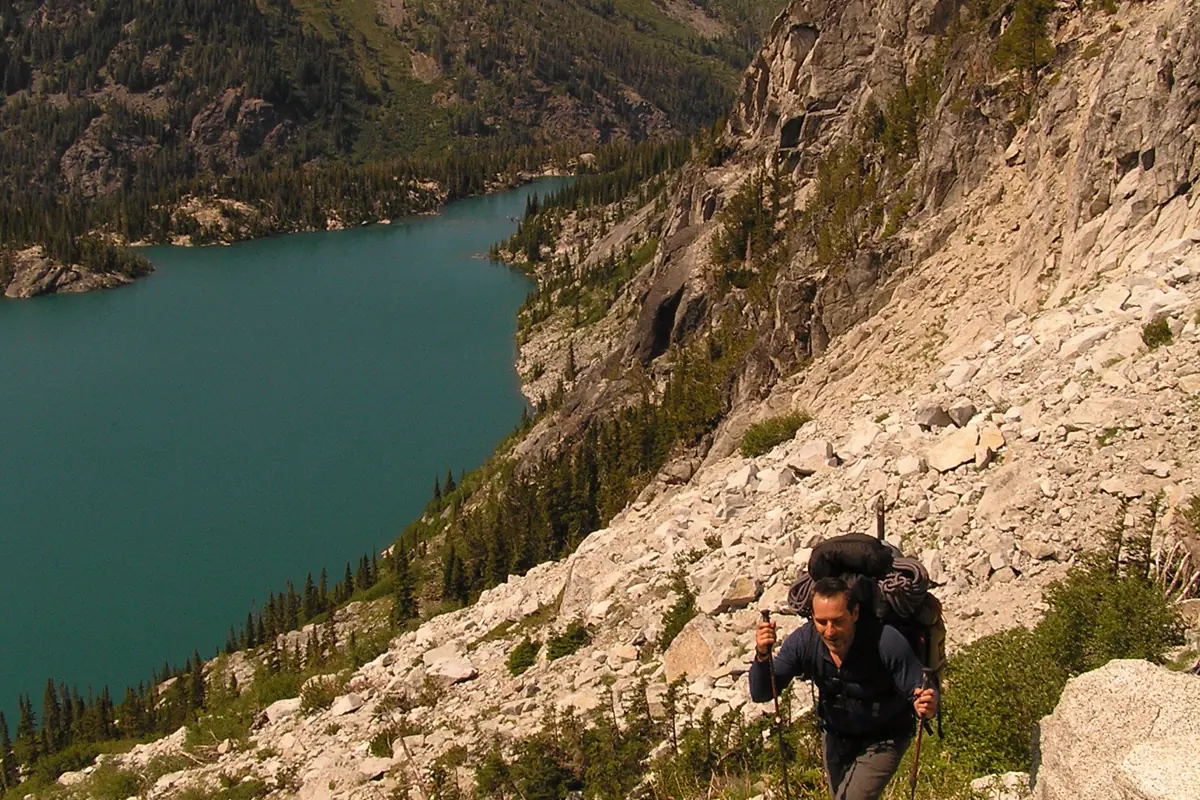
The route must remain readable for the descent. If you cannot explain how you will reverse a section, climbing above it creates a problem that effort alone cannot solve.
How does the pass fit into the full approach?
You first hike from the Stuart Lake trailhead to Colchuck Lake. The approach carries normal trail mileage and elevation before Aasgard adds its concentrated climb.
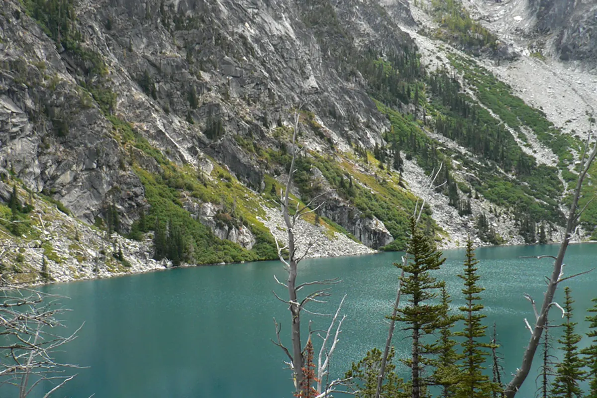
Near the lake, the route crosses boulders and reaches the base of the pass. The upper basin is still far above even when the saddle looks close from the water.
Scale of the Aasgard segment
- Less than 1 mileHorizontal distanceThe steep gain is compressed into a short line
- About 1,900 feetClimb from Colchuck LakeRoute choices and rests determine the practical effort
- Around 7,800 feetPass elevationWeather and temperature differ from the trailhead
- No maintained treadRoute characterNavigation remains part of every step
A full day from the trailhead to the pass and back is a major outing because you must repeat the lake approach and descend the same steep ground. A through-hike across the Enchantments adds an entirely different exit, transport, permit, time, and route-planning problem.
Which line avoids the waterfall hazard?
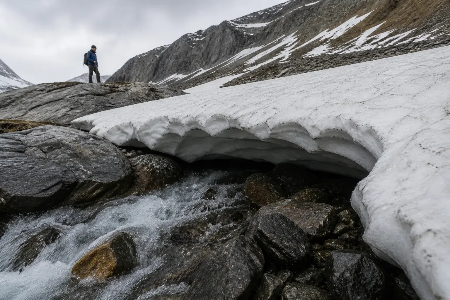
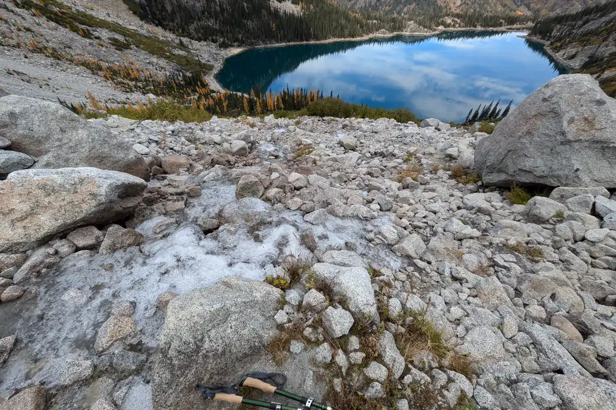
The main hazard is not simply the steepest-looking rock. Snow on the climber's left side can cover a creek and waterfall, forming cavities that are invisible from above.
Forest Service guidance directs hikers away from that dangerous snow finger. Stay on the established rocky route and use current local guidance rather than following glissade tracks.
Lower slope
Move through stable talus without dislodging rocks onto hikers below.
Rock island
Use this prominent feature to check that you have not drifted toward the waterfall line.
Upper slope
Expect loose soil, slabs, and snow patches to interrupt any single track.
Pass
Stop before committing to the descent if weather or visibility is deteriorating.
Groups should spread enough that one falling rock does not hit everyone, but remain close enough to communicate route changes. Never climb directly under a person who is testing loose stones.
When does snow make Aasgard Pass technical?
Snow persists after lower trails look like summer. A firm morning surface can require reliable traction and self-arrest skill, then soften into deep steps and hidden voids later in the day.
Microspikes improve grip on some firm surfaces but do not replace an ice axe, crampons where appropriate, or the training to stop a fall on steep snow. Carrying equipment without practicing its use does not control the hazard.
| Surface | What changes | Conservative response |
|---|---|---|
| Dry talus | Rocks move and footsteps can trigger rockfall | Test holds and avoid stacking hikers in one fall line |
| Firm snow | A slip can accelerate before you can stand | Use suitable equipment and known self-arrest skill or turn around |
| Soft snow | Feet punch through and hidden water channels weaken the surface | Avoid suspect snow bridges and the waterfall line |
| Mixed rock and snow | Repeated transitions make traction awkward | Change technique deliberately instead of rushing between surfaces |
If the route requires equipment or movement you have never used on a similar slope, Aasgard is not the practice hill. Choose a maintained objective or go with qualified instruction.
Why is glissading especially dangerous here?
Glissade tracks can point directly over hidden waterfalls and creek holes. Hikers have died after sliding into openings beneath the snow.
A track only proves that someone began sliding. It does not reveal whether they controlled the speed, avoided the watercourse, or reached safe ground.
Descending on foot also demands more than leaning back. Keep your center of mass over stable feet, shorten steps on loose material, and give falling rocks a clear path away from the group.
Do you need an Enchantments permit?
Day use is allowed in the Enchantments zones without an overnight permit. Overnight camping from May 15 through October 31 requires a limited-entry permit for the zone where you sleep.
A Northwest Forest Pass or another accepted recreation pass is required at the Stuart Lake trailhead. A parking pass and an overnight wilderness permit solve different requirements.
- Day hike
- No overnight Enchantments permit required
- Overnight May 15 through October 31
- Limited-entry zone permit required
- Trailhead parking
- Northwest Forest Pass or accepted equivalent required
- Camping plan
- Your permit must match the zone where you camp
- Waste
- Pack out all waste and follow current wilderness rules
Do not use a day-hike rule to justify an itinerary that will predictably run into the night or force an unplanned bivouac. Your turnaround time must preserve the complete descent and lake approach.
What conditions should cancel the climb?
Turn around for thunder near the pass, cloud that removes route visibility, hard snow without suitable equipment, uncontrolled rockfall, or a group pace that cannot protect the return. A forecast for Leavenworth does not describe wind and temperature at 7,800 feet.
Heat can also matter on the exposed lower pass. The steep climb reduces airflow at a slow pace while the long approach has already consumed water.
- The group can identify the rocky line away from the waterfall hazard
- Everyone has equipment and practiced skill for the existing snow
- Weather supports the climb, time at the pass, and full descent
- Water and food cover a slower return than the ascent estimate
- Every hiker can descend loose talus without relying on a glissade
- The turnaround time protects daylight for the Colchuck Lake approach
One failed condition is enough to stop. The pass does not become safer because the approach took several hours.
How should you descend Aasgard Pass?
Begin the return before fatigue or weather removes choices. Retrace known stable features rather than searching for a faster line that you did not inspect on the ascent.
Face into very steep steps when that gives three points of contact. On looser terrain, keep steps short and avoid kicking stones into the route below.
The boulder field near Colchuck Lake still requires attention after the steep slope ends. Save food, water, daylight, and concentration for that transition and the maintained trail back to the parking area.
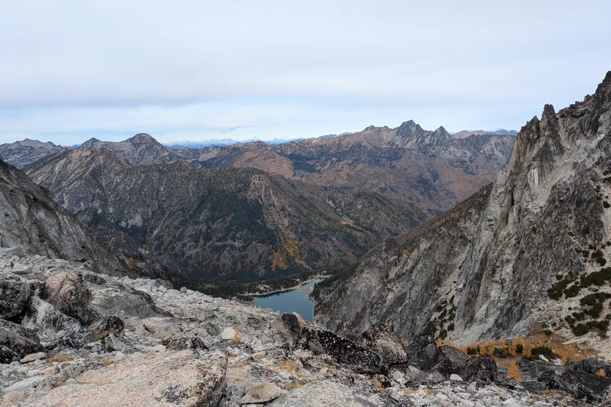
A controlled return is the route's real completion test. Reaching the pass with no safe descent margin is not a successful ascent.
Sources
Permits. Recreation.gov Enchantments permits supports day-use access, the May 15 through October 31 overnight permit season, zone rules, and trailhead pass requirement, verified August 30, 2026.
Route hazards. Okanogan-Wenatchee National Forest Aasgard Pass warning supports the unmaintained route, snow-covered creek and waterfall hazard, fatal glissade history, and need for steep-snow preparation, verified August 30, 2026.
Wilderness conditions. Okanogan-Wenatchee National Forest Enchantments information supports access, wilderness rules, and current-condition checks, verified August 30, 2026.
RespectHazards to plan for
- hidden waterfalls beneath snow
- long falls on steep snow
- rockfall
- route finding
- thunderstorms
- difficult descent