
Angels Landing Trail: Should You Go Past Scout Lookout?
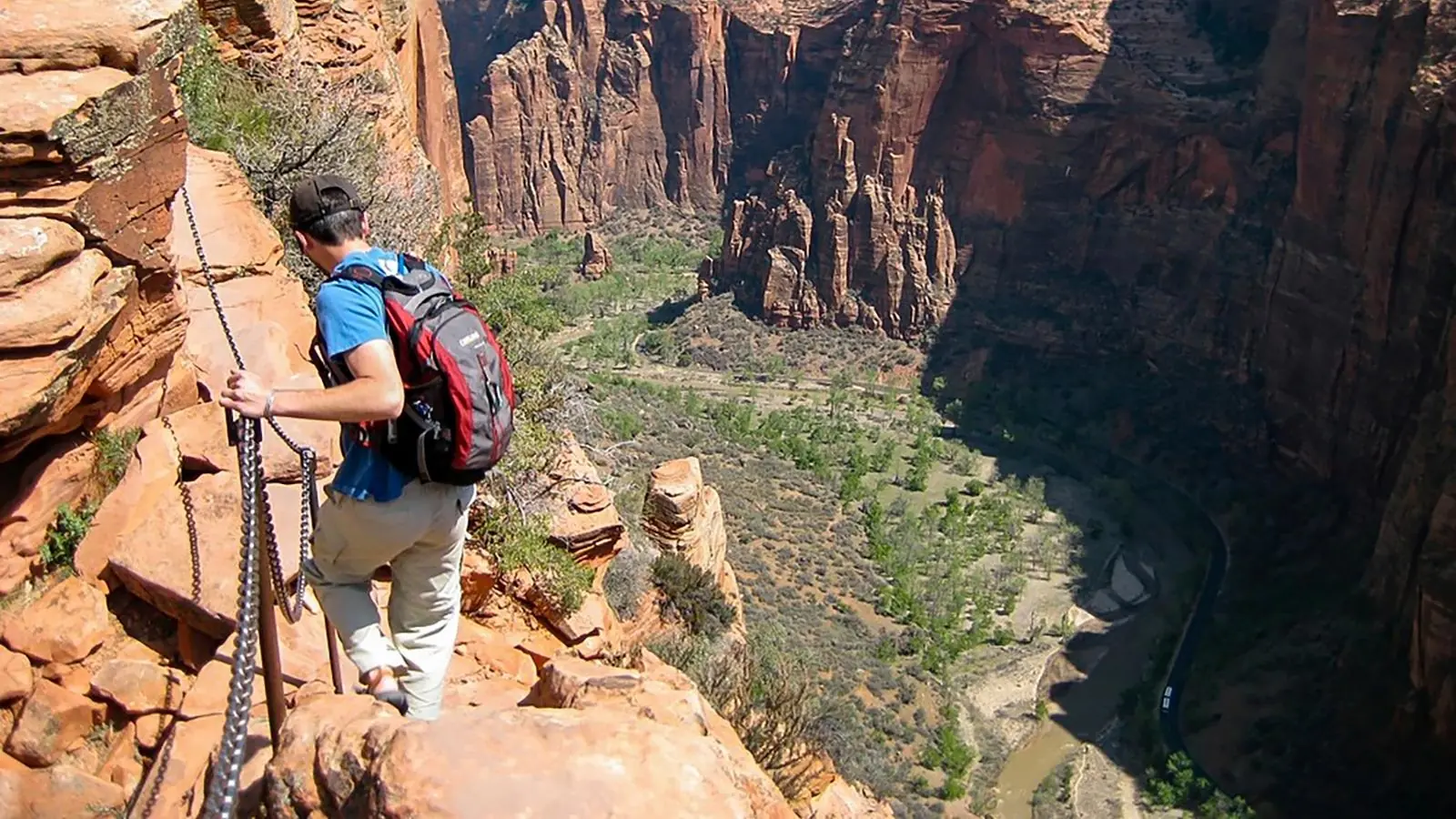
Angels Landing is two hikes separated by Scout Lookout. Plan the strenuous 5.4-mile route around its 1,488-foot climb, permitted chain ridge, weather, water, and shuttle return.
Angels Landing is a 5.4-mile round-trip hike with 1,488 feet of gain, but those totals hide the decision that matters most. You first climb the West Rim Trail to Scout Lookout, then choose whether to enter a permitted half-mile ridge where chains, narrow sandstone, opposing traffic, and severe drop-offs change the nature of the hike.
Most hikers take around four hours for the full route, according to the National Park Service.
That estimate is useful for transport planning, but it is not a pace you need to match or a reason to continue when your balance, the weather, or the available daylight says stop.
Which Angels Landing hike are you actually planning?
There are two complete and defensible plans on the same approach. The first ends at Scout Lookout after a strenuous canyon climb, while the second continues over the exposed ridge to Angels Landing and returns across the same chains.
You do not need an Angels Landing permit to reach Scout Lookout. You need one for everyone who continues past it, so Scout Lookout is a real destination rather than a consolation stop for hikers who lose the lottery or dislike exposure.
This split also gives a mixed group a cleaner plan.
People who stop can rest at Scout Lookout or continue on the West Rim Trail where permitted, while the permitted summit group completes the ridge and reunites at a named place and time.
Do not improvise that separation after someone freezes on a narrow passage. Agree on the meeting point, turnaround time, communication method, and rule that nobody waits near an exposed bottleneck before leaving the Grotto.
How hard is the climb before the chains?
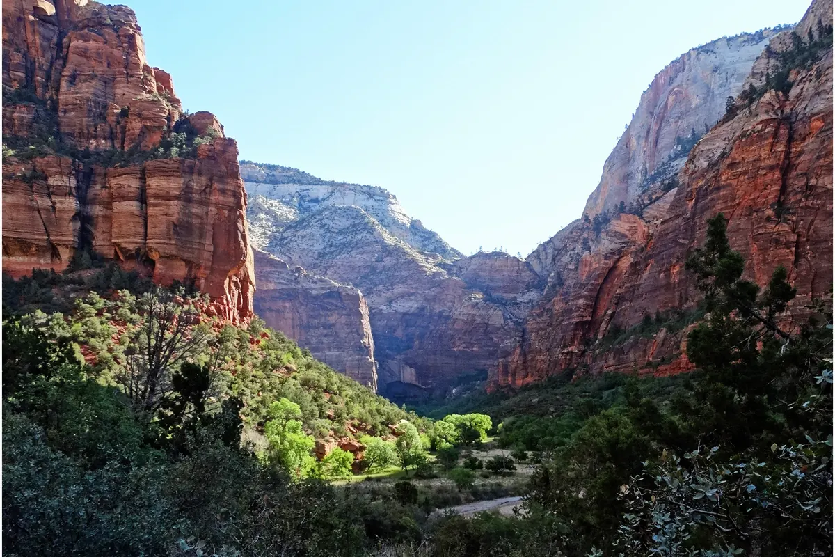
The approach begins at the Grotto, crosses the Virgin River, and follows the West Rim Trail uphill. The pavement makes the route easy to follow, but a paved climb is still a sustained climb with little flat ground to erase the accumulated effort.
The trail gains height on broad switchbacks above Zion Canyon before entering Refrigerator Canyon. That shaded passage may feel cooler, then Walter's Wiggles compresses the climb into 21 tight turns below Scout Lookout.
The full-route workload
- 5.4 milesRound tripThe Grotto to Angels Landing and back
- 1,488 feetElevation gainA sustained climb concentrated into a short distance
- Around 4 hoursTypical total timeThe NPS estimate, not a deadline
- 0 waterAbove the GrottoCarry the full supply from the trailhead
The official Scout Lookout description puts that intermediate hike at about 2.25 miles from the Grotto with roughly 1,000 feet of climbing. Even without the chains, this is not a casual overlook reached by a short level walk.
Pace the open switchbacks by breathing and temperature rather than by hikers passing you. A speed that feels sustainable in the first mile can become expensive when sun, reflected heat, and repeated turns arrive together.
Refrigerator Canyon offers a useful checkpoint because the setting changes before the steepest compact switchbacks. If your group is already consuming water quickly or losing steady conversation there, the approach is giving you evidence that the return may be harder than the map suggests.
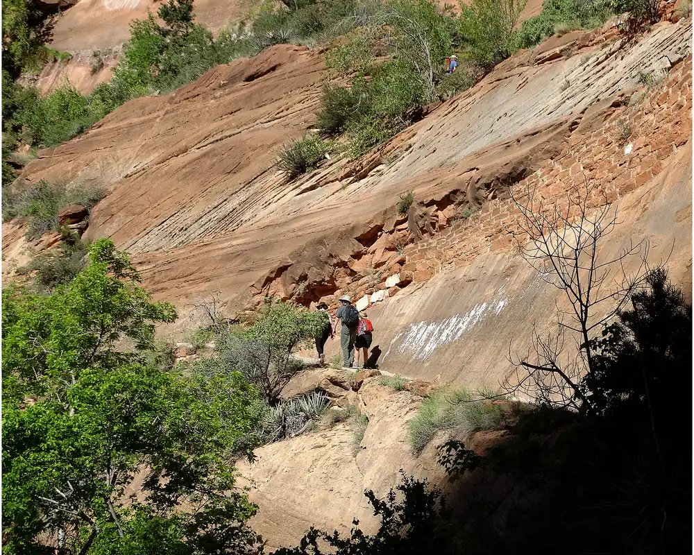
Walter's Wiggles is visually memorable, but it should not become a sprint to the decision point. Shorten your stride, let faster hikers pass at a wider turn, and preserve enough leg strength to descend the same grade after the exposed section.
What changes at Scout Lookout?
Scout Lookout is where one strenuous trail becomes two different days.
The paved West Rim approach continues, while the Angels Landing route turns onto uneven sandstone where the permit boundary and chain system begin.
Restrooms are available at Scout Lookout, but water is not. Use the stop to check water, time, weather, hand function, footwear, and the behavior of traffic on the first visible chain section.
| Decision | End at Scout Lookout | Continue to Angels Landing |
|---|---|---|
| Permit | No Angels Landing permit required | Permit required for every hiker |
| Surface | Paved West Rim Trail | Uneven rock and carved steps |
| Exposure | Viewpoint edges can be avoided | Narrow ridge beside severe drop-offs |
| Traffic | Ordinary trail passing | Two-way movement through chain passages |
| Time | Return on the shared approach | Add the ridge in both directions |
The strongest reason to continue is not that you have already climbed this far. It is that the remaining terrain fits each person, current conditions are stable, and the return still has generous margins.
The strongest reason to stop may be a quiet one. A hiker who dislikes the first exposed view, cannot keep both hands free, feels unsteady after the climb, or does not want to share narrow rock with opposing traffic has already gathered enough information.
Turnaround is a completed decision when it preserves a controlled descent.
You still receive the canyon views, Walter's Wiggles, Refrigerator Canyon, and the full physical work of the approach.
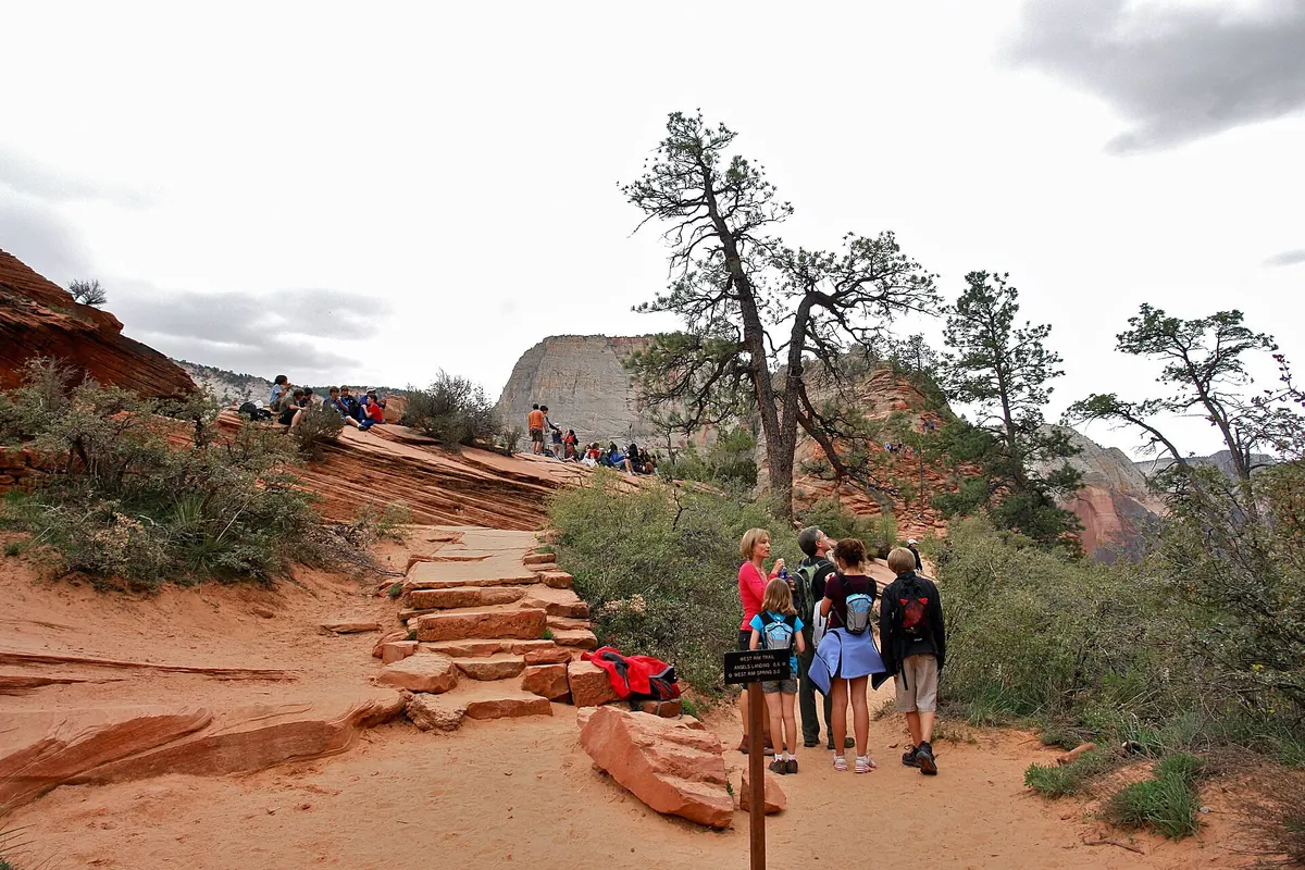
If a group splits, the people stopping should move away from the permit entrance and exposed edges. Set a reunion time that allows for a slow chain crossing rather than assuming the summit party will return in the fastest published time.
Can you handle the Angels Landing chains?
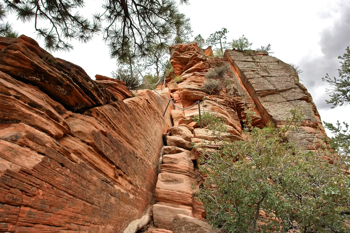
The final route is about half a mile each way, and the NPS says that segment alone can take one to two hours. Its difficulty comes from the combination of uneven rock, intermittent chains, narrow tread, exposure, and two-way traffic, not from mileage.
In places the route is less than three feet wide with drop-offs that reach about 1,000 feet.
The chains appear where the park has installed them, but they are not a continuous guardrail and they do not remove the need for deliberate foot placement.
- You can step across uneven sandstone without pulling on the chain to compensate for poor balance
- You can pause and communicate while another hiker moves in the opposite direction
- Your shoes grip dry rock and stay secure on steep carved steps
- Your pack leaves both hands available and nothing hangs loose
- Wind, rain, ice, and thunder are absent from the decision
- You are willing to turn around before the summit if movement stops feeling controlled
Opposing traffic changes a simple scramble into a shared movement problem. Wait at a wider stance, say what you intend to do, and give the other hiker time to finish a committed move before you enter the same narrow space.
Do not rush someone who has stopped. Pressure can make balance and judgment worse, so wait in a secure position or retreat to the last suitable passing place.
The route also asks you to descend every move you climb.
A step that feels manageable while facing upward may demand more hip mobility, visual judgment, and patience when you return with the drop in view.
Comfort must survive both directions. If you can tolerate going up only by avoiding any thought of the descent, the summit is a poor place to discover that mismatch.
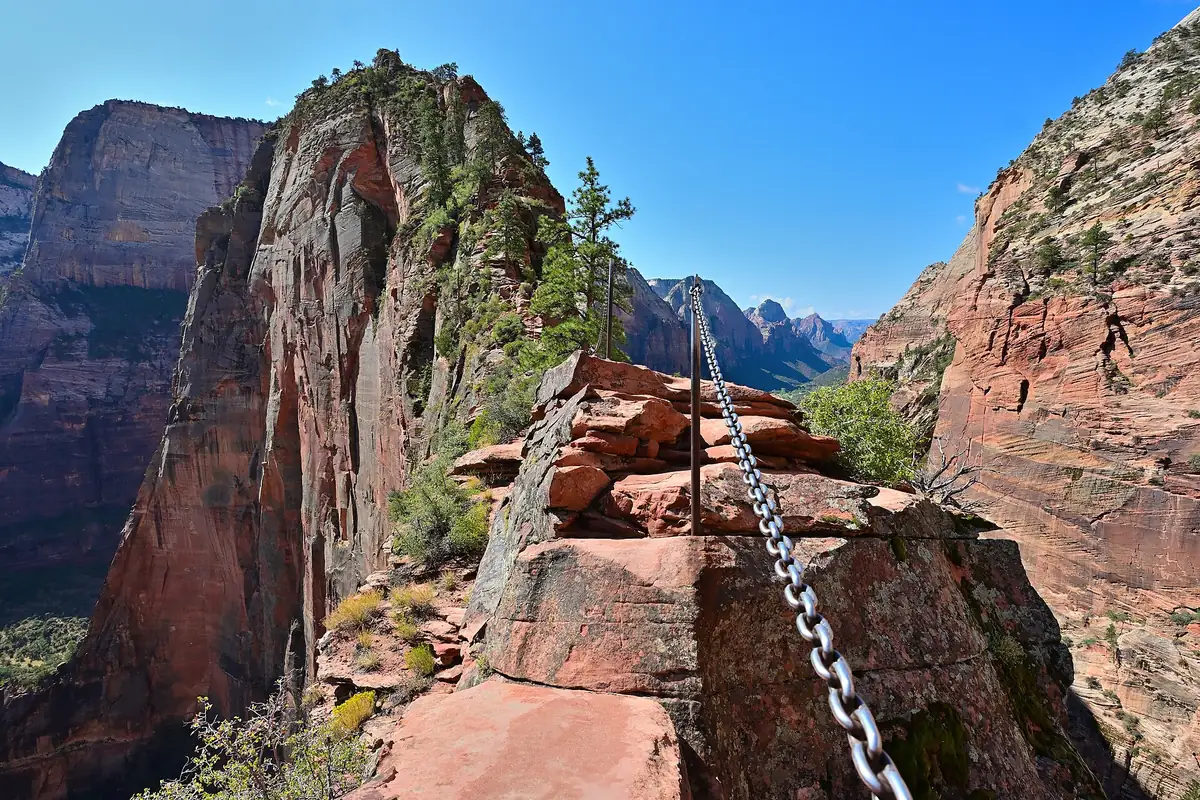
The NPS notes that most deadly accidents on Angels Landing since 1930 have occurred on the chain section. That history supports a conservative decision, but practical planning should stay focused on the observable conditions and actions that you can control today.
How do Angels Landing permits work in 2026?
Every person who goes past Scout Lookout toward Angels Landing needs a permit.
Rangers may check at the Grotto, Scout Lookout, or anywhere along the route, and the permit holder may need to show identification.
The park offers a seasonal lottery for advance plans and a day-before lottery for remaining access.
The two lotteries solve different timing problems, but neither guarantees a permit or replaces the park entrance fee.
The 2026 seasonal windows
For hikes from March 1 through May 31, the 2026 seasonal lottery opened February 13 and closed February 25. The summer window for June through August ran April 1 through April 20, and the fall window for September through November runs July 1 through July 20.
The winter application window for hikes from December 1, 2026 through February 28, 2027 runs October 1 through October 20. The official permit page publishes the issue date for each window, so verify that table before relying on a saved itinerary.
The day-before lottery
The day-before lottery opens daily at 12:01 a.m. and closes at 3 p.m. Mountain Time. Results are issued after 4 p.m., which means a Tuesday hike requires a Monday application rather than an application on Tuesday morning.
From application to the chain section
- Seasonal planApply in the window for the intended hike datesRank up to seven dates and times or date windows
- Day-before attemptApply from 12:01 a.m. to 3 p.m. Mountain TimeReceive the result after 4 p.m. that day
- AwardPay the per-person fee and confirm the named groupDo not add people beyond the permit
- Before the GrottoDownload, print, or screenshot the confirmationWeak mobile service cannot erase your proof
- On the trailCarry the confirmation and identificationA ranger may check before or beyond Scout Lookout
Each lottery application costs $6 and can include up to six people, including the applicant.
If selected, the permit costs another $3 per person.
Seasonal permits allow limited cancellations or group reductions until two days before the hike, while day-before permits cannot be changed and their fees are nonrefundable.
Permits are not transferable, so the named applicant cannot hand the reservation to another group.
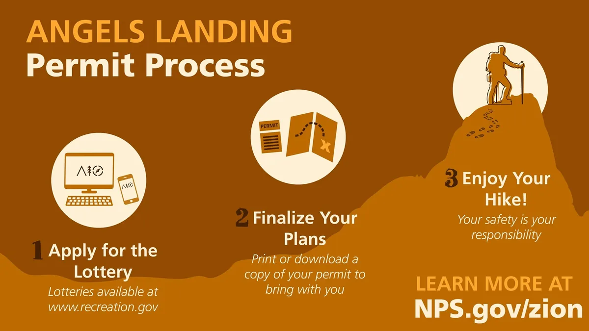
The confirmation email is the permit. Save it offline before entering Zion Canyon because unreliable service at the checkpoint is a preventable reason to lose access.
When should weather cancel the summit?
A park alert that leaves the trail open does not certify the ridge for your group.
Thunder, wet sandstone, ice, strong wind, and uncontrolled heat each change a specific part of the movement problem.
Thunder means the exposed ridge is the wrong place to be. The chain section has little shelter, and a clear patch directly overhead does not cancel a storm close enough to hear.
Rain reduces traction on steep sandstone and can slow opposing hikers until queues form in exposed places. Ice creates the same problem with fewer reliable foot placements, sometimes while the canyon floor still looks dry.
Wind deserves a behavioral test rather than a universal number.
If a gust changes your stance on the broad approach, the narrower ridge removes space for that correction.
Summer heat begins on the open switchbacks well before the chains. It can increase water use, reduce coordination, and leave the group with less reserve for a slow exposed return.
Weather changes the acceptable endpoint. A stable approach may still support Scout Lookout on a day when the final ridge does not, while lightning or dangerous heat may justify canceling the entire climb.
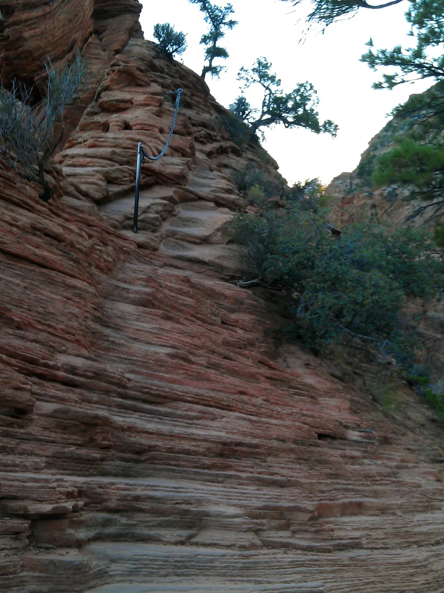
Check again before descending from the summit because the route home uses the same exposed ridge. A cloud building behind you is still relevant even when the view ahead remains bright.
How do you reach the Grotto without missing the last shuttle?
The Angels Landing approach starts at the Grotto, Zion Canyon shuttle stop 6.
For most of the year the Scenic Drive is restricted to shuttle buses, so trailhead access depends on parking, the queue, the ride into the canyon, and the last return service.
The park shuttle does not require a ticket or reservation. It is separate from the Angels Landing permit and the park entrance fee.
- Trailhead
- The Grotto, Zion Canyon shuttle stop 6
- Shuttle ticket
- No ticket or reservation required
- 2026 core season
- March 7 through November 28
- Holiday service
- December 26 through January 2
- Parking
- Visitor Center lots can fill early
- Missed return
- The added walk can reach eight miles or more
In 2026, Zion Canyon shuttle service runs from March 7 through November 28, then returns for the December 26 through January 2 holiday period. First and last departures change across the season, so a time copied from spring can be wrong in summer or late fall.
Budget the queue and ride before counting trail time. Arriving at the park entrance is not the same as stepping onto the trail at the Grotto.
On the return, protect more than the final scheduled bus. A slow chain descent, a full bus, or a longer rest at Scout Lookout can consume a margin that looked generous at the summit.
The shuttle deadline belongs in the turnaround plan because missing service can add a road walk of up to eight miles or more.
Save the current schedule offline and note which stop the last outbound bus departs from, rather than relying on a remembered park-closing time.
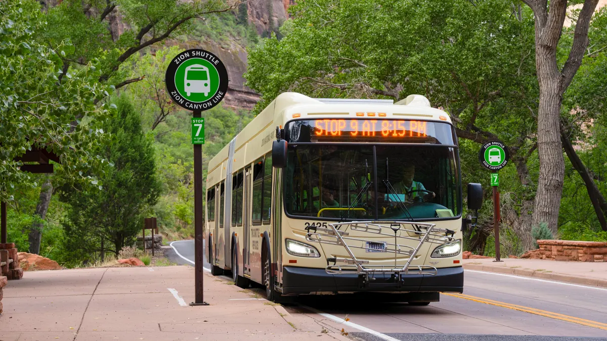
Outside shuttle operations, the Scenic Drive may open to private vehicles until parking fills or a temporary restriction applies. Verify current operations instead of assuming winter access will work like shuttle season.
What should you carry when water stops at the trailhead?
Potable water is available at the Grotto, but there is no water at Scout Lookout or on Angels Landing. Fill before crossing the river and carry enough for the climb, heat, delays, and complete descent.
A universal bottle count would ignore temperature, body size, pace, and duration. Use a water plan based on the forecast and your group, then carry a reserve that remains untouched until the return develops a real need.
- Water for the climb, delay margin, and descent from a trail with no refill above the Grotto
- Shoes with secure fit and reliable grip on dry sandstone
- A compact pack that keeps both hands free and holds every loose item
- Sun protection for open switchbacks and a layer for wind at elevation
- Food that can be eaten without a long exposed stop
- A headlamp with working batteries even when a daylight return is planned
- An offline permit, map, shuttle schedule, forecast, and current-condition notes
Footwear matters most when the surface tilts or a carved step asks for precise placement. Worn smooth soles, loose heels, and open footwear reduce control where the chain cannot solve a sliding foot.
Keep poles stowed before the chain section unless you can secure them completely. A pole occupying one hand or projecting from a loose pack can interfere with other hikers in a narrow passage.
The park recommends a flashlight or headlamp, food, and plenty of water in case the hike lasts longer than planned. A headlamp protects the descent, while a phone flashlight consumes the same battery that holds your permit, map, and emergency communication.
Pack for the route you will actually hike, not for a summit photograph.
Free hands are functional equipment on the chain section, so a secure small pack has more value than loose bottles, dangling straps, or an item you must carry by hand.
When is the best time to hike Angels Landing?
There is no month that removes exposure, permits, traffic, weather, and transport at once.
The best time is the window when the route's strongest seasonal constraint fits your skills and you can verify suitable conditions close to the hike.
| Period | Useful condition | Main constraint |
|---|---|---|
| Spring | Milder canyon temperatures | Variable storms and possible lingering ice |
| Summer | Long daylight | Heat and more frequent afternoon storms |
| Fall | Cooler starts | Shorter daylight and busy travel periods |
| Winter | Fewer visitors | Snow, ice, short days, and reduced traction |
Spring and fall often reduce the direct heat of the open approach, but neither guarantees dry rock or quiet trails. A cold storm can affect the ridge faster than the canyon floor suggests.
Summer offers long days, yet an early start does more than improve comfort. It moves the strenuous switchbacks away from peak heat and gives you more room to leave the ridge before afternoon storms develop.
Winter can offer solitude, but ice on a narrow exposed route is a decisive condition rather than a scenic variation. Do not treat traction devices as automatic permission to enter a chain section that you would reject on bare wet rock.
Time of day also affects traffic flow.
An early permit slot may reduce some congestion, but it does not guarantee an empty ridge or remove the need to wait for opposing hikers.
Choose a condition window, not a calendar label. Check daylight, shuttle hours, forecast, alerts, and visible ridge conditions together, then keep Scout Lookout or another Zion hike as an independent fallback.
Why does the descent deserve its own plan?
The summit is the halfway point in distance and the start of the most easily underestimated work.
You must reverse the exposed ridge, descend Walter's Wiggles, cross the long switchbacks, and still reach the Grotto within the transport window.
Downhill movement changes the view of each step. Place a foot before transferring weight, face the rock when that position gives better control, and avoid stepping backward into a space you have not checked.
Traffic remains two-way, so patience still matters after the summit crowd begins moving down. A secure stance is a better waiting place than a rushed pass made to protect an arbitrary pace.
Fatigue can shorten attention before it creates obvious muscle failure. If feet begin clipping steps, knees lose controlled flexion, or communication becomes irritable, slow down and widen the time margin instead of trying to recover it with speed.
The return through Scout Lookout is another useful check. Recount water, confirm the last shuttle margin, and treat the paved descent as real work because steep repetitive grades can expose foot pain and unstable knees.
Do not spend every reserve on the summit. The most useful success measure is a controlled return to the Grotto with enough water, light, and attention left to handle a delay.
That standard also protects the decision to turn around early.
The trail is complete when the group returns in control, whether its highest point was Scout Lookout, the first chain passage, or Angels Landing itself.
Sources
Permits and route figures. National Park Service Angels Landing permits and hiking supports the 2026 lottery dates, fees, permit rules, route figures, and Scout Lookout boundary, verified August 25, 2026.
Approach. National Park Service West Rim Trail to Scout Lookout supports the approach distance, ascent, facilities, water, and route sequence, verified August 25, 2026.
Chain section. National Park Service Angels Landing chain section supports the width, surface, exposure, chain coverage, traffic, and segment time, verified August 25, 2026.
Shuttle. National Park Service Zion shuttle information and the 2026 shuttle schedule support stop access, ticket rules, seasonal dates, and last-service planning, verified August 25, 2026.
Weather. National Park Service Zion weather and climate and current conditions support weather mechanisms and the pre-hike verification process, verified August 25, 2026.
RespectHazards to plan for
- severe cliff exposure
- falls
- wet or icy sandstone
- lightning
- extreme heat and dehydration
- two-way traffic on narrow chains