
Arches National Park Hiking by Heat and Surface
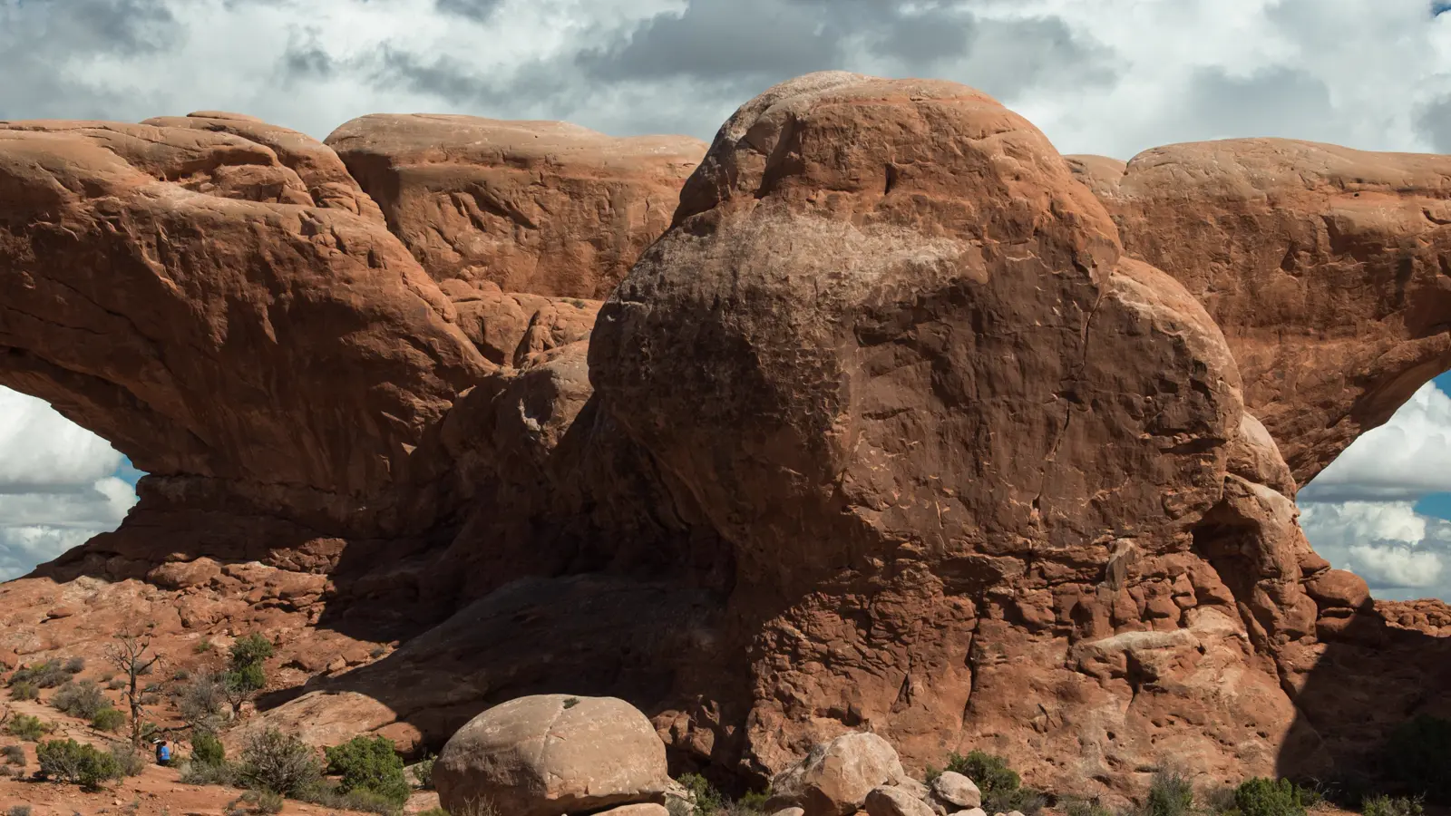
Plan Arches by route surface, cool-hour timing, parking flexibility, and the permits that apply only to specialized hikes.
Weather
Desert heat often exceeds 100 F in summer. Fast storms, winter ice, strong sun, and scarce shade can change exposed sandstone routes.
Plan the practical details
- Access
- One paved park road serves the main hiking areas. No timed-entry reservation is required in 2026, but traffic and full lots can still cause temporary diversions.
- Permits
- A park pass covers entry. Fiery Furnace, overnight backpacking, canyoneering, and developed camping use separate permits or reservations.
Arches is easiest to plan when you stop treating every formation as a roadside stop. Choose the kind of ground you want to cross, place the hardest movement in the coolest part of the day, and keep a second stop along the same road corridor.
That order matters in 2026 because the park does not require advanced timed entry, yet congestion can still close a parking area or temporarily divert vehicles. Admission, a parking space, and permission for a specialized hike are three separate questions.
Heat and access set the day. Mileage becomes useful only after you know the surface, shade, parking plan, and whether the route has its own permit.
- Landscape
- More than 2,000 natural stone arches, fins, pinnacles, and slickrock
- 2026 entry
- No advanced timed-entry reservation
- Summer heat
- Daytime temperatures often exceed 100 F
- Drinking water
- Visitor center and Devils Garden Campground
- Special access
- Fiery Furnace, overnight backpacking, and canyoneering use separate permits
- Current details checked
- August 24, 2026
The park road makes the map look simple. In practice, a full lot, a hot slickrock climb, or a permit boundary can remove one stop while every other part of the park remains open.
Which Arches hiking area fits your day?
Arches hiking ranges from firm paths measured in minutes to primitive routes where cairns, steep rock, sand, and exposed fins control the pace. A landmark name does not tell you which of those movements the route requires.
Start with the least experienced person in the group. If that person is uneasy on sloping bedrock or cannot manage a high step without using both hands, a short slickrock route may be a worse fit than a longer maintained path.
| Route family | Typical movement | What changes the choice |
|---|---|---|
| Viewpoint and firm path | Short walk on a defined surface | Heat, crowding, and accessible grade |
| Maintained desert trail | Rock steps, sand, and signed junctions | Water, sun exposure, and return distance |
| Slickrock climb | Continuous bedrock with cairns and open slopes | Ice, wet rock, footwear, and comfort near edges |
| Primitive loop | Route finding, fins, scrambling, and fewer easy exits | Navigation skill, daylight, and group agility |
| Fiery Furnace | Narrow passages, dead ends, squeezing, and careful foot placement | Permit, orientation, and confidence in a rock maze |
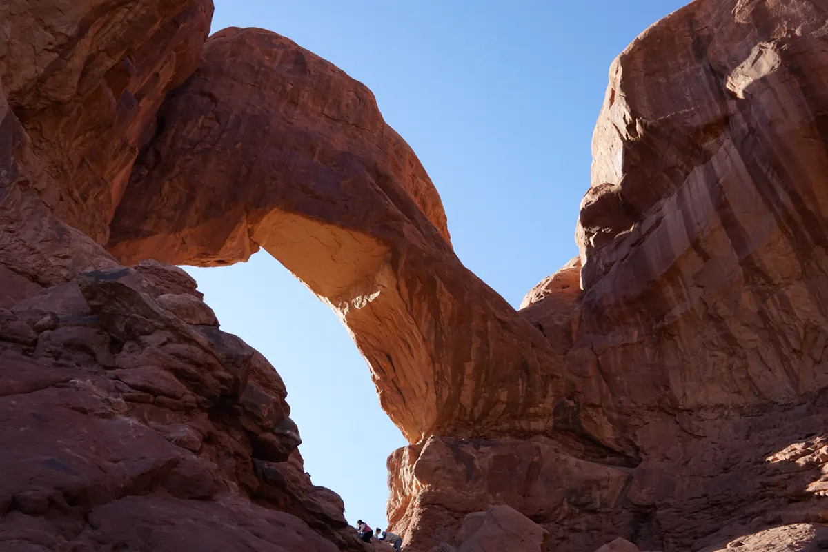
Delicate Arch and Devils Garden demonstrate the difference. One concentrates sustained slickrock and an exposed ledge, while the other can begin as a maintained trail and become a primitive route only after the easier arches.
That allows a mixed group to share the first part of a day without sharing the hardest finish. Decide the turnaround before the terrain changes, not after someone has spent the energy needed to return.
Choose the movement first. A famous destination is still the wrong hike when its surface asks for balance, exposure tolerance, or navigation the group does not have.
Footwear should match the surface rather than the park name. Deep sand rewards a different stride from slickrock, while loose stone near an edge demands slower spacing and deliberate foot placement.
Use the first ten minutes as a real test. If the group is already stumbling, overheating, or losing the cairned route, turn around while the trailhead is still close.
What time should you arrive at Arches for parking?
Arches will not use advanced timed entry in 2026. You may arrive during operating hours with a valid entrance pass, but the absence of a reservation does not reserve road capacity or a trailhead space.
The entrance line and popular lots can fill during busy periods. Park staff may divert vehicles or restrict access to a specific area, and visitors should not wait in a travel lane for a space to open.
A flexible arrival
- Before leaving MoabCheck the entrance webcam, alerts, and weatherThe first decision uses current conditions rather than yesterday's plan
- At the entranceKeep the main hike and one same-corridor alternative visible offlineA diversion does not require searching with weak service
- Lot fullContinue to the named alternative instead of circling or waiting in the roadTraffic keeps moving and the hiking window stays useful
- Later returnRecheck heat, daylight, and parking before trying the original stopA newly open space is useful only if the route still fits the day
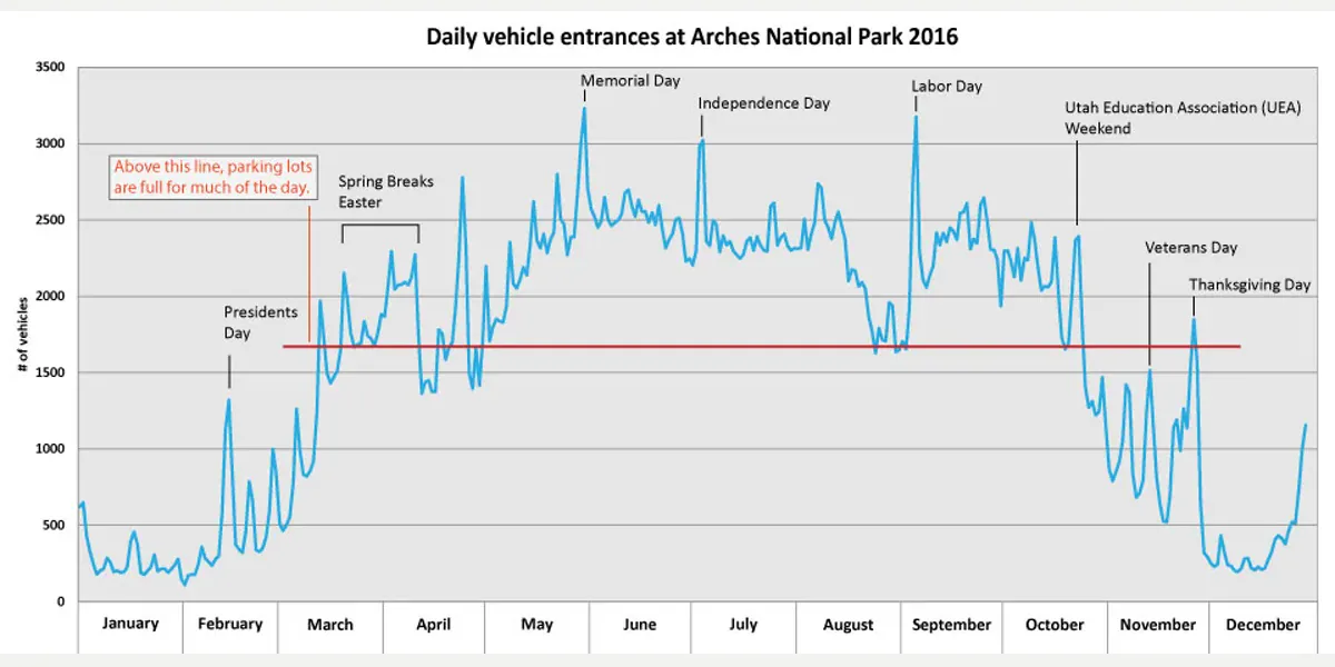
Build alternatives that use the road you are already on. Replacing Windows with Devils Garden can consume much of the cooler morning in driving, while replacing one Windows walk with another nearby short route preserves the access plan.
Arrival before 8 am or after 3 pm often avoids the busiest window, but it guarantees nothing. A backup is a named place and a matching route type, not a vague promise to find something else.
Night can also be a useful access window because Arches is open around the clock under normal conditions. Darkness changes navigation and fall consequences, so a night plan should use a familiar, short, clearly defined route rather than a primitive loop.
When is it too hot to hike in Arches?
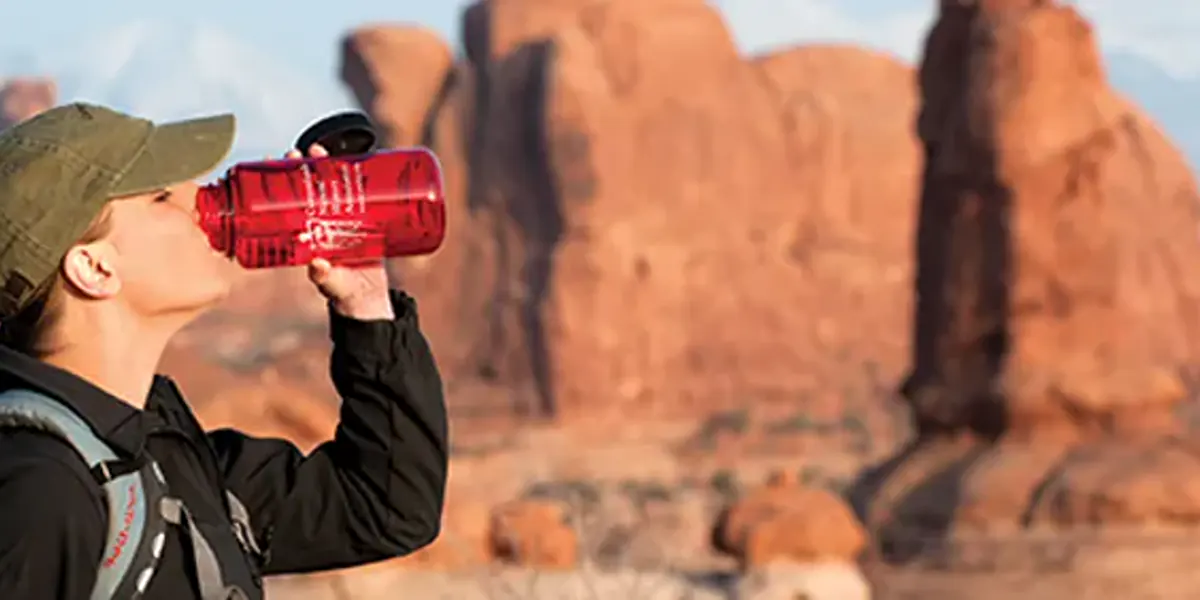
Summer temperatures regularly exceed 100 F, shade is scarce, and the dry air can hide how much sweat you are losing. The park advises avoiding strenuous activity from 10 am to 5 pm when heat is high.
That guidance changes the shape of the day. Put the longest or most exposed route near dawn, reserve midday for a visitor-center stop or a short viewpoint, and use evening only when the route can finish before navigation becomes harder.
- 100 F plusCommon summer daytime heatBare rock and low shade amplify exposure
- 2 to 3 litersFront-country water guidance per personMore may be needed for heat, distance, or slower groups
- 4 liters plusBackcountry water guidance per personNatural sources are scarce and unreliable
- 10 am to 5 pmPeriod to avoid strenuous summer activityMove effort to morning or evening

Drink to thirst and eat enough salty food to support sustained effort. Watch the whole group for dizziness, weakness, headache, nausea, cramps, confusion, or a sudden drop in coordination.
Heat exhaustion needs rest, cooling, food, and fluids before the group continues. Confusion or loss of normal behavior can indicate heatstroke, which is an emergency that requires rapid cooling and emergency help.
Turn around when half the group's usable water is gone. That boundary includes water reserved for the drive out if the car is hot and the next refill point is not operating.
A cooler route is a different route. Moving from one exposed slickrock trail to another does not remove the heat problem.
How hard is the Delicate Arch trail surface?
The Delicate Arch trail is 3.2 miles round trip, but the number understates the commitment. The route climbs exposed slickrock, follows cairns, and finishes along a rock ledge with a drop-off.
The broad bedrock also reflects heat and gives little shade. A start that feels reasonable near sunrise can become a long exposed return after visitors stop for photographs at the arch.
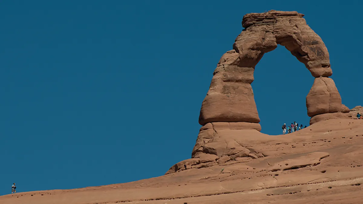
Winter changes the same rock through snow and ice. Traction can help on appropriate surfaces, but it does not make an exposed icy ledge a good fit for an inexperienced group.
Use the lower Delicate Arch viewpoint when the group wants recognition without the full slickrock climb. It changes the physical consequence while preserving the purpose of seeing the formation.
Crowding changes the return time too. Set the turnaround from the trailhead, not from the moment the group finally reaches the arch, because the walk back still holds the sun and descent.
Do you need a permit for Fiery Furnace?
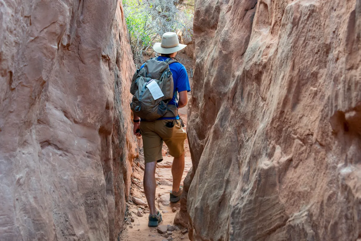
Most ordinary day hikes at Arches do not need a trail permit. Fiery Furnace is different because the dense sandstone fins create narrow passages, dead ends, difficult navigation, and fragile ground that cannot support unrestricted use.
You must join a ranger-guided hike or hold a self-guided exploration permit. A self-guided group must reserve online, attend the required orientation, and collect the permit during the specified pickup window.
- Fiery Furnace
- Ranger-led ticket or self-guided exploration permit
- Self-guided timing
- Reserve at least two days and no more than seven days before the trip
- Group limit
- Six people, with no children under five
- Backpacking
- Permit issued in person for designated overnight sites
- Canyoneering
- Separate permit required
GPS reception can fail between high rock walls, and boot tracks can lead into dead ends. Strong fitness does not replace observation, route memory, and the discipline to turn around while the return is still recognizable.
Backpacking uses another system. A permit authorizes an overnight itinerary, but it does not create reliable water, shade, or a maintained trail where none exists.
This distinction matters when comparing backpacking with day hiking. Adding a night changes the water load, navigation exposure, waste plan, and rescue timeline long before it changes the scenery.
What happens to Arches trails after rain?
Desert storms can arrive quickly, and rain changes more than comfort. Slickrock loses predictable friction, dry washes can flood, and deep sand or unpaved roads can become difficult to cross.
Lightning also turns an exposed viewpoint or fin into the wrong place to wait. Move toward a substantial building or hard-top vehicle before the storm is overhead instead of sheltering beneath an isolated rock overhang.
- Remove exposed slickrock when rain or lightning is approaching
- Do not enter a wash when storms can occur upstream
- Recheck unpaved-road status after heavy rain
- Carry the route offline and stay on official cairns
- Use wilderness first aid basics to decide whether an injury can move safely
A lower viewpoint may reduce climbing and navigation, but it does not remove lightning exposure. The best replacement changes the hazard that failed, which may mean leaving the open park landscape for the visitor center.
Winter brings another surface state. Snow can hide cairns and ice can remain on shaded bedrock after the road appears dry, so check the specific route rather than relying on the entrance forecast.
When is the best time to hike Arches?
Spring and fall offer the most comfortable average hiking temperatures, but they also draw the heaviest visitor pressure. Summer offers long daylight with severe midday heat, while winter trades quieter roads for cold, snow, and ice.
Choose the season by the route surface and time window you need. A short paved viewpoint has a broader workable season than a long primitive loop or an exposed slickrock climb.
| Season | Useful conditions | Main tradeoff | Better fit |
|---|---|---|---|
| Spring | Mild mornings and active programs | Holiday congestion and fast storms | Early maintained or slickrock hikes with a parking backup |
| Summer | Long daylight and night-sky access | Heat above 100 F and little shade | Dawn walks, short viewpoints, and low-output midday stops |
| Fall | Cooler hiking and broad access | Busy weekends and shorter daylight | Longer day hikes with an early start |
| Winter | Quiet roads and cool air | Snow, ice, cold wind, and fewer programs | Short defined routes after a surface check |
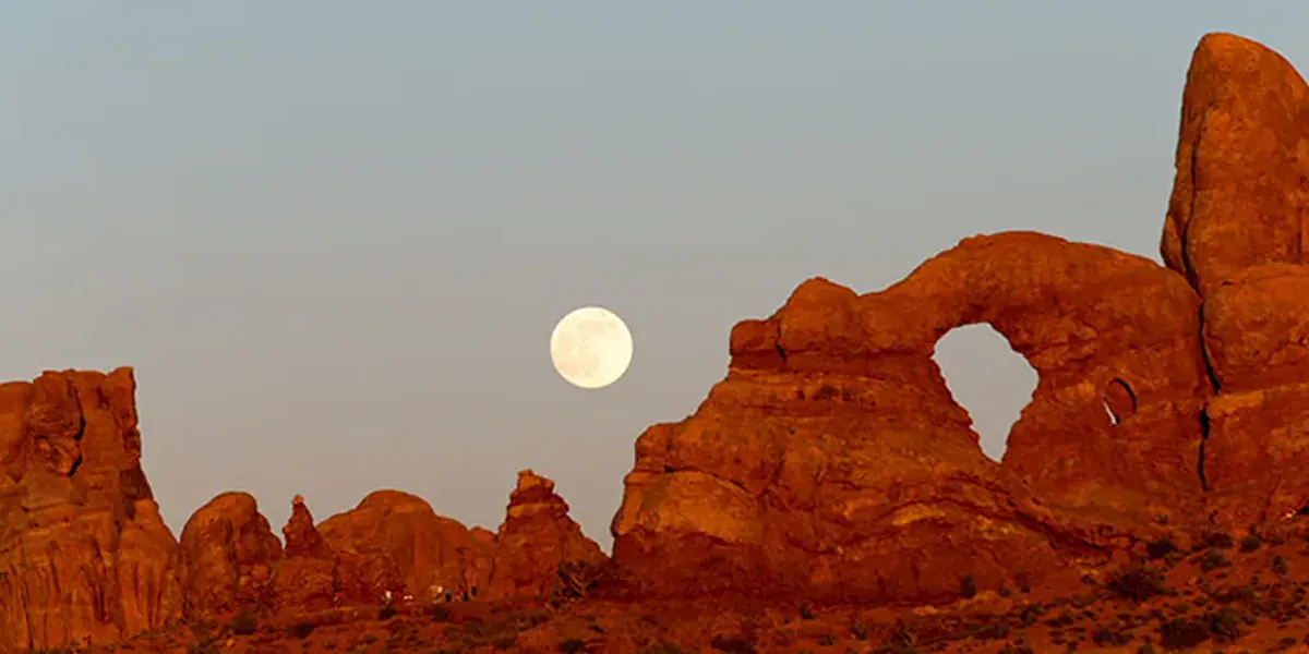
The park is normally open all year and all day. Facilities and ranger programs operate on narrower calendars, so verify what the chosen hike needs rather than asking only whether the gate is open.
For winter, winter hiking gear should support an already sensible route. Equipment cannot restore a hidden cairn or remove an exposed fall consequence.
Can you camp inside Arches National Park?
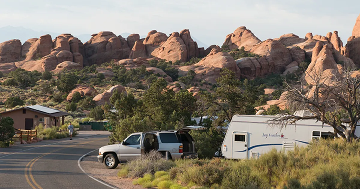
Devils Garden is the only developed campground inside Arches.
Reservations are available during the main season from March through October, and the campground is often full on summer nights.
There is no lodging in the park.
Visitors without a campground reservation need an overnight base outside the boundary and must include the morning entrance drive in the hiking window.
Devils Garden campsite
Best for an early start in the northern park and access to campground water, but it requires its own reservation.
Moab base
Best for lodging choice and services, but the entrance line and drive belong inside the hiking schedule.
Backpacking site
Best only for a permit-ready overnight itinerary with a complete water and navigation plan.
No campsite available
Use legal camping or lodging outside the park instead of sleeping in a pullout or parking area.
Camping near Devils Garden does not make Delicate Arch nearby, and it does not guarantee parking at another trailhead.
Keep the next morning in the same northern corridor when possible.
Store enough water before the visitor center or campground fill point closes or becomes inconvenient. The camp tap is infrastructure, not a reason to carry less on the trail.
A campsite also changes which route can honestly use the first cool hour. From Devils Garden, the northern trails receive that advantage, while a dawn start at Delicate Arch still requires a drive through the park.
Do not spend the temperature margin crossing the park for a famous objective when a suitable route begins near camp.
If you stay in Moab, place the entrance queue inside the schedule rather than treating arrival at the park boundary as the trail start. Fuel, breakfast, and drinking water should be settled before the vehicle joins the line.
The return to camp deserves the same attention as the approach.
A tired driver leaving an evening hike still has to cross dark park roads used by wildlife and other visitors.
Keep headlamps and one warm layer reachable in the vehicle even after a hot day. Desert temperatures fall quickly after sunset, and a delayed group should not have to unpack the entire car beside the road.
Morning flexibility comes from preparation, not proximity alone.
Before leaving camp, check the weakest part of the plan again. Parking, heat, water, and surface conditions can change overnight, and an early start is valuable only when it begins a route the group can still finish.
Leave the itinerary with someone outside the park. Include the trailhead, turnaround, group, vehicle, and time when that person should contact emergency services.
Sources
Park access, operating hours, and trip-planning details were checked against the National Park Service Arches planning hub, traffic guidance, and current hours and fees.
Heat, storm, and terrain claims use the park's official safety guidance. Fiery Furnace, canyoneering, and backpacking authorization details come from permits and reservations.
RespectHazards to plan for
- extreme heat
- dehydration
- lightning
- flash flooding
- falls on slickrock
- navigation errors