
How Do Flash Floods Catch Hikers Under a Clear Sky?
The rain that floods a canyon is usually falling somewhere you cannot see.
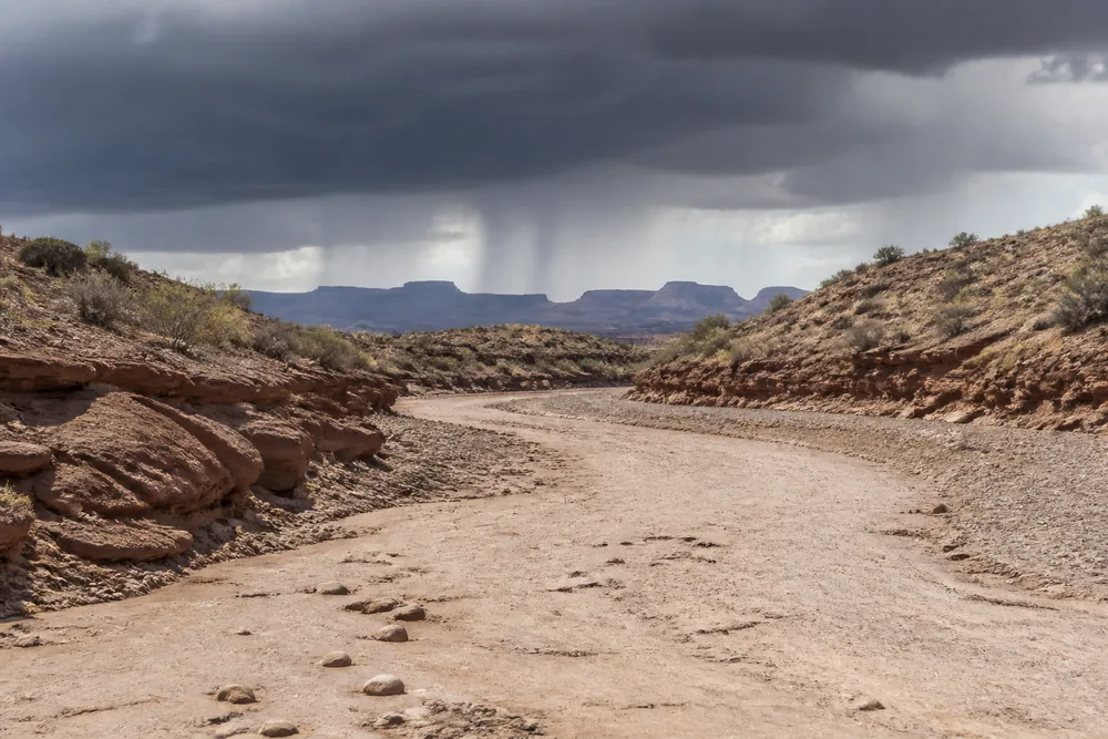
A flash flood is the one trail hazard whose cause is invisible from the place it reaches you. Your protection is bought hours earlier through terrain choice and forecast reading, and spent in the seconds afterwards on vertical distance.
The sky above Lower Antelope Canyon was clear on 12 August 1997, and eleven people walked into it and did not walk out.
The storm that killed them was falling miles upstream. Nobody standing in that canyon could see the ground it was landing on.
That gap between where the rain falls and where the water arrives is the whole problem. Every other hazard on a trail gives you something to notice first.
Here is the scale you are working against.
Those four numbers set up everything below. Your protection is bought hours before the water appears and spent in the seconds after it does.
What makes a dry wash flood under a clear sky?
Because the rain is not falling on you. It is landing on a catchment that can cover many square miles, and all of that ground drains toward the one channel you happen to be standing in.
A watershed works as a funnel. Rain spread thinly over a wide area of high ground gathers into fewer and fewer channels as it descends.
How much of it becomes runoff depends on what it lands on.
Desert soil, bare slickrock and hard-baked ground absorb very little. The same rainfall that would soak into a forest floor runs straight off these surfaces and reaches the channel almost whole.
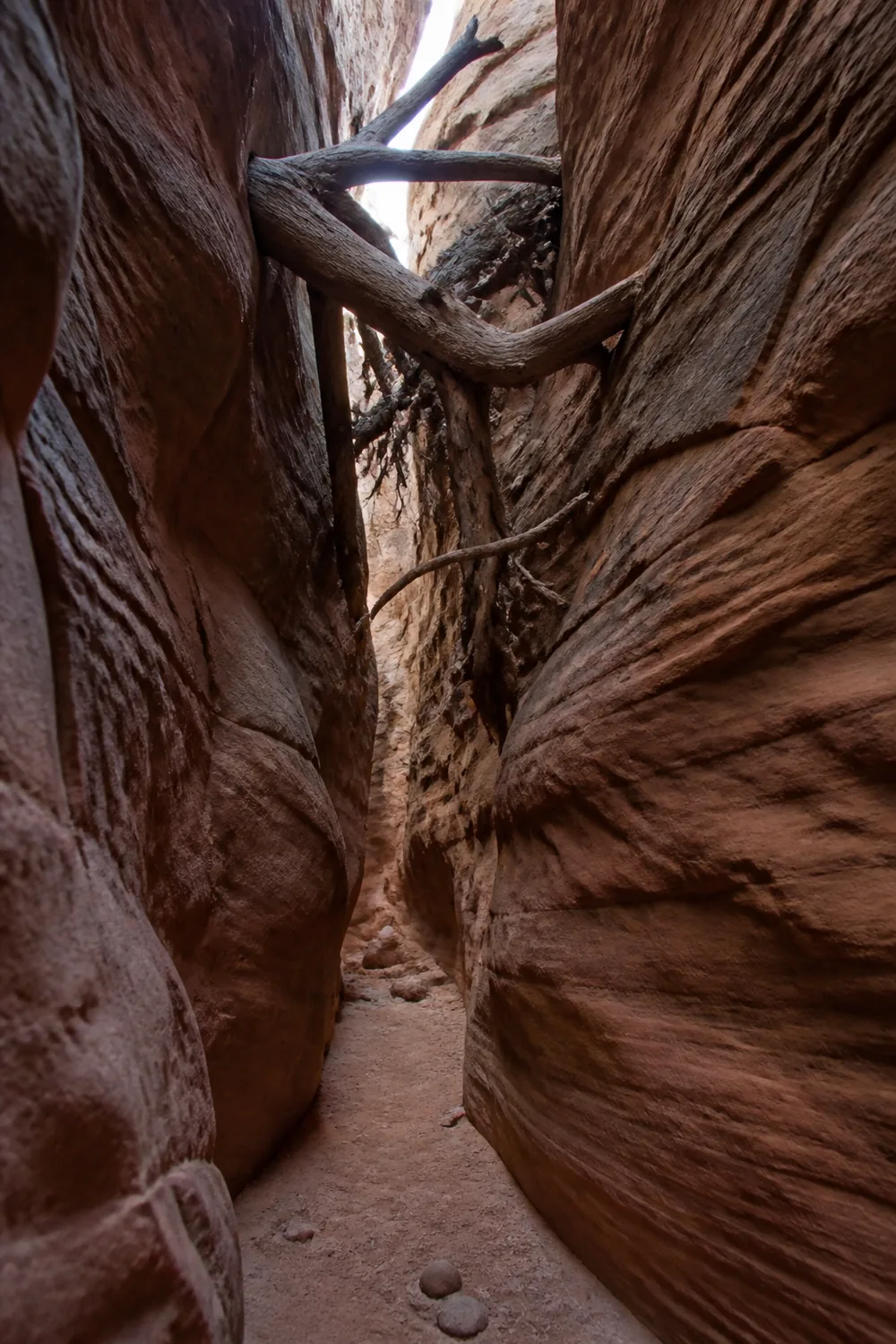
Then the channel does its own work. A slot canyon cannot spread sideways, so water that would lie a few inches deep across open ground has nowhere left to go but up.
That is how the 1997 flood reached roughly eleven feet in a passage no wider than a hallway in places.
Nobody inside had any view of the weather that produced it. A twisting slot shows you a ribbon of sky and nothing of the plateau feeding it.
The sky above you is not the sky that decides.
The depths that matter are also far smaller than people guess. Six inches of moving water knocks an adult off their feet, and twelve inches carries most cars.
Two feet takes SUVs and trucks away. From the bank, none of those depths look like enough.
Which ground turns ordinary rain into a flood?
Two conditions have to line up. Ground that sheds water rather than holding it, and a channel that concentrates what it sheds.
Where both are present, the rainfall needed to produce a dangerous flow drops sharply.
| Terrain | What it does to the water | What it takes |
|---|---|---|
| Slot canyon or narrows | Cannot widen, so volume becomes height | A storm anywhere in the catchment, seen or unseen |
| Dry wash or arroyo | Reads as a path, works as a drain | Rain on high ground you may never see |
| Burn scar drainage | Repels water like pavement | Half an inch of rain in under an hour |
| Slickrock basin | Near-total runoff from bare rock | One short intense cell over a small catchment |
| Wash crossing on the access road | Hides its depth and its current | Twelve inches to float the vehicle |
The burn scar row deserves separate attention, because its numbers are genuinely different from the rest.
Severe fire leaves soil that repels water instead of absorbing it. Rain sheets off it the way it sheets off a parking lot, and half an inch in under an hour is enough to flood the drainage below.
Anywhere else, that rainfall total would pass without comment.
Risk peaks in the first two years after a fire and stays raised for roughly five. A trail that reopens the season after a burn is not the trail it was before.
What comes down those drainages is often not clean water. USGS has documented debris flows moving at up to 20 mph and running more than a mile and a half past the mountain front, carrying rock and burned timber with them.
The last row is the one hikers skip. You cross washes on the drive to the trailhead, usually while paying less attention than at any other point in the day.
Check the whole watershed, not the sky at the trailhead
Look at the radar and the forecast for the ground above your route rather than for the spot you are standing on. A dry forecast at the trailhead says nothing about a cell parked over the plateau that drains into it.
In canyon country the more useful product is local. Parks post a daily flash flood potential rating, and it moves through four states.
- Possible
- Start early and be out before the afternoon storms build
- Probable
- Canyons are expected to flood, and nothing has been closed
- Expected
- The state at which closures generally arrive
- Flash flood watch
- Three to twelve hours of notice, wide enough to change the plan calmly
- Flash flood warning
- Generally thirty minutes or less on thunderstorm events
- Flash flood emergency
- Catastrophic flooding already underway, describing rather than warning
Read that list for the gap in the middle. Probable means canyons are expected to flood while the trail is still open, because closures generally wait for the top state or a formal warning.
An open trail is a management decision rather than a verdict on your day.
The timing compounds it. Closures are often posted late in the morning as storms build, by which point the people most exposed are already an hour into the canyon.
They will never hear about it. A warning reaches nothing underground, and no alert lands on a phone with no signal wedged under two hundred feet of sandstone.
That is why the watch matters more than the warning. Three to twelve hours is enough time to move a plan onto a ridge, and thirty minutes is only enough time to climb.
One more number belongs in this decision, and it is one only you can supply.
Work out how long it would take to get from your turnaround point back to ground that is not a channel. A route with a four-hour exit needs a far quieter forecast than a route you can leave in twenty minutes, and the published rating cannot know which one you are on.
In monsoon country that usually resolves to starting at first light. Storms build through the afternoon, so a party that is out by midday has removed itself from the part of the day the rating is really describing.
How much warning do you actually get?
Less than the standard advice implies, though the signs are still worth carrying.
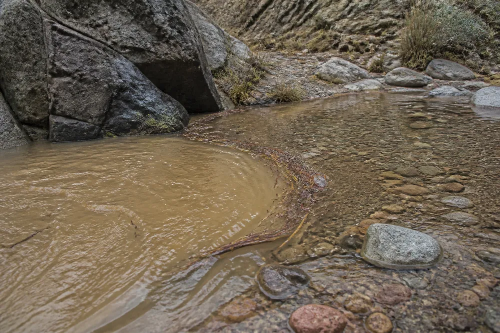
Water turning from clear to brown means sediment is already moving, which means flow has already increased somewhere above you. A sudden rise in floating sticks and pine needles carries the same message.
A rise in the water itself, however slight, is reason to leave the channel rather than to watch it.
The one people describe afterwards is the sound. A roar from upstream should be treated as the flood arriving rather than as weather in the distance.
Here is the part that gets left out.
In a narrow canyon the sound bounces off the walls and arrives with the water rather than ahead of it. Around a bend you may get no visual warning at all, and after dark you lose every sign except the noise.
Which puts the weight back where the previous section left it. Alertness is a weak defence against a hazard that gives you seconds, and terrain choice is a strong one.
Go up, not downstream
The channel is where the water is going, so distance along it buys you nothing. Only height does.
That inverts the instinct almost everyone has, which is to run for the way they came in.
- Move up the nearest bankTake the closest gain in height rather than the best one you can see
- Take the height availableA few feet of ledge beats a good position you did not reach in time
- Leave the pack if it slows youGoing back for gear is a recognised cause of death here
- Do not cross the channelCrossing puts you in the water at the moment it arrives
- Stay up until the flow drops and stays downSurges commonly come in pulses, and the second catches people who came down after the first
- Wait out the level rather than wadingSix inches of moving water is enough to take you off your feet
The two costly instincts are both about recovering something. Gear left in the channel and a companion on the far bank are the reasons people go back down, and neither is worth the exchange.
You cannot outrun it along the floor. Nothing about fitness changes that, because the water is taking the same route and moving faster than you are.
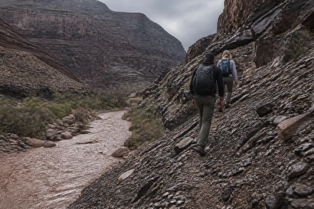
What arrives is rarely just water, either. A loaded flow carries logs, boulders and torn vegetation, which is why a position that would keep you clear of the water line is not automatically clear of what the water is pushing.
The aftermath asks for more patience than people expect. A small drainage can drop within the hour, and the crossing it leaves behind can stay impassable for a good deal longer.
If you drove in across a wash, the same arithmetic decides getting out. Twelve inches carries most cars, and moving water reads far shallower from a driver's seat than it is.
The best-looking campsite is often the channel
Flat, soft, sheltered from the wind, clear of undergrowth. That description fits an excellent pitch and it also fits an active drainage, which is exactly why the rule against camping in washes keeps getting broken.
The ground is flat and clear because water has been scouring it.
So read the site instead of trusting how it looks. The evidence is physical and it takes under a minute to check.
- Debris caught in branches above head height
- A scoured bank with roots exposed
- Fresh sand or gravel lying over older ground
- Flat ground carrying no established vegetation
- A pitch above the highest debris line, not above the water you can see
- A route up the bank you could climb in the dark
The debris line does the most work of any item on that list. It records the height water has already reached here, which is a better guide than the depth of the channel or the height of the bank.
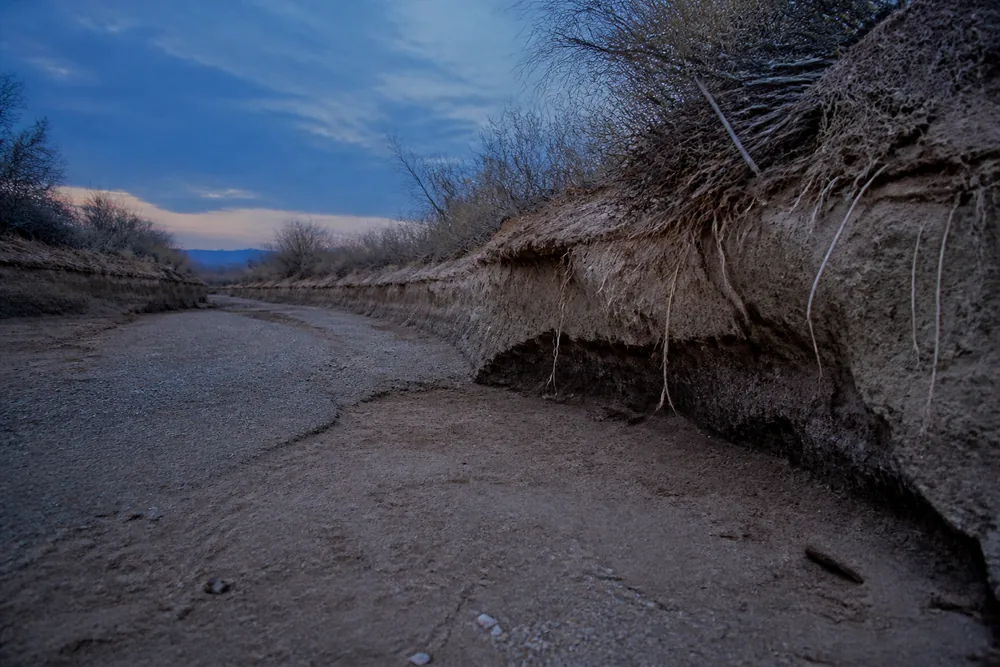
Measure your pitch against the debris, not the trickle. Pitching above the water you can see is the ordinary error, and on a dry night the water you can see may be nothing at all.
The last item is the one people leave out. A site is only checked once you know you could get up the bank without light and without deciding anything.
Which is the argument for arriving before dark. Every visual check on that list disappears at dusk, and the hours you spend asleep are the hours you have no signs at all.
Sources
Depths of moving water, the twelve-inch and two-foot vehicle thresholds, and the standing advice never to walk or drive into floodwater come from the National Weather Service: Turn Around Don't Drown and Flood Safety.
The watch, warning and emergency definitions, and the lead times attached to each, are set out in the NWS flood-related products guidance.
Burn scar rainfall thresholds, the water-repellent behaviour of severely burned soil, and the multi-year duration of raised risk come from NWS flash flooding and debris flows in burn areas and Flood After Fire.
The daily flash flood potential ratings, their four states, and the practice of closing slot canyons only at the top state or on a warning are described by Zion National Park and in reporting on its monsoon-season closures.
The Lower Antelope Canyon flood of 12 August 1997, the eleven deaths, and the surge height are documented in contemporary reporting and in the climb-utah account of the event.
AnswersQuestions readers ask
Can a flash flood happen when the sky above me is clear?
Yes, and that is the usual case. The rain falls on a catchment that can cover many square miles of high ground, then drains into the channel you are standing in, so the weather that produces the flood is often out of sight from the place it arrives.
How much rain does it take to flood a burn scar?
About half an inch in under an hour. Severely burned soil repels water rather than absorbing it, so rain sheets off it, and the risk peaks in the first two years after a fire and stays raised for roughly five.
How much warning does a flash flood warning give you?
For thunderstorm-type events, generally thirty minutes or less. A watch runs three to twelve hours ahead, which is why the watch is the product worth planning around and the warning is not.
Does an open trail mean the canyon is safe that day?
No. Closures generally wait until flooding is expected or a warning is issued, so a canyon rated probable can be open while flooding is anticipated, and closures are often posted late morning after people have already gone in.
Which way should you run in a flash flood?
Up, not along the channel. Distance downstream buys nothing because the water is taking the same route and moving faster, so take the nearest gain in height rather than the best position further away.
How deep does moving water have to be to knock you over?
Six inches is enough to take an adult off their feet. Twelve inches carries most cars and two feet carries SUVs and trucks, which is why a shallow-looking crossing is a poor bet on foot or in a vehicle.