
Glacier National Park Hiking by Access Corridor
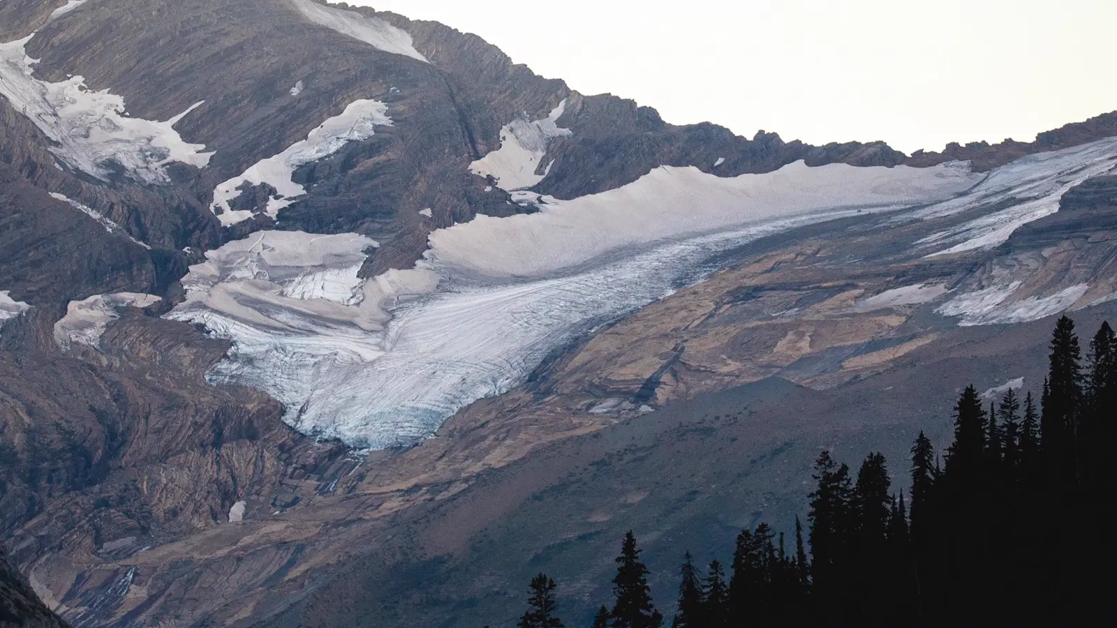
Plan Glacier one valley at a time, with 2026 Logan Pass access, snow, bear practice, weather, and wilderness permits checked separately.
Weather
Mountain weather shifts quickly across the Continental Divide. Alpine snow, wind, cloud, and storms can persist after valley trails and roads open.
Plan the practical details
- Access
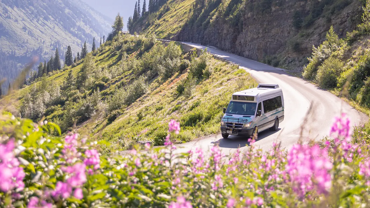
- Glacier uses separated valleys and entrances. No vehicle reservations are required in 2026, while Logan Pass has ticketed shuttle service and time-limited parking.
- Permits
- Most day hikes need no permit. Every wilderness overnight requires a permit tied to dates, campsites, route, and party.
Glacier works as several mountain valleys connected by long roads, not one trail district around Going-to-the-Sun Road. You should choose a corridor first, then verify its road, trail, shuttle, bear, and weather conditions as separate checks.
That distinction is especially important in 2026. Vehicle reservations are not required anywhere in the park, while Logan Pass uses a new ticket-only shuttle and a three-hour parking limit during the core summer season.
One valley makes one workable day. A trail across the map may sit behind another entrance, another weather pattern, and hours of driving.
Lake McDonald
West-side forest and lake access with Apgar services and the western Going-to-the-Sun Road approach.
Logan Pass
Alpine terrain with snow, wind, exposed trails, a 2026 parking limit, and ticketed shuttle access.
St. Mary
East-side access to the divide, St. Mary Lake, and the eastern Going-to-the-Sun Road corridor.
Many Glacier
A separate northeastern valley with major trailheads, lodging, and its own congestion pattern.
Two Medicine
A southeastern hiking and camping area reached outside the main Sun Road corridor.
North Fork
Remote northwest access on rougher roads with limited services and a slower driving plan.
The park has more than 700 miles of trails, but that abundance does not make every trail a practical substitute. The best backup stays in the same corridor and fails for a different reason than the original route.
Which part of Glacier National Park is best for hiking?
Glacier's area maps divide hiking among Lake McDonald, Many Glacier, North Fork and Goat Haunt, St. Mary and Logan Pass, and Two Medicine. You can use those divisions as day boundaries rather than as categories in one long checklist.
A Many Glacier trail cannot rescue a late Logan Pass morning if the replacement requires a long drive around the park. The same applies to Two Medicine when the group is already parked west of the Continental Divide.
| Corridor | Useful first choice | Access question that can block it |
|---|---|---|
| Lake McDonald | Forest, lake, and lower-elevation day hikes | West entrance traffic and trailhead parking |
| Logan Pass | Alpine meadows, Highline access, and divide views | Snow, three-hour parking, or shuttle ticket |
| St. Mary | East-side lake and mountain routes | Wind, seasonal services, and road status |
| Many Glacier | Dense cluster of lake and pass trails | Separate entrance drive and temporary congestion controls |
| Two Medicine | Quieter lake, waterfall, and pass options | 2026 construction and seasonal facility status |
| North Fork | Remote lake and forest travel | Rough roads, limited services, and longer emergency access |
Download the selected area map because cell coverage is limited outside Apgar and St. Mary. Your offline map must include the junctions and neighboring trails needed when the plan changes, not only a screenshot of one route description.
You need one main route and one lower-commitment route in the same valley. If snow removes an alpine pass, your backup should stay lower rather than switch to another high trail with the same snow problem.
Do you need a reservation for Logan Pass in 2026?
Glacier does not require vehicle reservations in 2026. That change removes one gate but does not solve congestion at Logan Pass, where private vehicles face a three-hour parking limit from July 1 through September 7.
Three hours fits a viewpoint visit or a short walk. It does not fit long Highline Trail itineraries, which need the new ticket-only shuttle or another legal transport plan.
A legal Logan Pass day
- Before travelDecide whether the visit fits three-hour parking or needs a shuttleThe transport mode matches the actual hiking time
- Ticket releaseReserve the correct date, boarding place, and departure timeA shuttle plan begins outside the park, where internet is reliable
- BoardingArrive at least 30 minutes early with the ticket available offlineCheck-in does not consume the departure window
- ReturnLeave margin before the final shuttle rather than targeting itWeather, wildlife, and traffic can delay vehicles
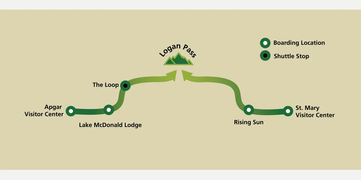
Shuttle tickets are assigned to a boarding location and time, and they are not sold inside the park. Limited connectivity makes a last-minute online purchase a poor primary plan.
The Loop can support a one-way Highline day only when the current shuttle operation serves the intended return. Do not assume an old stop pattern applies because the system changed in 2026.
No vehicle reservation does not mean unlimited vehicle access. Temporary diversions can still occur when a valley or parking area becomes too congested.
When does Going-to-the-Sun Road open for hiking?
Going-to-the-Sun Road crosses steep mountain terrain, and its full opening depends on snow removal, rockfall work, weather, and safe road conditions. The date cannot be predicted reliably months in advance.
Even after the road opens, alpine trails can hold steep snow. A dry parking lot at Logan Pass says little about the footing on a shaded traverse or the runout below it.
An ice axe is not a permission slip to cross snow. It only helps a trained person on terrain where a slip can be arrested, and many visitors should choose a lower trail until the traverse melts.
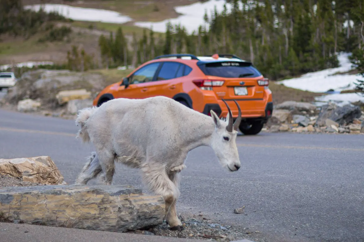
Wildlife closures are another independent layer. A trail can close because bears are feeding nearby even when the road, weather, and surface all appear suitable.
Keep one lower valley walk available. It preserves the day when an alpine route fails for snow, wind, or lightning without sending the group to another pass with the same exposure.
How should you hike in bear country at Glacier?
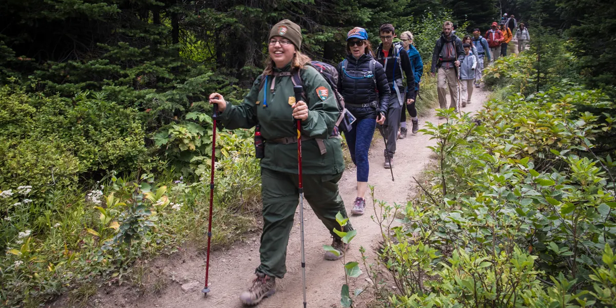
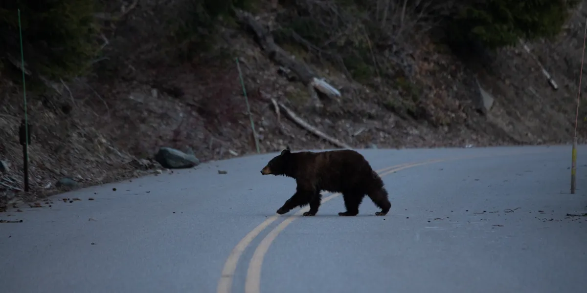
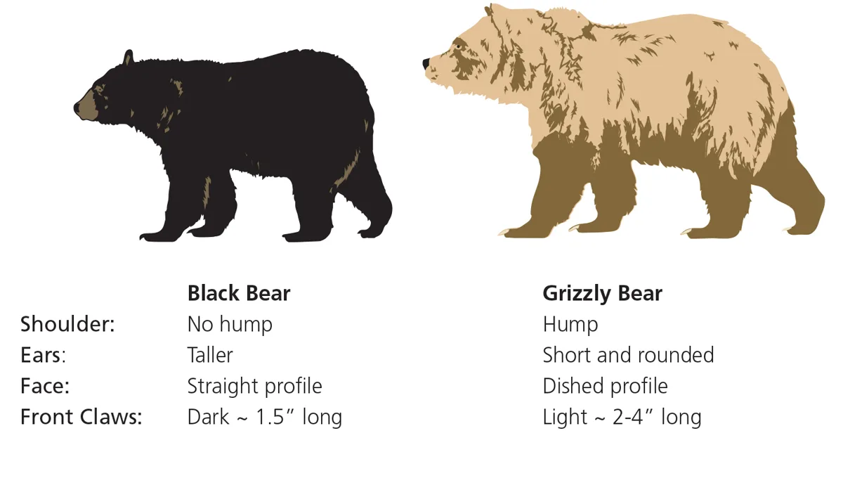
Both black bears and grizzly bears live throughout Glacier. Bear practice belongs on every trail, including busy routes near developed areas, because vegetation, bends, wind, and water can hide an animal until the group is close.
Make noise with the human voice, especially near streams, berry patches, thick brush, and blind corners. Hike in a close group, keep children near adults, and leave headphones packed.
- Carry bear spray where either hand can reach it immediately
- Know how to remove the safety clip before starting the hike
- Stay at least 100 yards from bears and wolves
- Back away when an animal uses the trail
- Secure food, trash, toiletries, and cooking items whenever they are unattended
- Review bear encounter responses before entering the park
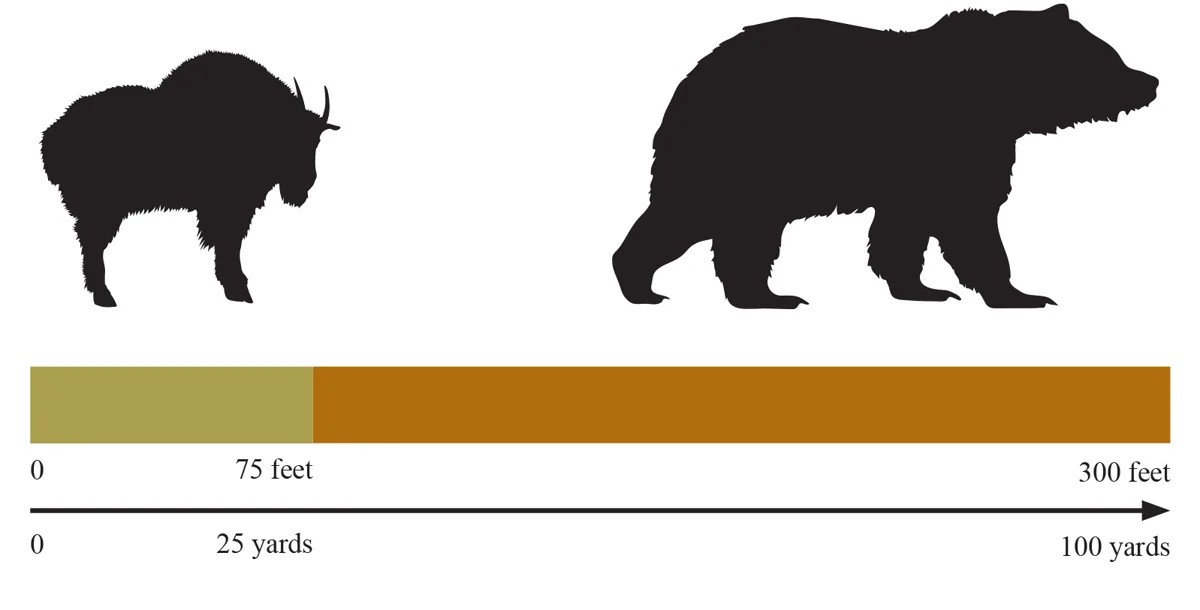
Bear spray belongs on a belt or chest strap, not beneath food inside the pack. Practice drawing an inert canister at home so the movement is familiar without discharging spray.
If a bear is on the trail, give it the route and time to leave. Trying to pass for the sake of an itinerary turns a distant observation into a close encounter.
Why does Glacier weather change across the Continental Divide?
Glacier's east and west sides can experience different wind, temperature, and precipitation at the same time. Logan Pass adds altitude, exposure, and cloud movement that a valley forecast may not capture.
Snow can fall in any month at high elevation. Summer hikers still need a warm layer and rain shell when the route climbs above trees or travels far from a rapid exit.
- West sideGenerally wetter and more forestedTrails may stay damp while the east side is windy and dry
- Continental DivideFast change in wind and cloudA valley forecast may not describe the pass
- Alpine terrainLess shelter and longer exposureTurn around before thunder or dense cloud reaches the route
- Any monthPossible mountain snowCarry layers even during a warm valley morning
Rain makes roots, boardwalk, and rock slippery, while cloud can erase landmarks on open slopes. Hiking in rain requires both clothing and a route whose footing remains manageable.
Wind can make wildlife detection harder because bears may not hear the group. Increase voice noise near brush and water instead of relying on a bell.
When is the best time to hike Glacier National Park?
July and August usually provide the broadest alpine road and trail access. They also bring the greatest congestion, while snow, storms, smoke, or wildlife activity can still remove a specific route.
June often favors lower trails because high routes retain snow. September can offer cool hiking and lighter traffic, but daylight shortens and services begin closing on different dates.
| Season | Useful terrain | Main tradeoff | Better plan |
|---|---|---|---|
| Spring | Valley lakes, lower forest, and road walking where allowed | Snow, wet trails, and limited facilities | Keep the day low and verify road restrictions |
| Early summer | Expanding valley and mid-elevation access | High snow and cold creek crossings | Treat every alpine route as conditional |
| Mid-summer | Broadest road, shuttle, and trail access | Congestion, storms, smoke, and full parking | Choose one corridor and reserve transport early |
| Early fall | Cooler days and fewer visitors | Shorter daylight and closing services | Start early with a conservative return time |
| Winter | Ski and snowshoe travel in selected areas | Closed roads, avalanche terrain, and severe cold | Use routes and gear matched to winter conditions |
The best month is therefore the one that opens the needed elevation band while leaving room for a lower replacement. A trip built around one exact alpine route remains fragile even during peak season.
Check smoke and fire information as current conditions, not as a seasonal promise. A clear week in one year does not predict the next.
Creek crossings also change through the season and after rain. A route that was ankle deep in a report can be unsafe after snowmelt or a storm, so use current ranger information and turn around when depth, speed, or footing exceeds the group.
Cold water can remove balance before the far bank. Never enter simply because another party crossed, since depth and footing can differ a few steps away.
Remote corridors increase the value of calm assessment after an injury. Review wilderness first aid basics so the group can protect the scene, identify immediate threats, and decide whether the person can move without making the injury worse.
Leave a trip plan with a reliable contact who knows the exact valley and trailhead. A message that says only Glacier National Park gives rescuers too large an area when the group misses its check-in.
Do you need a wilderness permit to backpack in Glacier?
Most day hiking needs no trail permit, though closures and transport rules still apply. Every overnight stay in Glacier's wilderness requires a permit valid for the dates, campsites, route, and party.
Advance reservations cover only part of the wilderness inventory. Roughly 30 percent of sites are set aside for walk-up permits, but that does not mean the desired itinerary will remain available.
- Day hike
- No general wilderness permit
- Overnight wilderness stay
- Permit required for every night and campsite
- Advance space
- Portion released through Recreation.gov
- Walk-up space
- Roughly 30 percent of sites held back, subject to availability
- Food storage
- Bear-resistant storage and campground rules apply
- 2026 Two Medicine
- Construction can limit trail and permit-office access
An overnight itinerary must be contiguous and realistic. A permit is not a collection of desirable campsites connected by drives, and the route between them still has to fit snow, water, and daily elevation gain.
Compare the added decisions in backpacking versus hiking before turning a day route into an overnight. Sleeping out adds food storage, campsite, permit, weather, and evacuation obligations.
How should you store food at a Glacier campground?
A developed campground does not remove bears. Food, cookware, coolers, trash, toiletries, and other scented items must be secured whenever they are not under direct control.
Keep a clean site and never move food into the tent. In wilderness camps, follow the designated food-preparation and storage layout rather than improvising beside the sleeping area.
Developed campground
Reserve or claim the site through its current system, then use vehicle or locker storage for every scented item.
Wilderness campground
Hold a valid itinerary permit and use the designated cooking and food-storage area.
Walk-up itinerary
Carry more than one campsite sequence because availability can force a different route.
Closed or full campground
Use a legal alternative outside that area rather than creating an unauthorized site.
Campground status changes through the season. Confirm water, fire restrictions, food lockers, and opening dates for the exact campground rather than relying on a park-wide label.
A bear-safe camp also improves the next morning. Packs remain organized, food remains accounted for, and the group can leave without searching for an unsecured item in the dark.
Keep a headlamp, warm layer, spray, and map reachable during the night. An animal outside the tent is a reason to stay calm and follow park guidance, not to investigate with food or a camera in hand.
Before departure, inspect the entire site for microtrash and scented items. One forgotten wrapper can teach an animal to search the next visitor's camp.
Your morning route should begin in the same valley as camp whenever possible. Driving to another entrance before dawn trades sleep and trail time for a road transfer that may still end at a full lot.
Pack the first meal so no scented item remains loose while the group organizes outside.
If rain arrives overnight, check whether the planned trail crosses steep muddy ground or swollen water before leaving the campsite. A lower forest walk may remain sensible even when a high pass and exposed divide route do not.
Everyone in the group should know where the bear spray, vehicle keys, map, and emergency contact card are stored. That shared knowledge matters if the person who planned the trip becomes injured or separated.
When you leave for the day, secure the camp as though a bear may arrive five minutes later.
The final check is the return plan. You should know whether the campground gate, shuttle, food-storage area, and water service will still be usable when the hike ends.
Sources
Trail planning and corridor conditions were checked against the National Park Service Glacier hiking guidance, 2026 Logan Pass plan, and 2026 shuttle information.
Wildlife decisions use the park's bear safety guidance. Overnight authorization details come from the official wilderness permit process.
RespectHazards to plan for
- bear encounters
- snow travel
- hypothermia
- lightning
- falls
- navigation errors
- wildfire smoke