
Abrams Falls Trail: 2026 Closures and Water Safety
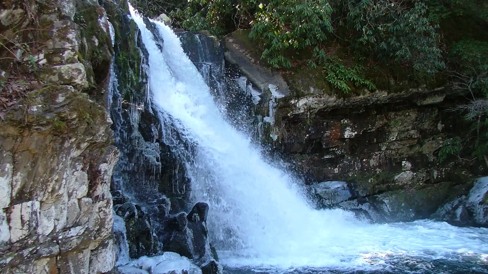
Abrams Falls is a five-mile Cades Cove hike to a 25-foot high-volume waterfall. In 2026, plan around weekday rehabilitation closures, one-way road access, rolling terrain, and the dangerous pool below the falls.
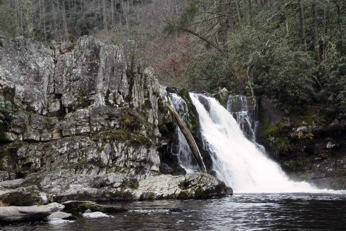
Abrams Falls Trail is a five-mile round trip to a 25-foot waterfall in Cades Cove. The route is popular and moderate, but the pool below the falls has powerful currents and is not a swimming hole.
As of August 30, 2026, the trail is also operating on a temporary weekly closure schedule while crews replace footlogs, handrails, and stone steps.
Which days is Abrams Falls Trail open in 2026?
Through September 30, 2026, Abrams Falls Trail is closed Monday through Thursday and open Friday through Sunday. It is also scheduled to open on Labor Day, Monday, September 7.
- Choose Friday, Saturday, or Sunday through September 30
- Treat September 7 as the announced Labor Day exception
- Check the official Great Smoky Mountains closure page on the day of the hike
- Allow time for the one-way Cades Cove Loop Road before and after the trail
- Display a valid Smokies parking tag when leaving the vehicle
The work schedule can change for safety, weather, or construction progress. The current park closure page provides the final answer, not a screenshot or saved itinerary.
How hard is the five-mile hike?
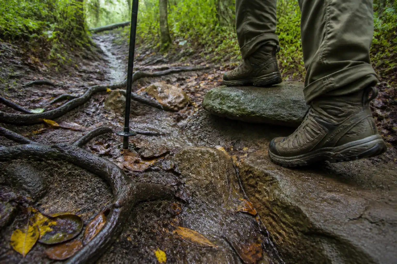
The trail rolls through forest above Abrams Creek rather than staying level beside the water. Roots, rocks, short climbs, and wet surfaces make the return more tiring than a simple distance figure suggests.
- Distance
- 5 miles round trip
- Destination
- 25-foot Abrams Falls
- Route
- Out and back from Cades Cove
- Typical terrain
- Forest tread, roots, rocks, short grades, footlogs
- Main water hazard
- Strong current and undertow below the falls
- Pets
- Not allowed on the trail
Most hikers should budget several hours and keep enough energy for the rolling return. The last half is not a downhill coast from the waterfall.
After rain, mud and slick roots can slow the route. Footlogs and narrow crossings deserve one person at a time without passing or bouncing the structure.
How does Cades Cove access change the day?
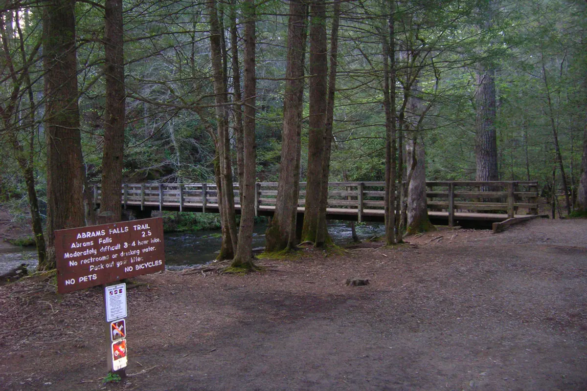
The trailhead lies near the back half of the 11-mile, one-way Cades Cove Loop Road between numbered tour stops 10 and 11. Reaching the parking area therefore takes longer than a map pin suggests, especially when wildlife viewing stops traffic.
On vehicle-free Wednesdays from early May through late September, motor vehicles do not enter the loop. That program creates a different access day rather than a quiet drive to the normal trailhead.
A realistic Cades Cove sequence
- Before entryCheck road, trail, and weather alertsA closure discovered at the trailhead wastes most of the loop drive
- Loop RoadFollow the one-way road to stops 10 and 11Congestion can change the start time
- ParkingDisplay the required parking tagAn entrance fee is not charged, but parking tags are required
- HikeProtect time for the full five-mile returnThe falls are the midpoint
- ExitContinue around the one-way loopYou cannot simply reverse the road to leave
Start with enough daylight for both the hike and the remaining loop-road travel. A crowded afternoon at the waterfall can make an already late return slower.
Why is swimming below Abrams Falls unsafe?
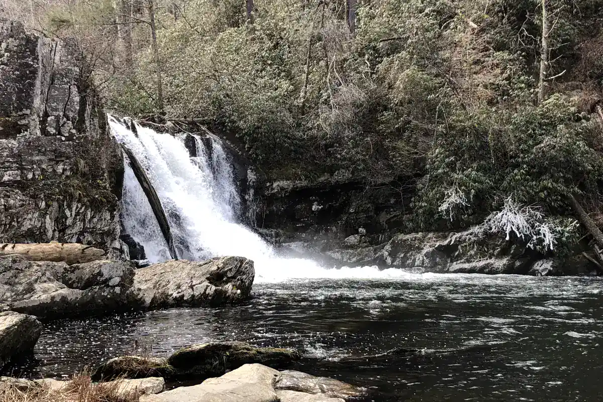
The waterfall is only 25 feet high, but a large volume of water pours into the pool. The current and undertow have contributed to drownings.
Do not wade onto wet ledges, enter the pool, or climb beside the cascade. Rocks that look dry from the viewing area may receive spray and algae that sharply reduce grip.
Height does not predict hydraulic force. A short, high-volume waterfall can be more dangerous than a taller cascade with a shallow runout.
What are crews repairing on the trail?
The 2026 rehabilitation project replaces damaged footlogs and handrails and repairs stone steps. These structures control safe movement across drainage and eroded terrain, so the weekday closure keeps hikers out of active work zones.
On open days, stay on the signed route and respect any localized barriers. Fresh work may narrow a passage or change where you wait for another group.
Footlogs
Cross one at a time and keep your balance centered over the structure.
Handrails
Use them for stability without leaning or shaking the rail.
Stone steps
Shorten your stride when edges are wet or uneven.
Work zones
Never enter a closed segment or move construction barriers.
The project is a useful reminder that trail structures reduce specific problems without making the entire surface uniform. Roots, loose stones, and creek moisture remain between repaired features.
When is the best time to hike Abrams Falls?
Spring brings stronger water flow and mild air, but wet surfaces and storms can increase creek hazards. Summer brings heat, humidity, crowds, and the 2026 weekday work closure.
Fall often offers cooler hiking weather and heavy Cades Cove traffic. Winter can be quieter, while short daylight, icy patches, and seasonal road conditions demand more conservative timing.
| Period | Useful feature | Main planning limit |
|---|---|---|
| Spring | Strong flow and mild temperatures | Rain, slick tread, and rising water |
| Summer | Long daylight | Heat, crowds, and 2026 weekday closures |
| Fall | Cooler hiking temperatures | Heavy loop-road traffic and shorter days |
| Winter | Fewer visitors | Ice, short daylight, and road conditions |
An early start reduces heat and crowd pressure, but it does not justify entering on a closure day. Check weather and park alerts even when the forecast for nearby Gatlinburg looks calm.
What should you carry for this trail?
Wear footwear that remains secure on roots and damp rock. Carry water, food, a simple first-aid kit, rain protection, and a light source even when the planned return is before sunset.
Save the park map and closure information offline because mobile service varies in Cades Cove. Keep food under control around wildlife and never approach bears for a photograph.
The practical plan is simple. Arrive on an open day, protect time for the one-way road, treat the falls as a viewing destination, and save enough attention for the rolling return.
Sources
Route and water safety. National Park Service hike to Abrams Falls supports the five-mile distance, 25-foot falls, trailhead location, dangerous undertow, and current 2026 weekly schedule, verified August 30, 2026.
2026 closure. Current road and facility closures supports the Monday through Thursday closure through September 30, bridge and step work, and the Labor Day exception, verified August 30, 2026.
Access. National Park Service Cades Cove information and parking tags support the one-way loop, vehicle-free Wednesday program, and parking requirement, verified August 30, 2026.
RespectHazards to plan for
- strong current and undertow
- wet rock
- roots and mud
- storms
- traffic and access delay