
How Do Hikers and Snowshoers Stay Out of Avalanche Terrain?
Written for walkers and snowshoers rather than adapted from ski touring advice.
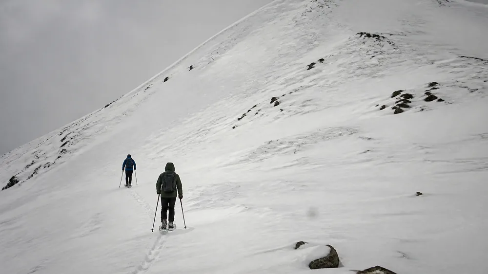
Avalanche material is nearly all written for skiers, so winter hikers quietly assume it does not apply to them. A slope releases on its angle and its snow, and a summer trail crosses that terrain more often than most walkers realise.
Almost everything written about avalanches is written for skiers. The gear lists assume skis, the terrain language assumes a descent, and a winter hiker reading it can reasonably decide that none of it is aimed at them.
That decision is the dangerous one.
A slope releases because of its angle and the snow sitting on it, and it has no way of knowing what is strapped to your feet.
Pros
- You can stop, turn around, and change the plan cheaply, which a committed descent does not allow
- Marked winter walking routes tend to stay on lower-angle ground by default
- Walking in single file is natural, so spacing out a crossing costs a party nothing
Cons
- You move slowly, so any exposed crossing keeps you in the wrong place far longer than a skier
- Summer trails were routed for summer, and they cross gullies that become avalanche paths under snow
- Postholing and snowshoes make retreat from a slope that starts talking slow and clumsy
- Most walking parties carry no rescue equipment and have never practised using any
The balance there is not comforting. A walker has better options before the trip and worse ones during it.
That is why this page spends most of its length on avoidance. Assessment is a course, not an article, and the parts of this subject that genuinely need training are marked as such rather than summarised badly.
Where does a winter walk actually cross avalanche terrain?
Picture the trail you walked in August. It contoured around a hillside, dipped through a couple of stream gullies, and crossed an open slope below some crags before dropping back into trees.
Every one of those features changes under snow.
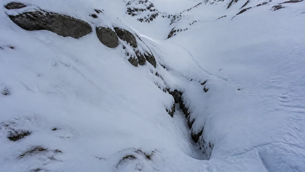
The gully is the one that catches people. In summer it is a minor drainage you step across, and in winter it collects wind-blown snow, sits at exactly the angle that releases, and funnels anything that slides into a narrow deep pile.
Open slopes above the treeline at least look like avalanche terrain, so walkers treat them with some caution.
The ground that fools people is flat. A slope can release two hundred metres above you and run out across level snow, which means standing somewhere gentle is no protection if something steep is looking down at you.
| What you cross | Why it matters in winter | What it does to a party |
|---|---|---|
| A stream gully or drainage | Collects wind-loaded snow and sits in the releasing angle band | Funnels debris into a narrow, deep pile, which is the worst case for burial depth |
| Open slope above treeline | The obvious avalanche terrain, and usually the one people respect | Direct exposure, but at least it is visible and can be planned around |
| Flat ground under a steep face | Runout, where a slide from above still reaches you | Catches walkers who believed they had left the terrain behind |
| A short steep roll in gentle ground | A start zone hiding inside an easy-looking slope | Releases under the party that is walking across it |
| Below a cornice or loaded ridge | Failure above reaches ground that never gets steep itself | Gives no warning from where the walker is standing |
One more fact belongs here, and it changes how the rest of this reads.
The great majority of avalanches that catch people are triggered by those people or by somebody in their group. You are rarely a bystander to a natural event, which means the decision about where to put your feet is the decision.
The slope angle does most of the deciding
If you learn one number from this page, learn the band rather than a threshold. Most avalanches release on slopes between roughly 30 and 45 degrees, and the peak of that distribution sits near 38.
A Swiss dataset of more than a thousand slides put 96 percent of releases between 30 and 50 degrees.
Below about 30 degrees, a slope rarely releases on its own. That single fact is what makes low-angle routing the most powerful tool an untrained party has, because it removes the question instead of answering it.
Very steep ground behaves differently again.
Faces above roughly 50 degrees shed snow more or less continuously and hold less of it, which surprises readers who assume the risk climbs forever with the angle. The classic dangerous slope is not a cliff, it is a smooth open hillside you would happily walk up in summer.
Judging an angle without instruments takes practice, and there are two habits worth building.
Compare the slope against something you can already estimate, such as a staircase at around 30 degrees, and check the map before you leave, because contour spacing tells you more than a glance from below will.
- Below about 30 degrees
- Rarely releases on its own, which is why low-angle routing works
- About 30 to 45 degrees
- Where most slides start, and the band to identify before anything else
- Around 38 degrees
- The peak of the distribution rather than a line you can stand next to
- Above about 50 degrees
- Sheds snow more continuously and holds less of it
Measure the steepest part, not the average. The start zone decides, and a gentle slope with one steep roll in the middle of it is a slope with a start zone in the middle of it.
Signs you can read without a course
There is a real line between observing and assessing. Digging pits and reading layers is a skill taught over days with feedback, and reading about it here would give you the vocabulary without the judgement.
What follows sits on the observation side of that line.
These signs need no interpretation, because they are the snowpack telling you directly. A whumpf underfoot is a layer collapsing under your weight, and cracks running out from your boots mean a slab is present and reactive right now.
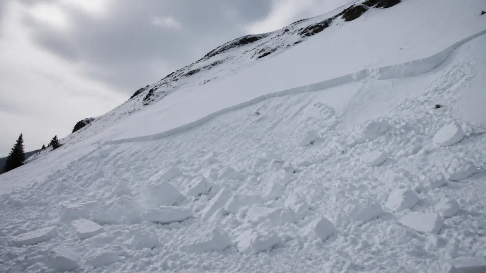
Recent avalanche debris on a nearby slope is the most useful thing you can see all day.
It tells you that slopes of that aspect and angle have already failed in these conditions, which is a better piece of evidence than anything you could work out from first principles.
- Fresh avalanche debris on slopes of similar angle and aspect.
- Cracks shooting out ahead of your boots as you walk.
- A hollow whumpf and a settling sensation underfoot.
- Heavy new snow within the last day or two.
- Strong wind visibly moving snow onto sheltered slopes.
- Rapid warming, or rain falling onto snow, during the day.
Wind deserves its own note, because it loads slopes on days with no snowfall at all. A clear cold windy day can build a slab on a lee slope while the valley stays dry and bright.
Now the limitation, stated plainly.
None of these signs appearing means the snowpack is fine. Persistent weak layers can sit quietly for weeks and produce no whumpfs, no cracks, and no recent activity right up until a party crosses the wrong slope.
What is the forecast actually telling you?
For a walker who will not be assessing the snowpack, the regional forecast is the substitute for expertise. It is written by people who have been in that snow all season, and reading it is the highest-value ten minutes in the whole trip.
The rating runs across five levels, and each one is better read as a permission than as an adjective.
Low
Terrain choice relaxes, and natural avalanches are unlikely. Small isolated pockets still exist, so this is the one rating where a normal winter walk needs little modification.
Moderate
The rating most often misread as a green light. Heightened conditions on specific terrain features, which for a walker means gullies and steep rolls stay off the route.
Considerable
The level associated with the largest share of avalanche accidents. Human-triggered slides are likely, and an untrained party should be on low-angle ground with nothing steep above it.
High and Extreme
Avalanche terrain comes off the plan completely, and that includes runout ground under steep faces. Choose a valley walk or a different day.
Two limits are worth holding onto. The forecast describes a region across a range of elevations and aspects rather than the specific slope in front of you, and it is issued for a period that the weather can overtake by lunchtime.
Considerable catches people, which is worth sitting with. It reads like a middling rating and it is where most accidents happen, because conditions are dangerous enough to matter and not obviously dangerous enough to cancel plans.
The clock starts the moment the snow stops moving
Survival after a full burial is a steep curve, and knowing its shape explains why this page is mostly about not being there.
The cause of death in that window is asphyxia rather than cold or injury. Avalanche debris sets hard almost immediately, a buried person cannot move or clear space to breathe, and the air around their face runs out.
That timescale rules out almost everything a party might hope for.
A phone call starts a process measured in hours. A helicopter, in the rare case one is close and the weather allows it, still lands long after the curve has fallen away.
The people who get somebody out alive are the people standing next to them when it happened.
Which places the whole burden back on the earlier decisions.
For a party without transceivers, without probes, and without practice, a full burial is close to unsurvivable regardless of how fast everyone moves. That is not a reason to panic about winter walking, it is the reason low-angle routing matters more than any skill you could pick up from reading.
Do you need a beacon if you are only walking?
The honest answer is that terrain decides this, not the activity. If your route enters avalanche terrain or passes under it, the party needs the equipment and the practice, and calling the trip a hike changes nothing about the slope.
If the route genuinely avoids that terrain, the equipment is not the thing keeping you safe. The routing is.
Where parties go wrong is treating the purchase as the solution.
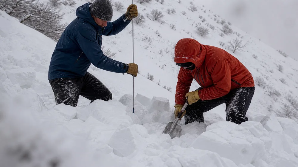
A transceiver, a probe, and a shovel work as one system, and a party missing any of the three is much worse off than the shopping list suggests. Everyone needs all three, because a rescuer without a shovel can locate a burial and then stand over it.
Digging is the part nobody expects. Moving a cubic metre of set avalanche debris by hand takes several minutes of hard work from a fit person, and burials are frequently deeper than that.
Choose a route that never asks you to be right
Everything above points one way for a party without avalanche training. Avoiding the terrain beats judging it, because judging it is the skill you do not have and avoiding it is a decision you can make at the kitchen table.
The good news is that the features which catch walkers are visible on a map before the trip.
Contour lines bunching through a drainage is a gully. A tight band of contours inside otherwise wide spacing is a steep roll.
Both can be spotted at home, in the warm, with time to pick a different line.
- Read the forecast firstLet the rating decide which walk happens rather than only whether you go at all.
- Choose low-angle groundPick a route under about 30 degrees with nothing steeper looming above it, which removes the start zone and the runout together.
- Find the traps on the mapLook for contours bunching through drainages and for tight bands inside gentle slopes, then route around them.
- Prefer ridges and open valley floorsA broad ridge keeps you off the loaded slope and out of the runout at the same time.
- Cross unavoidable exposure one at a timeSpacing does not make a crossing safe, it keeps somebody uncaught and able to start digging immediately.
- Set the turnaround before you leaveA condition agreed at home survives pressure far better than one argued about at the bottom of a slope.
That last step matters more in winter than in summer, because the pressure is different. Short daylight, cold, and a long drive all push a party toward finishing the plan, and the slope does not take any of that into account.
Sources
The US avalanche centres set out the terrain fundamentals used here, including the release band of roughly 30 to 45 degrees, the concentration around 38, terrain traps such as gullies and abrupt flat transitions, and the finding that most slides catching people are triggered by the party itself: Avalanche.org, Identify Terrain and Slope Angle.
The survival figures come from analysis of avalanche burial outcomes, which put survival near 90 percent inside the first ten to fifteen minutes, falling to roughly 30 percent by 35 minutes, with asphyxia the dominant cause: Lessons learned from avalanche survival patterns.
REI sets out the same terrain judgement, equipment, and training requirements specifically for travellers on foot rather than on skis: Avalanche Safety for Snowshoers.
The Gallatin National Forest Avalanche Center explains why slope angle is measured on the steepest part of the start zone and why small steep rolls inside gentle terrain are so often missed: Know Your Angles.
AnswersQuestions readers ask
Can you get caught in an avalanche while hiking?
Yes. A slope releases on its angle and its snow, so walkers and snowshoers are exposed on the same terms as anyone else, and summer trails routinely cross gullies that become avalanche paths in winter.
What slope angle causes avalanches?
Most release between about 30 and 45 degrees, with the peak near 38. Below roughly 30 degrees a slope rarely releases on its own, which is why low-angle routing is the most useful tool an untrained party has.
What are the warning signs of avalanche danger?
Recent avalanche debris nearby, cracks shooting out from your boots, a hollow whumpf underfoot, heavy new snow in the last day or two, strong wind moving snow, and rapid warming. None of these appearing does not mean a slope is safe.
How long can you survive buried in an avalanche?
Survival is around 90 percent if the person is dug out inside the first ten to fifteen minutes and falls to roughly 30 percent by 35 minutes. Asphyxia is the dominant cause, so companion rescue is the only rescue fast enough.
Do hikers need a beacon, probe, and shovel?
If the route enters avalanche terrain or passes beneath it, yes, and every member needs all three. Calling the trip a hike rather than a ski tour changes nothing about the slope.
What is the most dangerous avalanche danger rating?
Considerable is associated with the largest share of accidents. It reads like a middling rating while conditions are dangerous enough to matter, which is exactly why parties talk themselves into going.